A Brief Central Alabama Weather Update Just Before 10 am

RADAR CHECK AT 9:45 AM: The outer rainbands of the remnants of Ida have mostly pushed across the state line over into Georgia, except for the extreme southeastern parts of Central Alabama. Another shield of rain is rotating around the center of Ida, and is moving across the north and central parts of the state, roughly from Huntsville to Clanton and from Double Springs to Gadsden. The good news is that there are no tornado warnings in effect and the threat is starting to drop for the eastern half of the area. We will have to watch as temperatures continue to warm through the remainder of the morning and makes the air a little more unstable over the threat areas, which could lead to an increased risk of a brief tropical-induced tornado or two. Here are the active items in effect for the area just before 10 am:
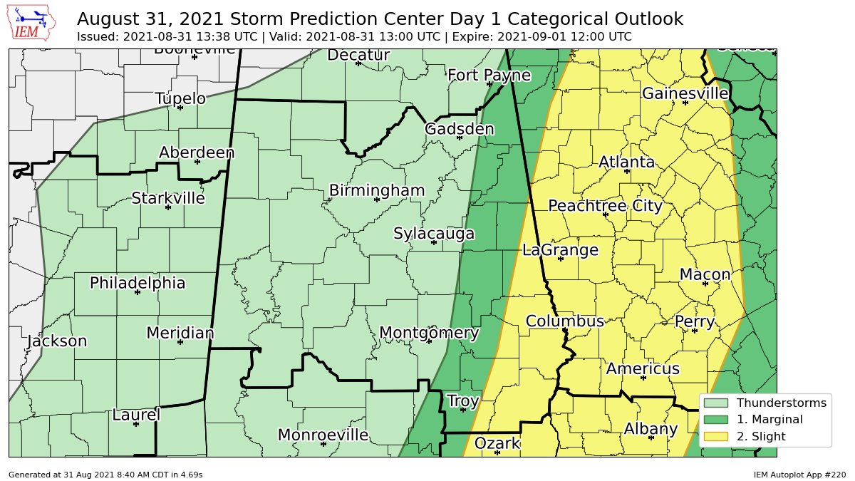
A Slight Risk continues for the extreme eastern and southeastern parts of Central Alabama through the remainder of the day. This includes locations along and east of a line from Ranburne to Loachapoka to Brundidge. A Marginal Risk continues west of that to a line stretching from Fort Payne to Anniston to Red Level. Timing for these threat areas will be from now through 10 am for the northern half (Alexander City and north) and from now through 4 pm for the southern half. There is no threat of severe weather to the west.
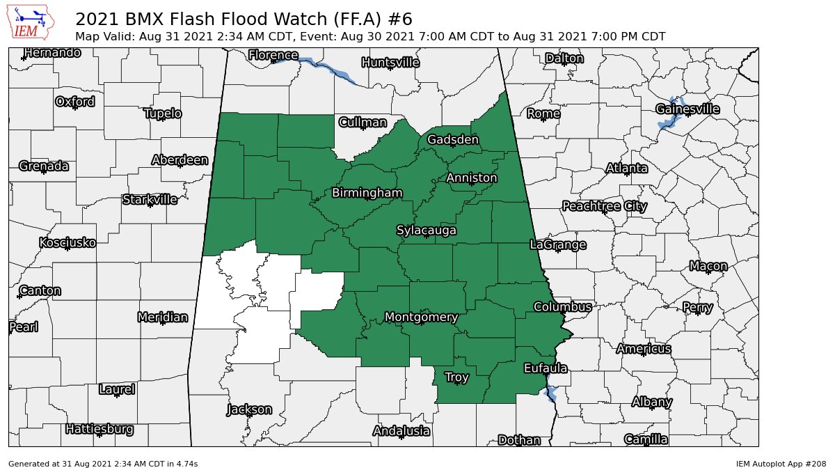
A Flash Flood Watch continues until 7pm this evening for Autauga, Barbour, Bibb, Blount, Bullock, Calhoun, Chambers, Cherokee, Chilton, Clay, Cleburne, Coosa, Dallas, Elmore, Etowah, Fayette, Jefferson, Lamar, Lee, Lowndes, Macon, Marion, Montgomery, Pickens, Pike, Randolph, Russell, Shelby, St. Clair, Talladega, Tallapoosa, Tuscaloosa, Walker, and Winston counties in Central Alabama. With the rainfall ending over the southwestern counties, NWS Birmingham has canceled the watch for Greene, Hale, Marengo, Perry, and Sumter counties.
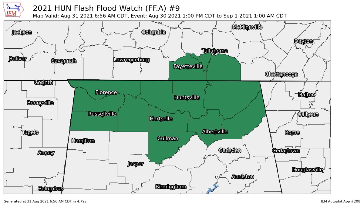
A Flash Flood Watch continues for Colbert, Cullman, DeKalb, Franklin, Jackson, Lauderdale, Lawrence, Limestone, Madison, Marshall, and Morgan counties in North Alabama until 1 am Wednesday.
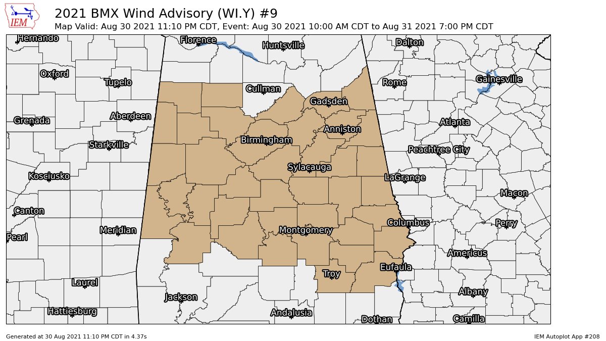
A Wind Advisory continues until 7 pm this evening for the following counties in Central Alabama: Autauga, Barbour, Bibb, Blount, Bullock, Calhoun, Chambers, Cherokee, Chilton, Clay, Cleburne, Coosa, Dallas, Elmore, Etowah, Fayette, Greene, Hale, Jefferson, Lamar, Lee, Lowndes, Macon, Marengo, Marion, Montgomery, Perry, Pickens, Pike, Randolph, Russell, Shelby, St. Clair, Sumter, Talladega, Tallapoosa, Tuscaloosa, Walker, and Winston. South winds averaging 10 to 20 mph with gusts up to 40 mph will be possible, especially on ridge tops.
Category: Alabama's Weather, ALL POSTS, Severe Weather, Tropical
About the Author (Author Profile)
Scott Martin is an operational meteorologist, professional graphic artist, musician, husband, and father. Not only is Scott a member of the National Weather Association, but he is also the Central Alabama Chapter of the NWA president. Scott is also the co-founder of Racecast Weather, which provides forecasts for many racing series across the USA. He also supplies forecasts for the BassMaster Elite Series events including the BassMaster Classic.Subscribe
If you enjoyed this article, subscribe to receive more just like it.


