A Very Nice Midday Across Central Alabama
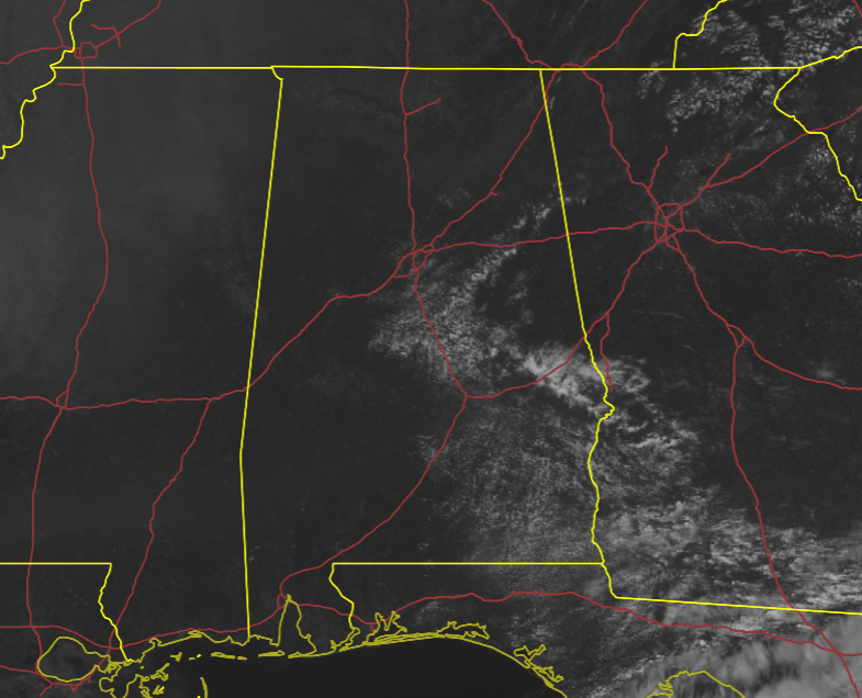
As of 11 am, skies across a good portion of Central Alabama remain clear, but we do see some fair weather clouds hanging out over much of the eastern half of the area. Temperatures were in the mid-70s to the mid-80s across the area. Birmingham was the warm spot at 85 degrees, while Auburn was the cool spot at 75 degrees.
Today will continue to be an absolute wonderful day across Central Alabama with mainly sunny skies and warm, but a comfortable warm as we continue to have lower humidity values. Highs will be in the mid to upper 80s. No weather issues for Alabama, Auburn, and UAB today as all three games will be played in nearly-complete sunshine with temperatures making it into the 80s.
While we will continue with mainly sunny skies on Sunday, it will be a little warmer. Humidity values will be on the rise as tropical air from the disturbance moving up from the southern Gulf of Mexico will begin to invade Central Alabama. Highs in the upper 80s to the lower 90s.
THE TROPICS: Larry has transitioned into a post-tropical cyclone over the Labrador Sea and is now off of the board, but large swells are continuing to affect portions of the east coast of the US and up onto the eastern shores of Canada.
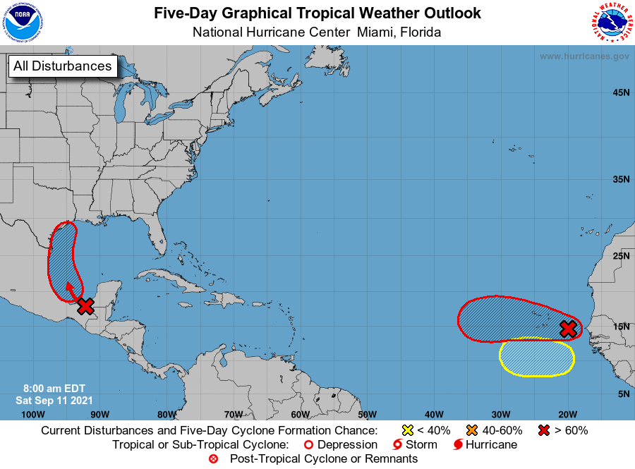
Invest 94L continues to produce disorganized showers and thunderstorms over portions of Central America, southeastern Mexico, and the adjacent waters of the northwestern Caribbean Sea and southern Gulf of Mexico. Although upper-level winds are not conducive for development currently, they are expected to become more favorable for the system during the next day or so. A tropical depression is likely to form on Sunday or Monday while the disturbance moves northwestward and then northward near the coast of northeastern Mexico. Further development will be possible through the middle of next week if it remains over water, and interests along the western and northwestern Gulf coast should monitor the progress of this system. Regardless of development, this disturbance is expected to produce heavy rain across portions of Central America and the Yucatán Peninsula through today, which may lead to flash flooding and mudslides. By late this weekend, heavy rain will likely reach portions of the western Gulf coast, including coastal Texas and Louisiana, through the middle of next week. Localized significant rainfall amounts will be possible, potentially resulting in areas of flash and urban flooding.
We also have Invest 93L on the board, which continues to produce a concentrated area of showers and thunderstorms just southeast of the Cabo Verde Islands. Environmental conditions appear generally conducive for gradual development, and a tropical depression is likely to form late this weekend or early next week while the system moves westward over the far eastern Atlantic. Regardless of development, this system is likely to bring gusty winds and locally heavy rain across the Cabo Verde Islands later today and tonight. Way too early to know if it will recurve or continue westward toward the US mainland.
Another tropical wave is expected to move off the west coast of Africa in a few days. Some development of this system will be possible through the middle of next week while it moves westward across the eastern tropical Atlantic Ocean.
Category: Alabama's Weather, ALL POSTS, Tropical
About the Author (Author Profile)
Scott Martin is an operational meteorologist, professional graphic artist, musician, husband, and father. Not only is Scott a member of the National Weather Association, but he is also the Central Alabama Chapter of the NWA president. Scott is also the co-founder of Racecast Weather, which provides forecasts for many racing series across the USA. He also supplies forecasts for the BassMaster Elite Series events including the BassMaster Classic.Subscribe
If you enjoyed this article, subscribe to receive more just like it.


