Saturday Weather Xtreme — Rain & Storms Likely At Times Throughout the Weekend
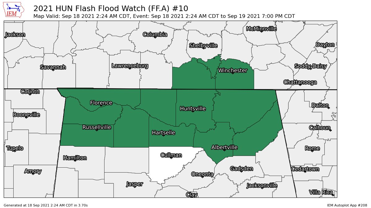
THE CENTRAL ALABAMA WEEKEND: Rain and thunderstorms will be likely throughout the day across Central Alabama for your Saturday, with some of the activity becoming heavy at times, especially over the northern half of the state. A Flash Flood Watch is in effect for Colbert, DeKalb, Franklin, Jackson, Lauderdale, Lawrence, Limestone, Madison, Marshall, and Morgan counties in North Alabama until 7 pm Sunday for the threat of flash flooding due to the rainfall rates in heavier storms potentially reaching over 2 inches per hour. Highs will be in the upper 70s to the lower 80s.
Much of the same story for your Sunday… scattered to numerous showers and storms will be likely throughout the day, with heavy rain possible. Once again, some flooding issues may occur over the northern parts of the area. Highs will be in the upper 70s to the lower 80s.
THE WORK WEEK AHEAD: More scattered to numerous showers and storms are expected on Monday. Highs in the upper 70s to the mid 80s. A cold front will be approaching the area that will keep showers and thunderstorms likely on Tuesday. Could we see a few strong storms before the front moves through? It’s hard to say for now, but one or two can’t be ruled out, as we’ll have some instability in place. Highs will be in the lower to mid 80s.
By Wednesday afternoon, the front will have moved through the area and much drier air moves in behind it. Showers and storms will end by midday and skies will start to clear out after frontal passage. Highs will be in the mid 70s to the mid 80s.
It will actually start to feel like Fall for the first two full days of the season for Thursday and Friday. Skies will be sunny on both days, with much lower humidity and temperatures reaching the lower 70s to the lower 80s on Thursday and the mid 70s to the lower 80s on Friday.
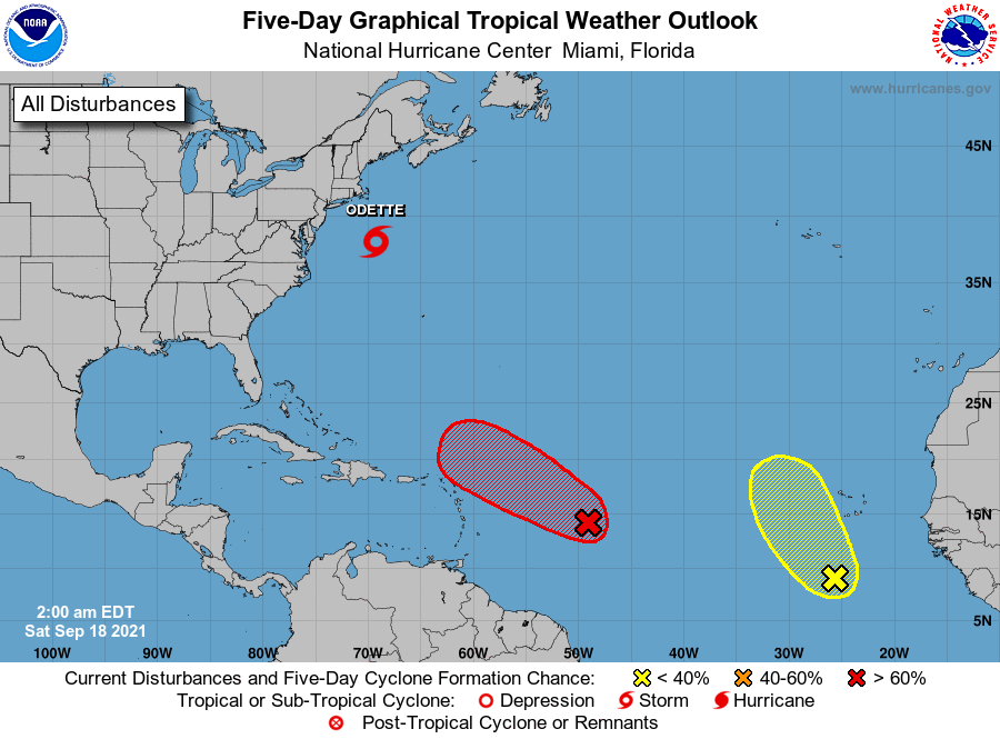
THE TROPICS: At 4 am, Tropical Storm Odette had maximum sustained winds at 45 mph and was moving to the northeast at 15 mph. She will continue to move away from the US Mainland and potentially become a post-tropical low later tonight. Rough surf and rip currents can be expected along the New England and Atlantic Canada coasts throughout the weekend.
Invest 95L is getting better organized and further development is expected, potentially becoming a tropical depression later today or on Sunday. It will approach the northern Leeward Islands on Monday and Tuesday, but conditions will become less friendly to the system and further development will be unlikely. Nearly every member of the latest guidance run has it recurving and staying away from the US Mainland.
Invest 97L is located around a few hundred miles to the south-southwest of the Cabo Verde Islands and is not moving very much at all at this point. Some development is possible as it will generally be moving to the northwest and should stay out over the open waters.
Category: Alabama's Weather, ALL POSTS, Tropical
About the Author (Author Profile)
Scott Martin is an operational meteorologist, professional graphic artist, musician, husband, and father. Not only is Scott a member of the National Weather Association, but he is also the Central Alabama Chapter of the NWA president. Scott is also the co-founder of Racecast Weather, which provides forecasts for many racing series across the USA. He also supplies forecasts for the BassMaster Elite Series events including the BassMaster Classic.Subscribe
If you enjoyed this article, subscribe to receive more just like it.


