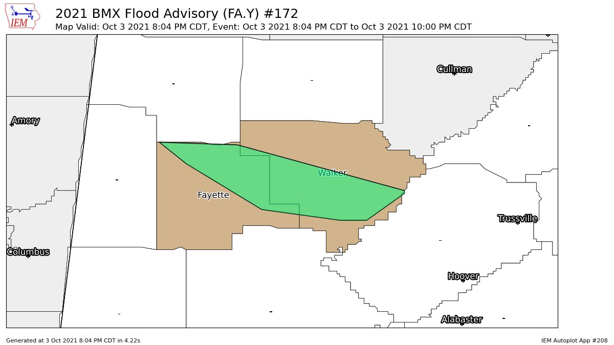
Flood Advisory for Parts of Fayette & Walker Co. Until 10 pm
The National Weather Service in Birmingham has issued a
* Flood Advisory for…
Central Walker County in central Alabama…
Northeastern Fayette County in west central Alabama…
* Until 1000 PM CDT.
* At 804 PM CDT, Doppler radar indicated heavy rain due to
thunderstorms. Minor flooding is ongoing or expected to begin
shortly in the advisory area. Between 1 and 2 inches of rain have
fallen in the past 6 hours.
* Some locations that will experience flooding include…
Jasper, Winfield, Sumiton, Cordova, Dora, Carbon Hill, Berry,
Parrish, Oakman, Glen Allen, Gu-Win, Gorgas, Gorgas Steam Plant,
Beloit, Burnwell, Corona, West Corona, Townley, Holly Grove and
Cedrum Area.
Additional rainfall amounts of 1 to 2 inches are expected over the
area. This additional rain will result in minor flooding.
PRECAUTIONARY/PREPAREDNESS ACTIONS…
Be especially cautious at night when it is harder to recognize the
dangers of flooding.
In hilly terrain there are hundreds of low water crossings which are
potentially dangerous in heavy rain. Do not attempt to cross flooded
roads. Find an alternate route.
Category: Alabama's Weather, ALL POSTS
About the Author (Author Profile)
Scott Martin is an operational meteorologist, professional graphic artist, musician, husband, and father. Not only is Scott a member of the National Weather Association, but he is also the Central Alabama Chapter of the NWA president. Scott is also the co-founder of Racecast Weather, which provides forecasts for many racing series across the USA. He also supplies forecasts for the BassMaster Elite Series events including the BassMaster Classic.Subscribe
If you enjoyed this article, subscribe to receive more just like it.


