A Late Night Look at Our Weather Situation
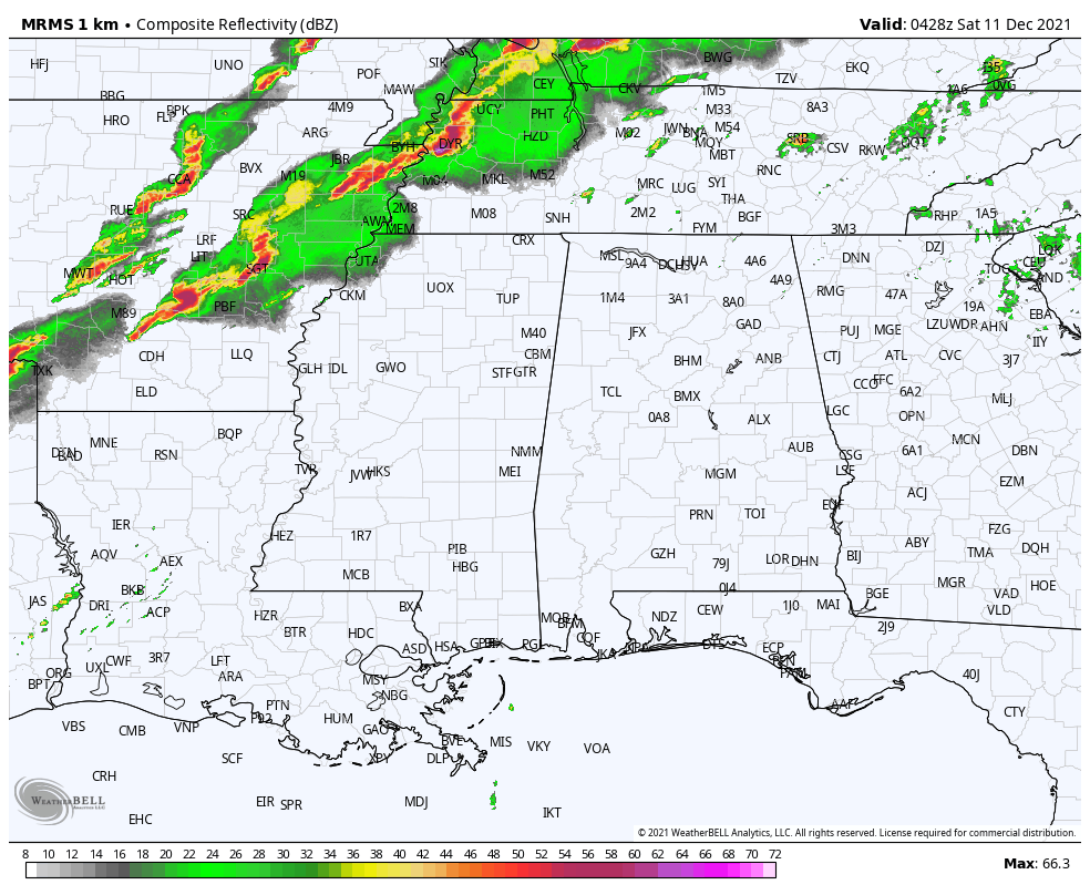
Radar as of 10:30 pm across North/Central Alabama shows that everything is all quiet for us, but the story is much different back to our northwest and west. A line of strong to severe storms continue to move eastward across the western parts of Kentucky, down through the northwestern corner of Tennessee, and back through a good portion of west and central parts of Arkansas. Showers are just now beginning to cross the Mississippi River into the extreme northwestern parts of Mississippi.
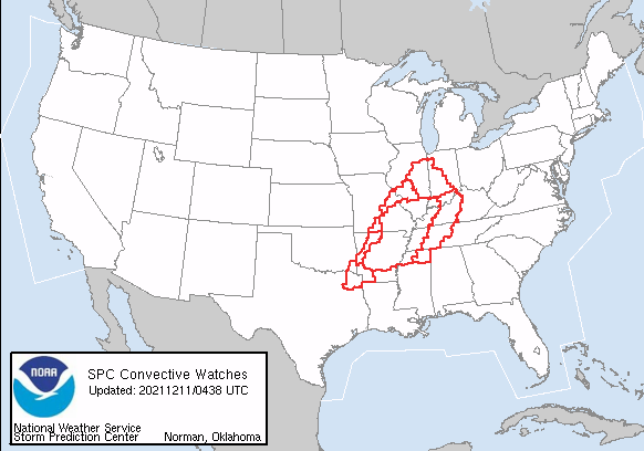
Here is a list of Tornado Watches currently in effect for this incoming storm system:
Tornado Watch #552 continues until 11:00 pm for portions of Arkansas, Illinois, Indiana, Kentucky, Mississippi, Missouri, and Tennessee.
Tornado Watch #553 continues for a few counties in Illinois and Missouri until 11:00 pm.
Tornado Watch #554 continues for portions of Indiana, Kentucky, Mississippi, and Tennessee until 2:00 am Saturday morning.
Tornado Watch #555 continues for portions of Arkansas, Texas, and Oklahoma until 11:00 pm.
Tornado Watch #556 continues for portions of Arkansas and Oklahoma until 11:00 pm.
Tornado Watch #557 continues for portions of Illinois and Indiana until 2:00 am Saturday morning.
Tornado Watch #558 was just issued for portions of Arkansas, Louisiana, Mississippi, Tennessee, and Texas until 5:00 am Saturday morning.
While it is quiet across North/Central Alabama, it has already become quite breezy out there. I was having a little difficult time keeping my vehicle in my lane while returning home from the Van Gogh exhibit at the BJCC.
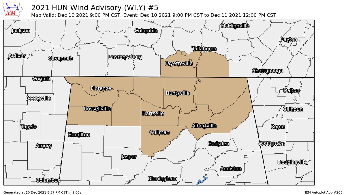
A Wind Advisory is in effect for Colbert, Cullman, DeKalb, Franklin, Jackson, Lauderdale, Lawrence, Limestone, Madison, Marshall, Morgan counties in North Alabama until 12 pm Saturday.
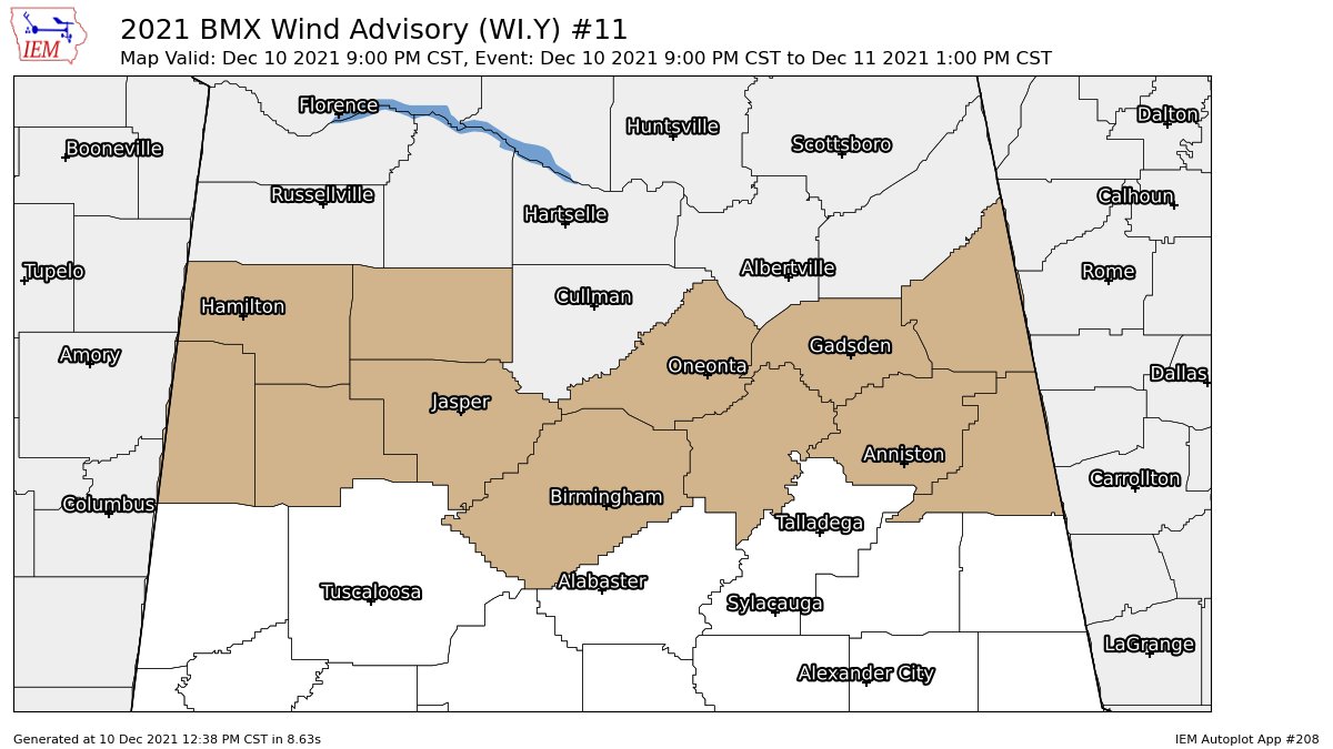
A Wind Advisory is in effect for Blount, Calhoun, Cherokee, Cleburne, Etowah, Fayette, Jefferson, Lamar, Marion, St. Clair, Walker, Winston counties in Central Alabama until 1 pm Saturday.
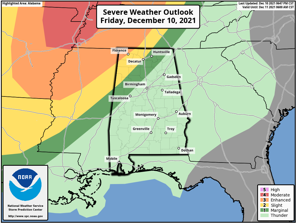
For the overnight hours up until 6 am Saturday morning, we have an Enhanced Risk (level 3/5) for the extreme northwestern corner of the state, including the city of Florence. A Slight Risk (level 2/5) continues for locations south of that to a line from roughly Hazel Green (Madison Co.) to Grayson (Winston Co.) to Crossville (Lamar Co.). A Marginal Risk (level 1/5) is up south of that to a line from Scottsboro (Jackson Co.) to Cordova (Walker Co.) to Emelle (Sumter Co.).
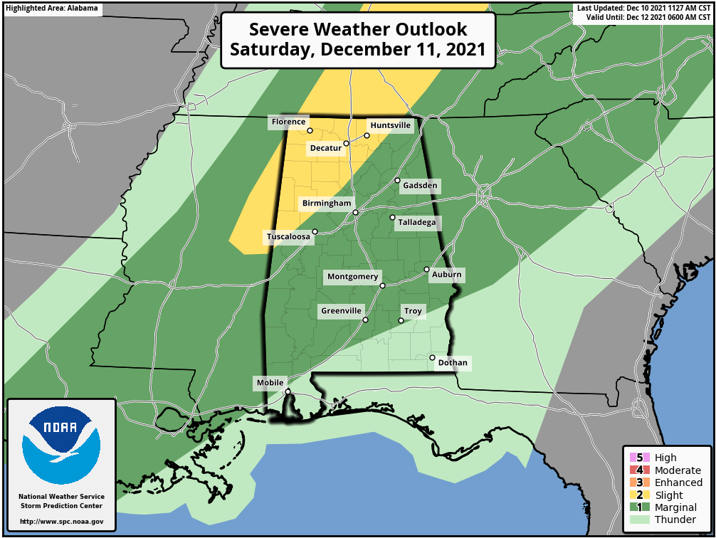
After 6 am, the Enhanced Risk goes away, and we’ll be left with a Slight Risk for locations along and north of a line from Pleasant Grove (Jackson Co.) to Hanceville (Cullman Co.) to Aliceville (Pickens Co.). A Marginal Risk is up for nearly all locations south of the Slight Risk in North/Central Alabama, except for the southern and southwestern parts of Pike County and the southern 3/4ths of Barbour County.
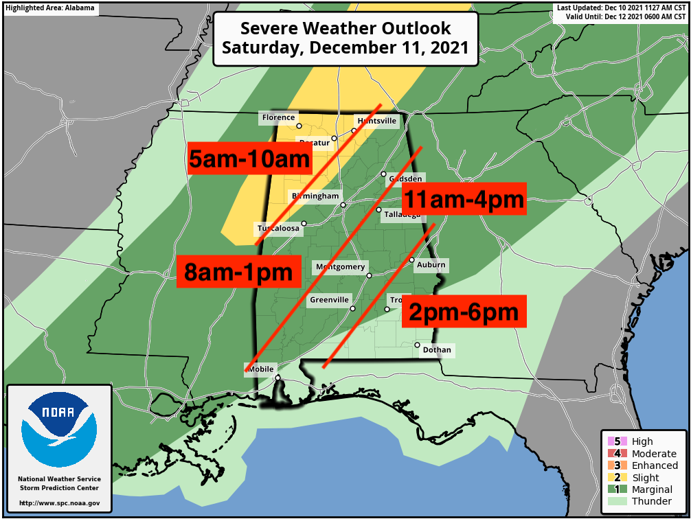
The main window for the threat of strong to severe storms across the area will be from around 4 am to 6 pm on Saturday. The above map shows a breakdown for the timing in portions of North/Central Alabama. I have 5 am for the start time in the northwestern parts of the state, but it may actually begin just before that, possibly as early as 4 am.
Stay weather aware through the overnight hours. We’ll be with you with updates and any watches, warnings, or advisories that are posted throughout the event.
Category: Alabama's Weather, ALL POSTS, Severe Weather
About the Author (Author Profile)
Scott Martin is an operational meteorologist, professional graphic artist, musician, husband, and father. Not only is Scott a member of the National Weather Association, but he is also the Central Alabama Chapter of the NWA president. Scott is also the co-founder of Racecast Weather, which provides forecasts for many racing series across the USA. He also supplies forecasts for the BassMaster Elite Series events including the BassMaster Classic.Subscribe
If you enjoyed this article, subscribe to receive more just like it.


