A Brief Update as of 1:30 pm
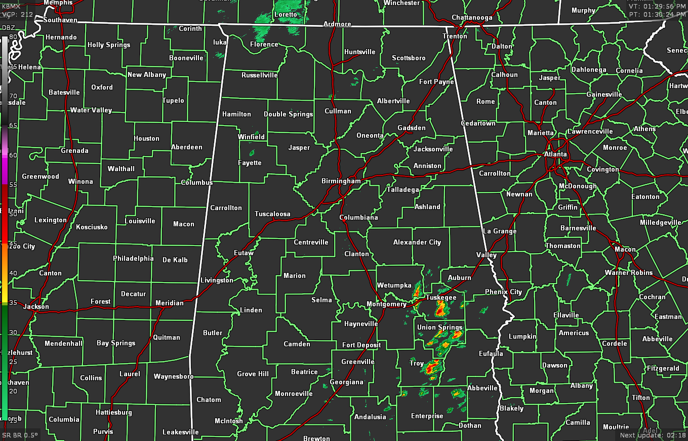
As of 1:29 pm, there is not a lot to talk about across North/Central Alabama at the moment. We have a few showers and storms moving northeastward at about 25-30 mph across the southeastern portions of the area, mainly south of the I-85 corridor. Other than that, just a few light showers showing up over portions of Lauderdale County in North Alabama and a couple of stray showers in Marion and Fayette counties.
The bad news is all the sunshine that much of the area is receiving, as that added heat will add to the already rising surface instability. We are already seeing CAPE values in the 500-2,000 J/kg range across much of the area. Add that to the wind shear values in the 50-60 knot range and helicity values already above 150 m2/s2, the ingredients are already in place for the development of stronger to severe thunderstorms. The only thing we are waiting on is the lift that we need to get those storms firing off. For now, that is still located to our west and northwest over the eastern parts of Arkansas and into the extreme western parts of Tennessee.
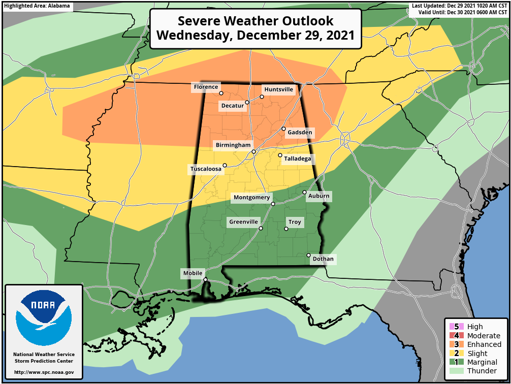
An Enhanced Risk continues for North/Central Alabama down to as far south as a line stretching from Millport to just north of Birmingham to Heflin. South of that, a Slight Risk continues for Central Alabama down to a line from Uniontown to Deatsville to just south of Lafayette. For the rest of Central Alabama, a Marginal Risk for severe storms continue to be in effect.
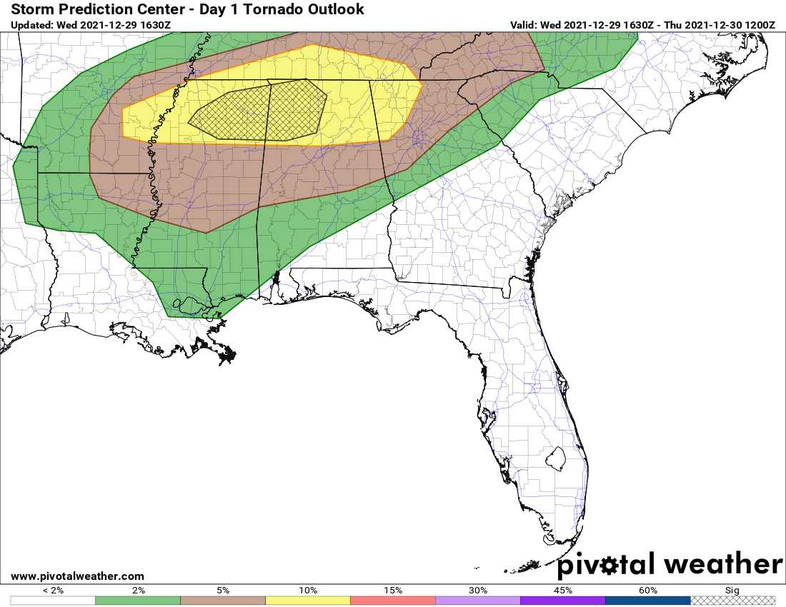
The SPC also continues to show the hatched area for a higher tornado risk for much of the northwestern parts of North/Central Alabama, including the cities of Athens, Decatur, Hartselle, Cullman, Florence, Russellville, Double Springs, Hamilton, Haleyville, Jasper, Fayette, and Vernon.
When any other updates come out from the SPC or from the local NWS offices in Birmingham or in Huntsville, I will post those here immediately.
Category: Alabama's Weather, ALL POSTS, Severe Weather
About the Author (Author Profile)
Scott Martin is an operational meteorologist, professional graphic artist, musician, husband, and father. Not only is Scott a member of the National Weather Association, but he is also the Central Alabama Chapter of the NWA president. Scott is also the co-founder of Racecast Weather, which provides forecasts for many racing series across the USA. He also supplies forecasts for the BassMaster Elite Series events including the BassMaster Classic.Subscribe
If you enjoyed this article, subscribe to receive more just like it.


