A Quick Update on Our Weather Just Before 11 pm
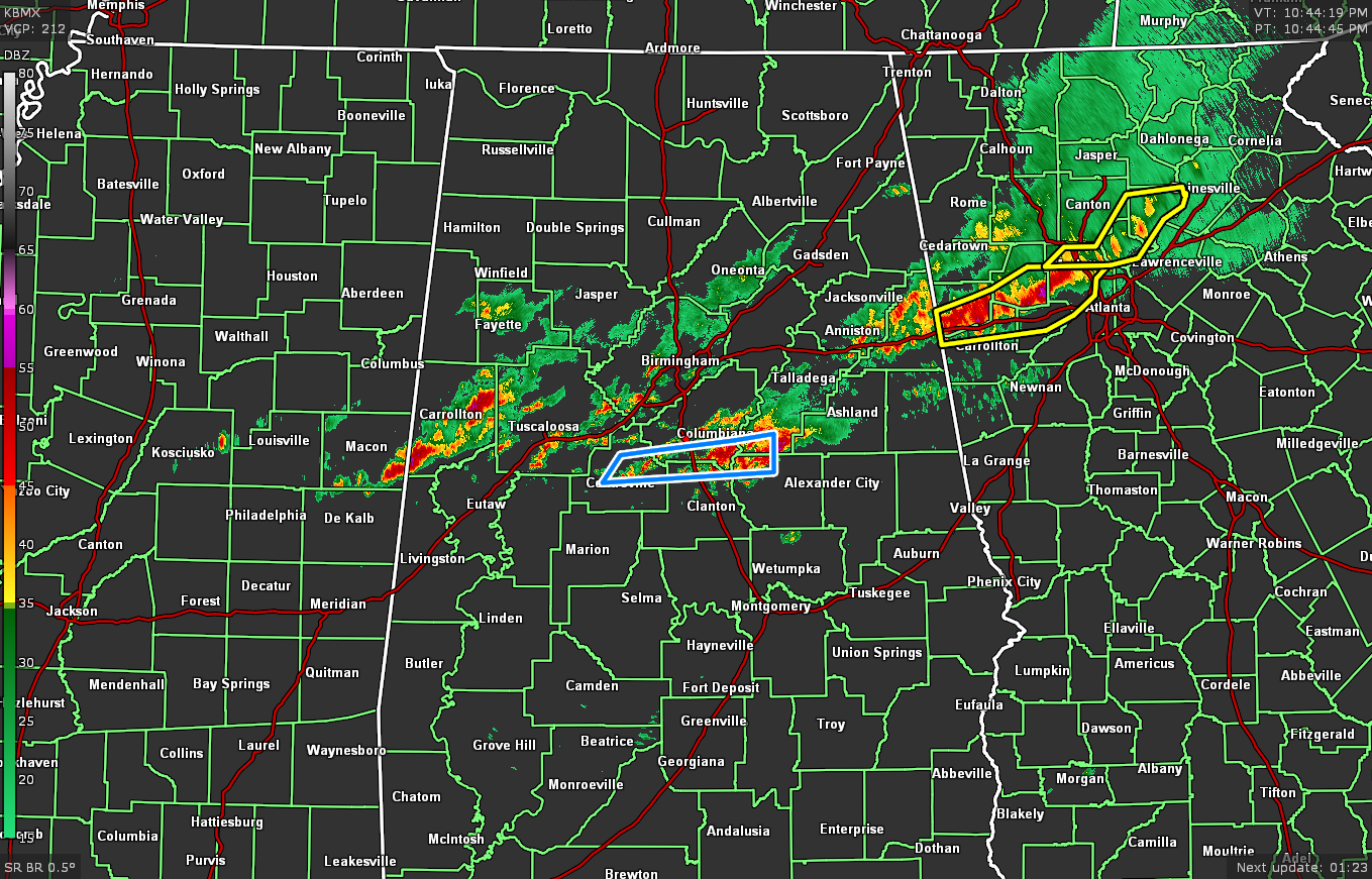
As of 10:45 pm, scattered clusters of showers and thunderstorms continue across the central parts of the area from west to east, roughly along and surrounding the I-20 corridor. The good news is that there are no severe weather warnings currently in effect, but plenty of rain has fallen over the locations where the stronger storms moved over. A Flash Flood Warning is currently in effect until 12:45 am Thursday for Bibb, Chilton, Coosa, Shelby, and Talladega counties.
For the locations north of the clusters of storms, the severe thunderstorm threat has come to an end. For those locations along and south of the storms, the severe threat continues for the rest of the night and through the overnight hours.
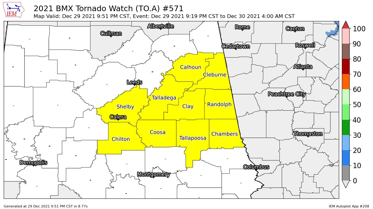
A Tornado Watch continues for Calhoun, Chambers, Chilton, Clay, Cleburne, Coosa, Randolph, Shelby, Talladega, and Tallapoosa counties in Central Alabama until 4 am Thursday morning.
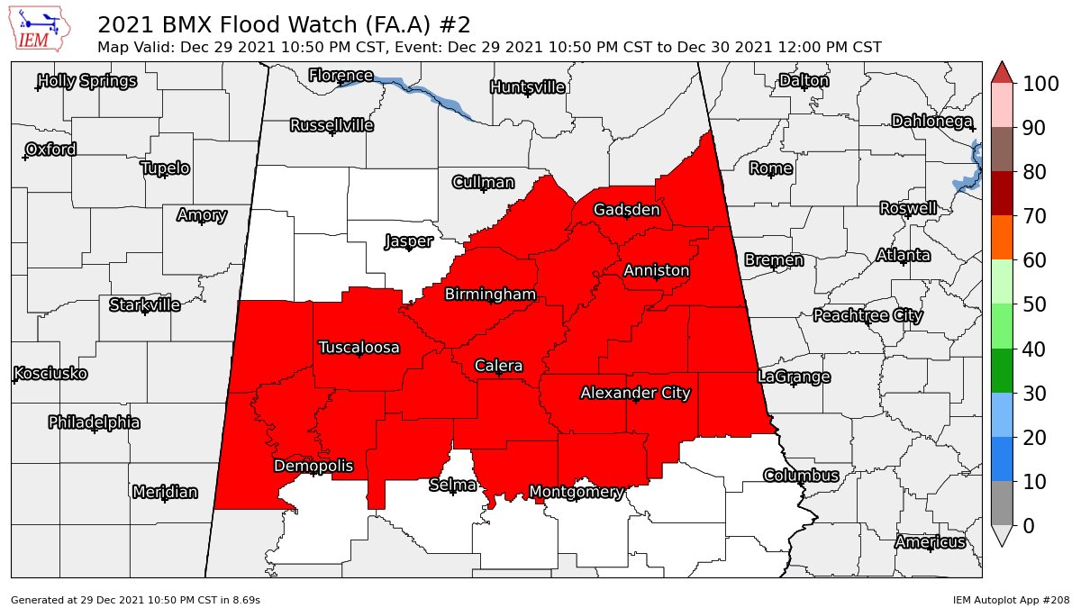
NWS Birmingham has just issued an Areal Flood Watch for Autauga, Bibb, Blount, Calhoun, Chambers, Cherokee, Chilton, Clay, Cleburne, Coosa, Elmore, Etowah, Greene, Hale, Jefferson, Perry, Pickens, Randolph, Shelby, St. Clair, Sumter, Talladega, Tallapoosa, and Tuscaloosa counties in Central Alabama until 12 pm Thursday.
Category: Alabama's Weather, ALL POSTS, Severe Weather
About the Author (Author Profile)
Scott Martin is an operational meteorologist, professional graphic artist, musician, husband, and father. Not only is Scott a member of the National Weather Association, but he is also the Central Alabama Chapter of the NWA president. Scott is also the co-founder of Racecast Weather, which provides forecasts for many racing series across the USA. He also supplies forecasts for the BassMaster Elite Series events including the BassMaster Classic.Subscribe
If you enjoyed this article, subscribe to receive more just like it.


