Brief Check on Our Weather; Plus, A Look at the New Year’s Severe Weather Threat
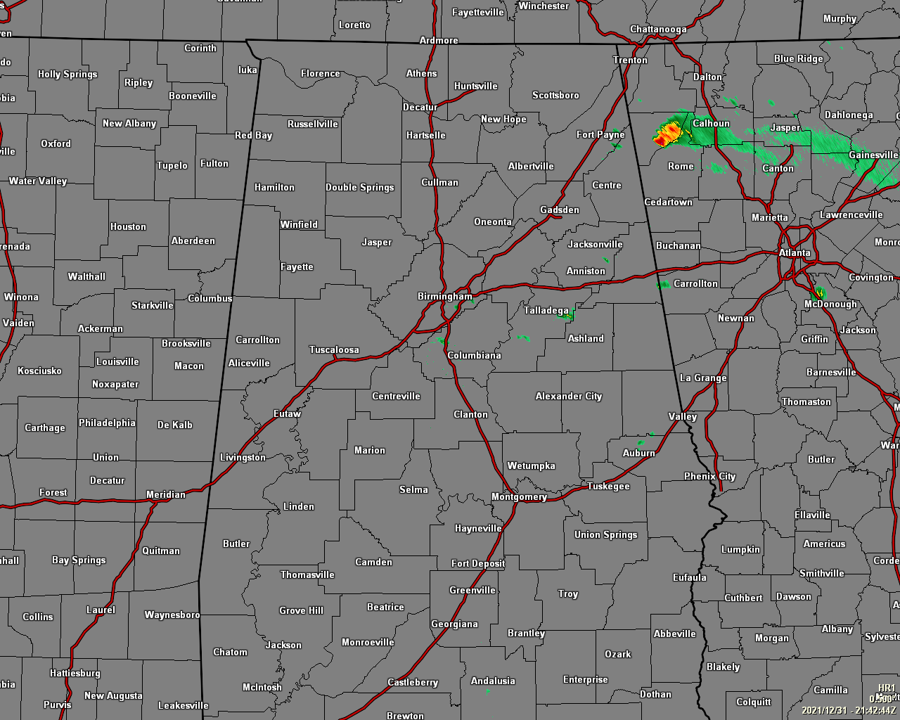
As of 3:42 pm, there is very little going on across Central Alabama as there are a few isolated light showers occurring east of I-65 and mostly in between I-20 and I-85. We still have the possibility of a few scattered showers and thunderstorms developing across the northern 2/3rds of the area, with the potential of one or two of those becoming strong with gusty winds being the main threat, but there is a very small, non-zero threat of a brief tornado.
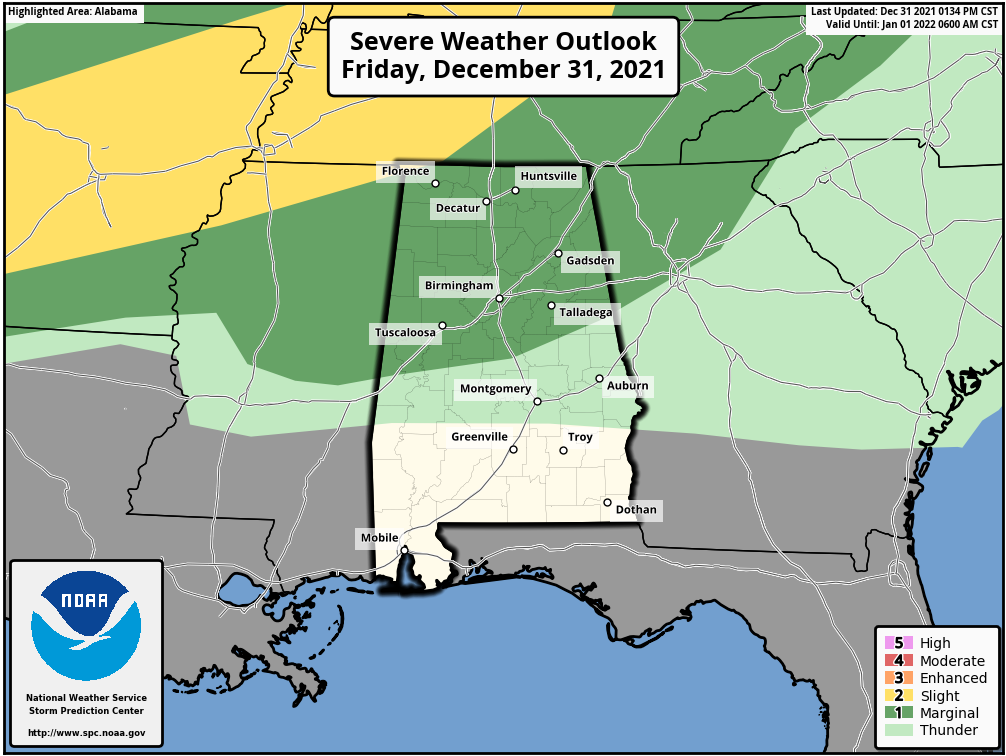
The SPC has a Marginal Risk for severe storms up for the northern half of the state, mainly along and north of a line from roughly Livingston to Clanton to Wedowee for that risk of isolated damaging wind gusts. The threat will go through the rest of the afternoon hours, but will dissipate around or just after sunset. The northwestern tip of Lauderdale County in North Alabama is under a Slight Risk, but the threats will relatively be the same.
By tonight, the chance of showers will decrease across the area as the warm front continues to move northward into the northern parts of the state. The greatest rain chances tonight will be north of I-22 and I-20 and increasing as you go north. Almost everyone will be dry tonight to ring in the New Year, but I can’t rule out a stray shower south of those interstates down to as far south as Tuscaloosa to Clanton to Alexander City. Lows tonight will be in the 60s.
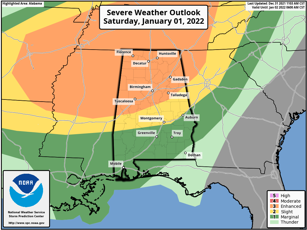
We are still looking a decent severe weather threat across all of North/Central Alabama, where all modes of severe weather will be possible, especially the threat of damaging winds up to 70 mph and tornadoes. We will have plenty of shear and helicity in place, along with a decent bit of instability. Match that with higher dewpoints in the upper 60s to the lower 70s, and all ingredients are there for severe storm development. Here is the breakdown of the SPC’s Day Two Severe Weather Outlook:
ENHANCED RISK: All of North Alabama and much of Central Alabama down to a line from Livingston to just north of Jemison to just east of Heflin.
SLIGHT RISK: South of Enhanced Risk to a line stretching from Sweet Water to Hayneville to Auburn.
MARGINAL RISK: South of Slight Risk for the remainder of Central Alabama.
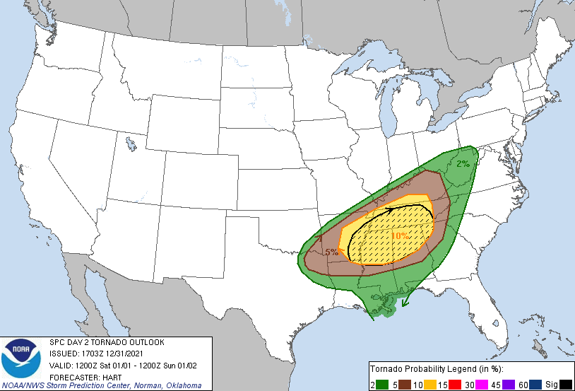
We do note that the SPC also has those locations in the Enhanced Risk are in the hatched area on the Day Two Tornado Outlook, which means there is a greater risk of tornadoes within those locations.
The main action will be with the main squall line that will move into the area late into Saturday evening and moving across the area through the night and into the morning hours on Sunday, exiting the area before the midday hour. That is where we’ll have the larger risk of damaging winds. We’ll really have to watch for discrete cells that may form out ahead of that line of storms, possibly as early as the mid-afternoon hours on Saturday. These cells will carry the potential for tornadoes, possibly a strong tornado as well.
The only limiting factor that is keeping this setup from causing the SPC from raising the risks to a Moderate Risk for some locations is the potential of having warm air aloft. If that occurs, that will limit the height of the storms to build and will lessen the risk of severe storms just a little. If the warm air disappears or show to be cooler over the next few runs of the models, we could see that upgrade, meaning that the threats may increase. It is almost a wait-and-see game for now.
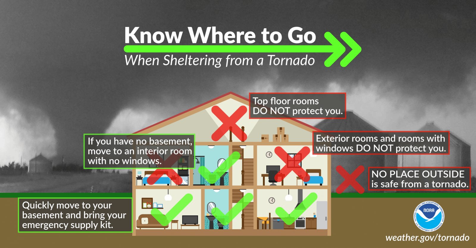
Be sure to know where to go if a warning is issued for your location. Now is the time to be sure that your safe place is free from clutter and your safety supplies have been restocked and ready to go. Have multiple ways to receive warnings and have those mobile devices fully charged and those weather apps installed. Also, keep fresh batteries in those WeatherRadios as some of this activity will take place during the overnight hours on Saturday night through Sunday morning.
Category: Alabama's Weather, ALL POSTS, Severe Weather
About the Author (Author Profile)
Scott Martin is an operational meteorologist, professional graphic artist, musician, husband, and father. Not only is Scott a member of the National Weather Association, but he is also the Central Alabama Chapter of the NWA president. Scott is also the co-founder of Racecast Weather, which provides forecasts for many racing series across the USA. He also supplies forecasts for the BassMaster Elite Series events including the BassMaster Classic.Subscribe
If you enjoyed this article, subscribe to receive more just like it.


