Active Storms Over and Approaching Lamar and Marion Counties
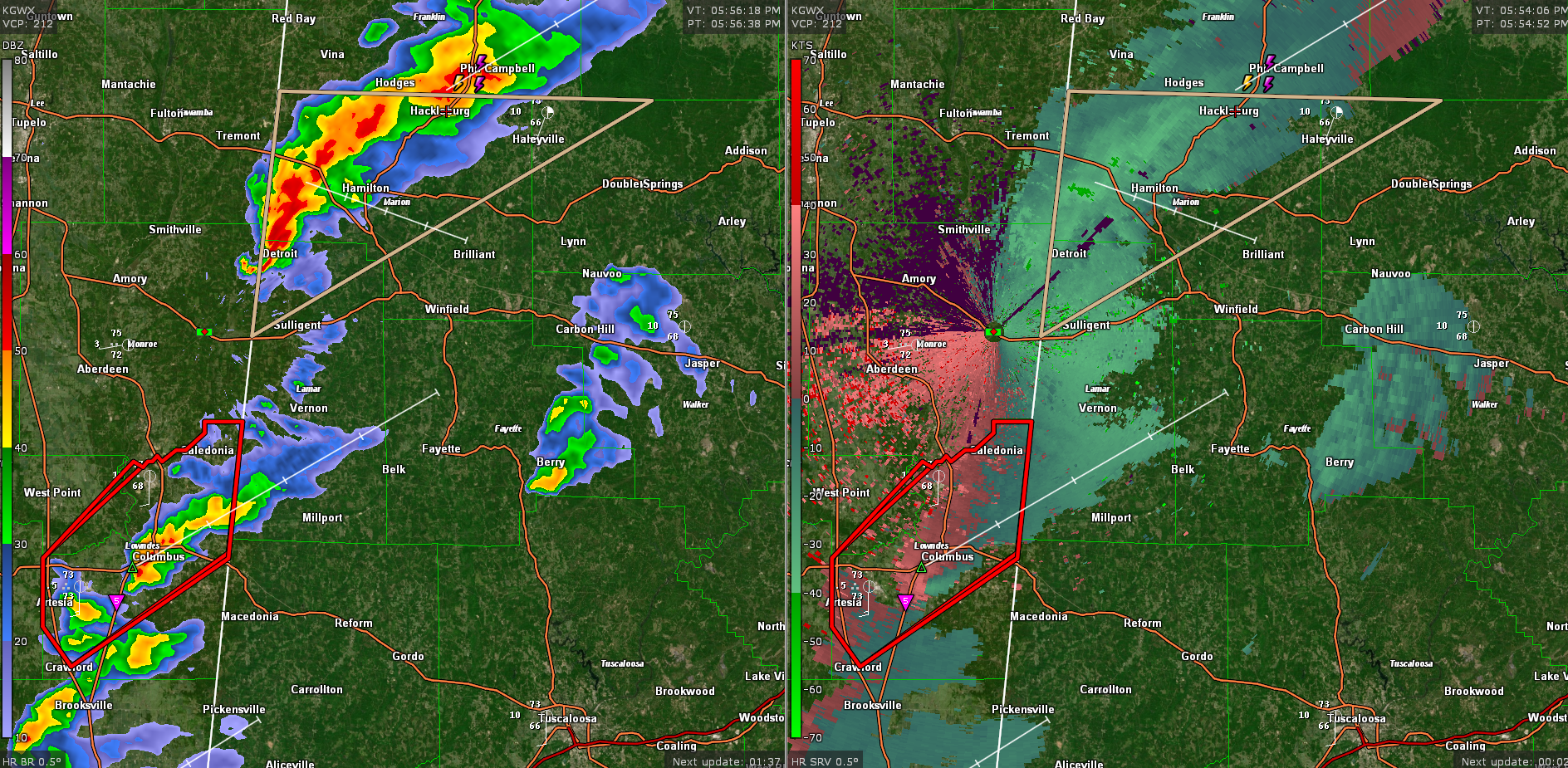
Two sets of strong thunderstorms are approaching the Alabama/Mississippi border or are over West Central Alabama at this hour.
The first is passing near Columbus MS. It has a tornado warning on it. The storm will move into Lamar County, clipping extreme NW Pickens County, and moving to between Millport and Vernon. It does have broad rotation but does not appear to have a tornado down at this time. The storms are racing northeastward at 65 mph. We will see if the NWS Birmingham issues a warning when it gets a little closer.
The second is over northern Lamar and western Marion County. The core of this storm will pass near and south of Hamilton, although much of the county will experience it. Be ready for 50 mph winds that would bring down tree limbs and blow around unsecured objects.
Category: Alabama's Weather, ALL POSTS, Severe Weather
About the Author (Author Profile)
Bill Murray is the President of The Weather Factory. He is the site's official weather historian and a weekend forecaster. He also anchors the site's severe weather coverage. Bill Murray is the proud holder of National Weather Association Digital Seal #0001 @wxhistorianSubscribe
If you enjoyed this article, subscribe to receive more just like it.


