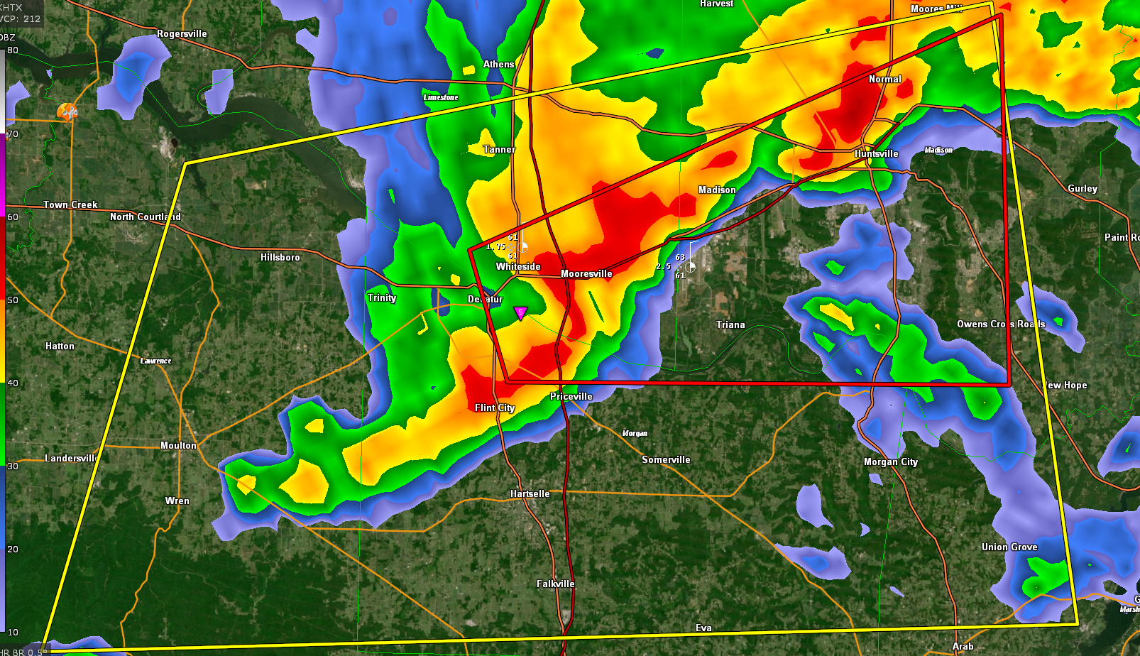
EXPIRED Tornado Warning for Portions of Madison, Limestone, and Morgan Counties Until 745 pm
This dangerous storm is approaching Huntsville.
Power was knocked out at 565 and Greenbrier.
Rotation is approaching Madison.
The National Weather Service in Huntsville Alabama has issued a
* Tornado Warning for…
Southwestern Madison County in north central Alabama…
Southeastern Limestone County in north central Alabama…
Northeastern Morgan County in north central Alabama…
* Until 745 PM CST.
* At 719 PM CST, a severe thunderstorm capable of producing a tornado
was located near Decatur, moving east at 50 mph.
HAZARD…Tornado.
SOURCE…Radar indicated rotation.
IMPACT…Flying debris will be dangerous to those caught without
shelter. Mobile homes will be damaged or destroyed.
Damage to roofs, windows, and vehicles will occur. Tree
damage is likely.
* This dangerous storm will be near…
Triana and Huntsville International Airport around 730 PM CST.
Madison and Marshall Space Flight Center around 735 PM CST.
Redstone Arsenal and University Of Alabama In Huntsville around
740 PM CST.
Alabama A And M University around 745 PM CST.
Other locations impacted by this tornadic thunderstorm include
Mooresville, Belle Mina, Ryland, Hampton Cove, Farley and Whitesburg.
Category: Alabama's Weather, ALL POSTS, Severe Weather
About the Author (Author Profile)
Bill Murray is the President of The Weather Factory. He is the site's official weather historian and a weekend forecaster. He also anchors the site's severe weather coverage. Bill Murray is the proud holder of National Weather Association Digital Seal #0001 @wxhistorianSubscribe
If you enjoyed this article, subscribe to receive more just like it.


