Severe Risk Continues for Northeast Alabama — Latest Mesoscale Discussion
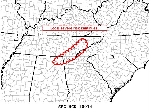
SUMMARY… Severe risk continues locally across valid portions of WW 007.
DISCUSSION… Latest objective analyses indicate a continued/gradual decrease in mixed-layer CAPE across the region, ongoing in conjunction with diurnal boundary-layer cooling. This corresponds with an overall decrease in convective intensity/organization within the main/frontal band of storms moving across eastern Tennessee and northern Alabama. At this time, the strongest storms are shifting into far northeastern Alabama.
With that said, weak height falls will spread eastward across the central Gulf Coast region/Tennessee Valley area tonight, ahead of the advancing upper system. As such, weak ascent aloft may steepen lapse rates a bit with time, possibly/partially offsetting the ongoing/diurnal airmass stabilization. As such, given the very favorable kinematic environment, at least some severe risk will likely continue overnight near and ahead of the advancing cold front.
Category: Alabama's Weather, ALL POSTS, Severe Weather
About the Author (Author Profile)
Scott Martin is an operational meteorologist, professional graphic artist, musician, husband, and father. Not only is Scott a member of the National Weather Association, but he is also the Central Alabama Chapter of the NWA president. Scott is also the co-founder of Racecast Weather, which provides forecasts for many racing series across the USA. He also supplies forecasts for the BassMaster Elite Series events including the BassMaster Classic.Subscribe
If you enjoyed this article, subscribe to receive more just like it.


