Flash Flood Warning for Parts of Madison Co. Until 12 am
The National Weather Service in Huntsville has issued a
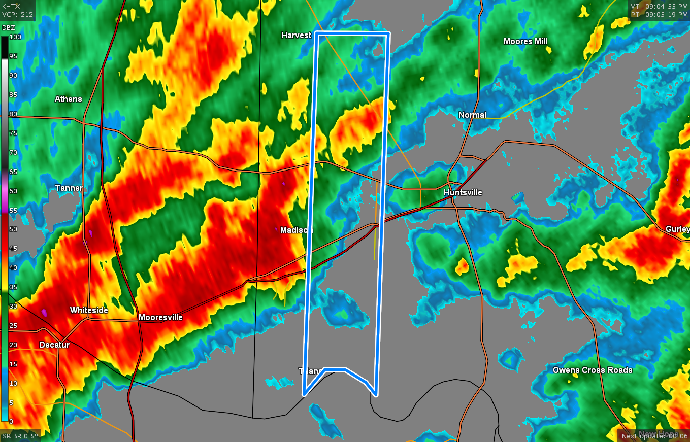
* Flash Flood Warning for…
Southwestern Madison County in north central Alabama…
* Until midnight CST.
* At 903 PM CST, Gauge reports and radar trends indicated
thunderstorms producing heavy rain will force Indian Creek in the
Madison area above flood stage. Flash flooding is expected to
begin as this occurs near this creek.
HAZARD…Flash flooding caused by thunderstorms.
SOURCE…Indian Creek in the Madison area is quickly rising and
is expected to climb above flood stage over the next 3
hours with additional heavy rainfall expected.
IMPACT…Flash flooding of small creeks and streams, urban
areas, highways, streets and underpasses as well as
other poor drainage and low-lying areas.
* Some locations that will experience flash flooding include…
Northwestern Huntsville, Madison, Redstone Arsenal, Triana,
Marshall Space Flight Center and Harvest.
PRECAUTIONARY/PREPAREDNESS ACTIONS…
Turn around, don’t drown when encountering flooded roads. Most flood
deaths occur in vehicles.
Be especially cautious at night when it is harder to recognize the
dangers of flooding.
Category: Alabama's Weather, ALL POSTS
About the Author (Author Profile)
Scott Martin is an operational meteorologist, professional graphic artist, musician, husband, and father. Not only is Scott a member of the National Weather Association, but he is also the Central Alabama Chapter of the NWA president. Scott is also the co-founder of Racecast Weather, which provides forecasts for many racing series across the USA. He also supplies forecasts for the BassMaster Elite Series events including the BassMaster Classic.Subscribe
If you enjoyed this article, subscribe to receive more just like it.


