A Quick Look at Your Saturday Afternoon Weather
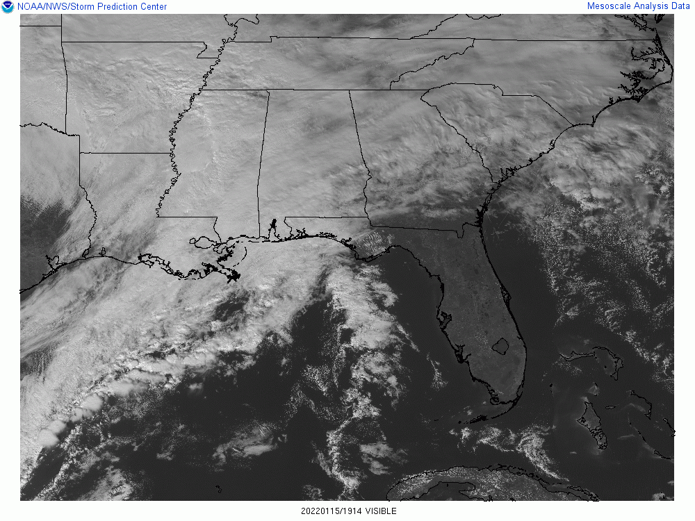
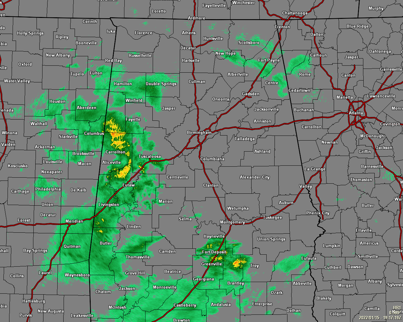
As of 1:20 pm, we have cloudy skies across Central Alabama with a good bit of shower activity located over the western and southern parts of the area, along with a few light showers falling over the extreme northeastern parts of the area. Temperatures as of 1 pm were ranging from the upper 40s to the mid-60s across the area. Troy was the warm spot at 66 degrees. Gadsden and Haleyville were tied as the cool spots at 48 degrees. Birmingham was sitting at 52 degrees. Highs will be in the lower 50s to the mid-60s.
All of North Alabama and most of Central Alabama goes under a Wind Advisory tonight as sustained winds will be around 10-20 mph and gusting as high as 35 mph. Please use caution if having to drive tonight and through the overnight hours. Rain will also continue through the late-night and overnight hours, with lows dipping into the mid-30s to the mid-40s.
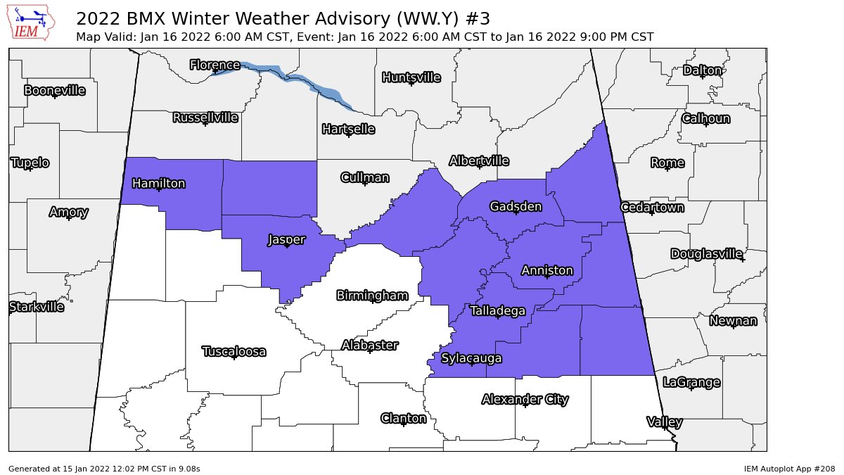
CHANGES SINCE THE MORNING VIDEO: A Winter Weather Advisory has been issued for Blount, Calhoun, Cherokee, Clay, Cleburne, Etowah, Marion, Randolph, St. Clair, Talladega, Walker, and Winston counties in Central Alabama starting at 6 am Sunday morning and is set to expire at 9 pm Sunday night.
A Special Weather Statement has been issued for Colbert, Cullman, Franklin, Lauderdale, Lawrence, Limestone, Madison, Marshall, and Morgan counties in North Alabama concerning the potential from a dusting up to 1 inch of snowfall accumulation across much of those locations, with higher elevations potentially receiving a little more.
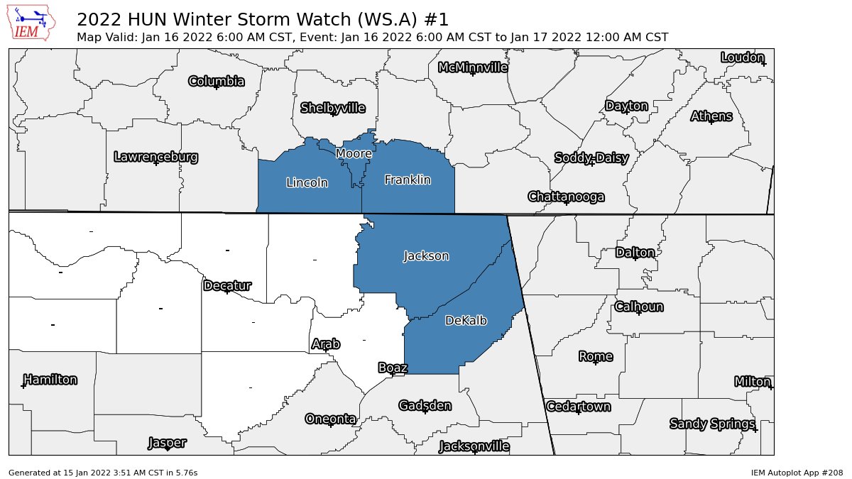
A Winter Storm Watch is set to go into effect for DeKalb and Jackson counties in North Alabama at 6 am Sunday morning, with the expiration set for midnight Sunday night.
THE BOTTOM LINE: Rain will start to transition over into snow around sunrise on Sunday morning, and a wintry mix will continue through much of the morning. By the time we get to the midday hour, much of the activity over the northern portions of the area will have transitioned over to snow flurries and snow showers. Much of the activity will come to an end on Sunday evening, but we may have a few lingering flakes or frozen drizzle hanging around through the late night hours.
We could see some slick spots form on the roadways as early as late Sunday morning; plus, gusty winds and locally heavy snow showers may lead to a few branches or tree limbs falling and causing minor power outages. Any water remaining on the roadways after dark most likely will freeze, as low temperatures will dip well-below freezing.
Stay up-to-date throughout the rest of your Saturday, just in case there is a change in the forecast. If the low goes just a little farther south than forecasted, snowfall totals and impacts may be greater. Just the opposite if the low goes a little farther north.
Category: Alabama's Weather, ALL POSTS, Winter Weather
About the Author (Author Profile)
Scott Martin is an operational meteorologist, professional graphic artist, musician, husband, and father. Not only is Scott a member of the National Weather Association, but he is also the Central Alabama Chapter of the NWA president. Scott is also the co-founder of Racecast Weather, which provides forecasts for many racing series across the USA. He also supplies forecasts for the BassMaster Elite Series events including the BassMaster Classic.Subscribe
If you enjoyed this article, subscribe to receive more just like it.


