

Midday Nowcast: Cold with Very Slow Clearing
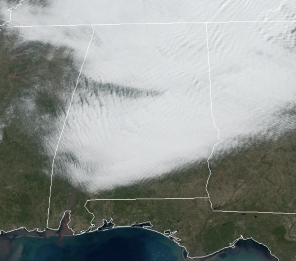
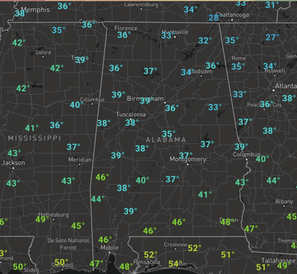
A cloudy and cold morning for much of the area, and as we approach the midday hours, the clouds are hanging tough, but we should see some gradual clearing this afternoon. It remains cold with temperatures in the 30s and 40s.
Tonight will be clear and cold with lows back in the 20s. Tomorrow will be a sunny and warmer day with mid 50s by afternoon.
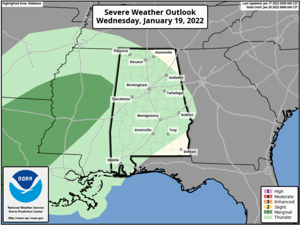
MIDWEEK FRONT: Clouds will increase Wednesday ahead of a cold front. Rain will push into the northwest part of the state by mid to late afternoon, and rain is likely statewide Wednesday night. There could be a rumble of thunder in spots; SPC has defined a “marginal risk” (level 1/5) of severe thunderstorms west of the state for parts of Southeast Texas, Louisiana, and Mississippi, but severe storms are not expected in Alabama.
The rain and storms will push through the state overnight and the rain ends early Thursday. Behind the front, another shot of cold air rolls into the state. There could be some snow flurries possible over some northern counties early Thursday no impact is expected, but temperatures will be in the upper 30s to low 40s. Thursday night will be cold with lows back in the 20s. Friday will be cold and dry with a mix of sun and clouds, highs will again be in the upper 30s and lower 40s.
COLD WEEKEND WEATHER: Temperatures will remain below average for this weekend, as it looks like we will be in a long stretch of below-average temperatures across the Deep South. Highs will be in the 40s and lows in the low and mid 20s both days, and for now will feature a mix of sun and clouds.
WEEKEND WINTRY MISCHIEF?: Cold air will be in place and this time of year we have to watch for any feature that could produce precipitation in the cold air. As of now, the global models are hinting at the potential for a surface low tracking along the in the northern Gulf of Mexico Saturday. History teaches us that this is typically one of the more ideal setups for snow in Alabama, so we are watching model trends carefully this week as there remains a great amount of inconsistency in model output.
If this Gulf low does form, we would need to adjust the weekend forecast, mentioning a cloudy day Saturday with a chance of some rain or snow in the coming days…just too early to call.
CONTINUED COLD NEXT WEEK: For now a decent part of the week looks dry with below average temperatures… highs most days will be in the 30s and low 40s with lows in the 20s.
BEACH FORECAST CENTER: Get the latest weather and rip current forecasts for the beaches from Fort Morgan to Panama City on our Beach Forecast Center page. There, you can select the forecast of the region that you are interested in visiting.
WORLD TEMPERATURE EXTREMES: Over the last 24 hours, the highest observation outside the U.S. was 112.1F at Santiago Del Estero, Argentina. The lowest observation was -61.8F at Delyankir, Russia.
CONTIGUOUS TEMPERATURE EXTREMES: Over the last 24 hours, the highest observation was 80F at Boca Chica, FL. The lowest observation was -29F at Averill, VT.
WEATHER ON THIS DATE IN 1982: Strong chinook winds caused severe wind damage in Boulder, CO. Wind gusts to 118 mph was recorded on the roof of the Environmental Research Laboratories (ERL), and a wind gust to 137 mph was measured atop the roof of the NCAR building (in the southwest part of the city, 600 feet above ground level). The high winds uprooted trees and damage roofs.
Category: Alabama's Weather, ALL POSTS
About the Author (Author Profile)
Macon, Georgia Television Chief Meteorologist, Birmingham native, and long time Contributor on AlabamaWX. Stormchaser. I did not choose Weather, it chose Me. College Football Fanatic. @Ryan_StinnetSubscribe
If you enjoyed this article, subscribe to receive more just like it.


