A Brief Check on Our Weather Situation Just Before 1 pm
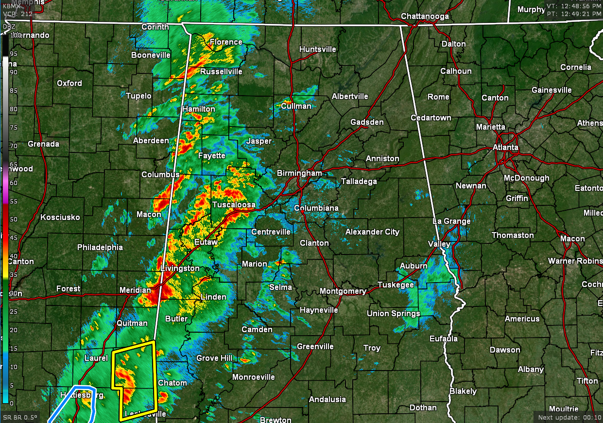
Rain and thunderstorms are moving across the western parts of North/Central Alabama, some of which are bringing heavy rain and gusty winds to portions of the area, especially for Sumter County. Here is the text from NWS Birmingham on that cell.
…A strong thunderstorm will impact portions of southern Sumter County through 115 PM CST…
At 1235 PM CST, Doppler radar was tracking a strong thunderstorm near Alamucha, or 11 miles southwest of Cuba, moving northeast at 50 mph.
HAZARD…Wind gusts up to 50 mph and pea size hail.
SOURCE…Radar indicated.
IMPACT…Gusty winds could knock down tree limbs and blow around unsecured objects. Minor damage to outdoor objects is possible.
Locations impacted include…
Livingston, York, Cuba, The University Of West Alabama, Bluffport, Coatopa, Dug Hill, Kinterbish, Old Mallard Airport, Belmont, Demopolis Lock And Dam, Lilita, McDowell, Bellamy, I-20 Welcome Center At Cuba, Ward and Whitfield.
PRECAUTIONARY/PREPAREDNESS ACTIONS…
If outdoors, consider seeking shelter inside a building. This storm may intensify, so be certain to monitor local radio
stations and available television stations for additional information and possible warnings from the National Weather Service.
The eastern half of Central Alabama is rather quiet at this time with only a few light showers showing up over portions of Lee, Macon, Russell, Bullock, and Barbour counties.
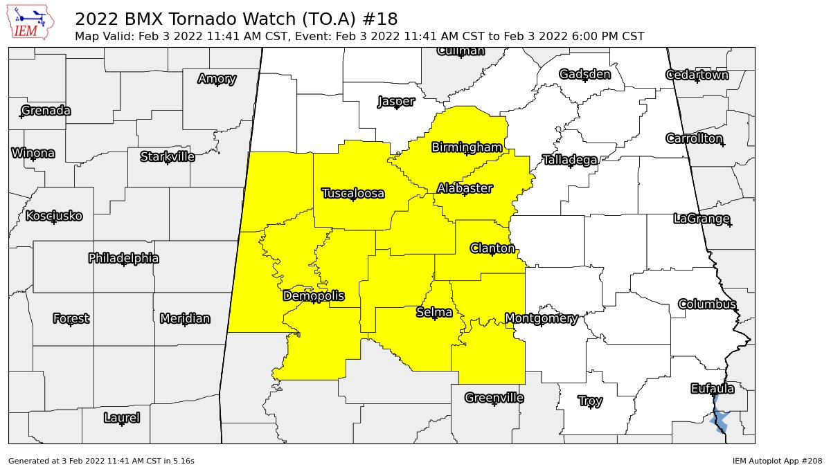
A TORNADO WATCH continues in effect until 6 pm tonight for the following counties in Central Alabama: Autauga, Bibb, Chilton, Dallas, Greene, Hale, Jefferson, Lowndes, Marengo, Perry, Pickens, Shelby, Sumter, Tuscaloosa.
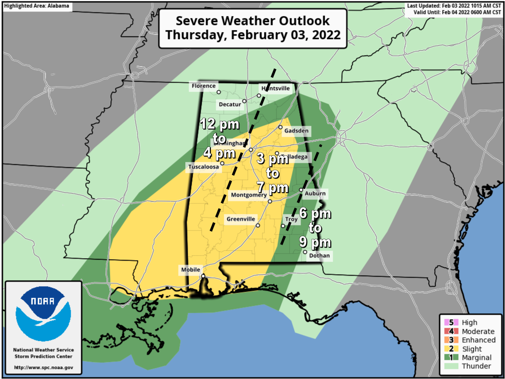
A Slight Risk for severe storms continues across much of Central Alabama, with parts of the eastern half of North Alabama and a small portion of the eastern half of Central Alabama remains in a Marginal Risk. Timing for the threat of severe storms will be from now through 9 pm tonight. Damaging winds up to 70 mph, a couple tornadoes, and isolated hail up to quarter size are possible with any cell that becomes severe.
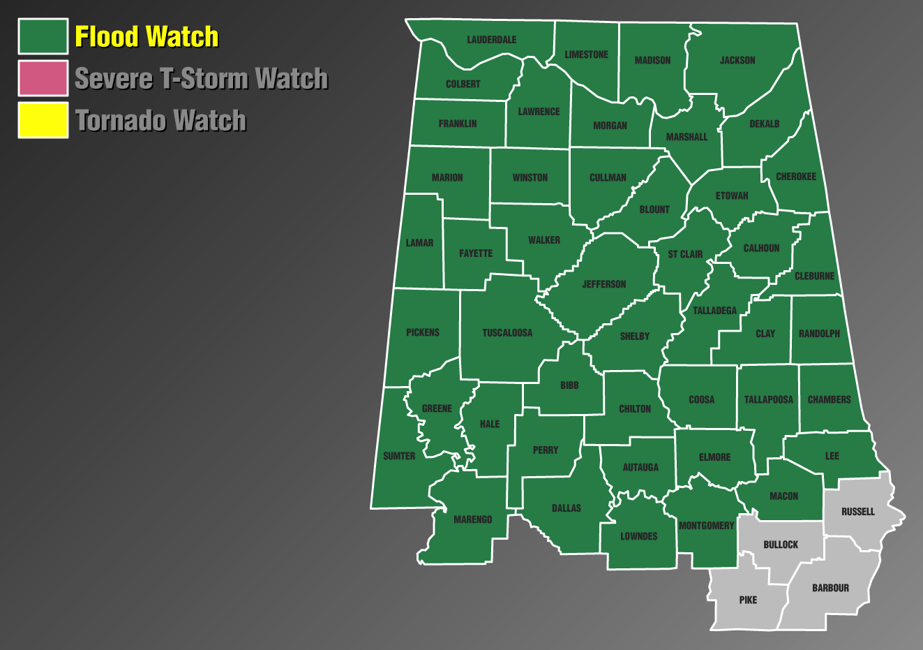
Also, we have a threat of a few flash flooding issues today as rainfall totals may reach as high as 3 inches with the potential of localized heavier amounts with strong thunderstorms. A Flood Watch continues until 6 am Friday morning.
Category: Alabama's Weather, ALL POSTS, Severe Weather
About the Author (Author Profile)
Scott Martin is an operational meteorologist, professional graphic artist, musician, husband, and father. Not only is Scott a member of the National Weather Association, but he is also the Central Alabama Chapter of the NWA president. Scott is also the co-founder of Racecast Weather, which provides forecasts for many racing series across the USA. He also supplies forecasts for the BassMaster Elite Series events including the BassMaster Classic.Subscribe
If you enjoyed this article, subscribe to receive more just like it.


