Tornado Watch Extended Eastward; Set to Expire at 6 pm
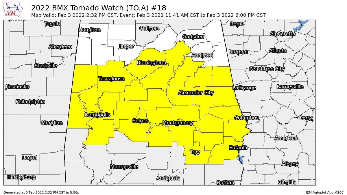
NWS Birmingham has extended the TORNADO WATCH in area to now include Barbour, Bullock, Chambers, Clay, Coosa, Elmore, Lee, Macon, Montgomery, Pike, Randolph, Russell, St. Clair, Talladega, and Tallapoosa counties to go along with Autauga, Bibb, Chilton, Dallas, Greene, Hale, Jefferson, Lowndes, Marengo, Perry, Pickens, Shelby, Sumter, and Tuscaloosa counties. The watch is set to expire at 6 pm.
We have a report of entrapments and injuries in parts of Hale County close to the towns of Sawyerville and Wedgeworth. Here are some raw reports from NWS Chat:
Local Storm Report by NWS BMX: 5 WNW Kinterbish [Sumter Co, AL] emergency mngr reports TSTM WND DMG at 12:55 PM CST — trees down county road 5 and campbell street. possible tornado.
Local Storm Report by NWS BMX: 4 SSE York [Sumter Co, AL] fire dept/rescue reports TSTM WND DMG at 01:04 PM CST — tree down on alabama 17 at lucy walker drive. possible tornado.
Local Storm Report by NWS BMX: 4 WNW Lilita [Sumter Co, AL] public reports TSTM WND DMG at 01:16 PM CST — trees down on county road 13 6 miles north of highway 80. possible tornado.
Category: Alabama's Weather, ALL POSTS, Severe Weather
About the Author (Author Profile)
Scott Martin is an operational meteorologist, professional graphic artist, musician, husband, and father. Not only is Scott a member of the National Weather Association, but he is also the Central Alabama Chapter of the NWA president. Scott is also the co-founder of Racecast Weather, which provides forecasts for many racing series across the USA. He also supplies forecasts for the BassMaster Elite Series events including the BassMaster Classic.Subscribe
If you enjoyed this article, subscribe to receive more just like it.


