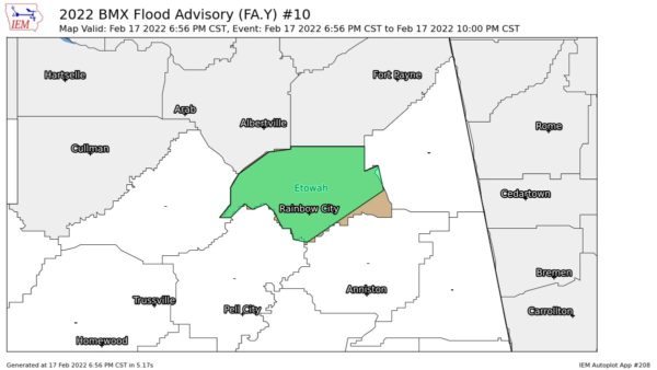
EXPIRED — Areal Flood Advisory for Parts of Etowah Co. Until 10 pm
…FLOOD ADVISORY IN EFFECT UNTIL 10 PM CST THIS EVENING…
* WHAT…Urban and small stream flooding caused by excessive
rainfall is expected.
* WHERE…A portion of central Alabama, including the following
county, Etowah.
* WHEN…Until 1000 PM CST.
* IMPACTS…Minor flooding in low-lying and poor drainage areas.
* ADDITIONAL DETAILS…
– At 656 PM CST, Doppler radar indicated heavy rain due to
thunderstorms. This will cause urban and small stream
flooding.
– Some locations that will experience flooding include…
Gadsden, Rainbow City, Attalla, Hokes Bluff, Glencoe, Sardis
City, Steele, Altoona, Walnut Grove, Reece City, Noccalula
Falls, Gadsden Mall, Aurora, Neely Henry Lake, Tabor Road,
Ballplay, Southside, Crudup, Rockledge and Northside.
PRECAUTIONARY/PREPAREDNESS ACTIONS…
Turn around, don’t drown when encountering flooded roads. Most flood
deaths occur in vehicles.
Category: Alabama's Weather, ALL POSTS


