CANCELED — Flash Flood Warning for Parts of DeKalb Co. Until 11:15 pm
The National Weather Service in Huntsville has issued a
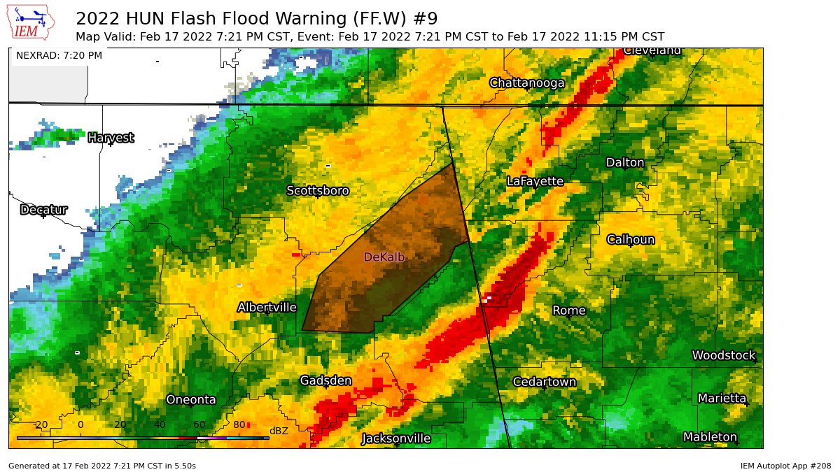
* Flash Flood Warning for…
DeKalb County in northeastern Alabama…
* Until 1115 PM CST.
* At 721 PM CST, emergency management reported thunderstorms
producing heavy rain across the warned area. Between 1 and 2
inches of rain have fallen. Additional rainfall amounts of 0.5 to
1 inch are possible in the warned area. Flash flooding is already
occurring.
HAZARD…Flash flooding caused by thunderstorms.
SOURCE…Emergency management reported.
IMPACT…Flash flooding of small creeks and streams, urban
areas, highways, streets and underpasses as well as
other poor drainage and low-lying areas.
* Some locations that will experience flash flooding include…
Fort Payne, Rainsville, Henagar, Crossville, Sylvania, Fyffe,
Powell, Geraldine, Ider, Valley Head, Hammondville, Mentone, Pine
Ridge, Lakeview, Collbran, Lebanon, Guest, Peeks Corner, Dog Town
and Adamsburg.
PRECAUTIONARY/PREPAREDNESS ACTIONS…
Turn around, don’t drown when encountering flooded roads. Most flood
deaths occur in vehicles.
Be especially cautious at night when it is harder to recognize the
dangers of flooding.
Category: Alabama's Weather, ALL POSTS
About the Author (Author Profile)
Scott Martin is an operational meteorologist, professional graphic artist, musician, husband, and father. Not only is Scott a member of the National Weather Association, but he is also the Central Alabama Chapter of the NWA president. Scott is also the co-founder of Racecast Weather, which provides forecasts for many racing series across the USA. He also supplies forecasts for the BassMaster Elite Series events including the BassMaster Classic.Subscribe
If you enjoyed this article, subscribe to receive more just like it.


