A Beautiful, Warm, & Breezy Day Out There at Midday
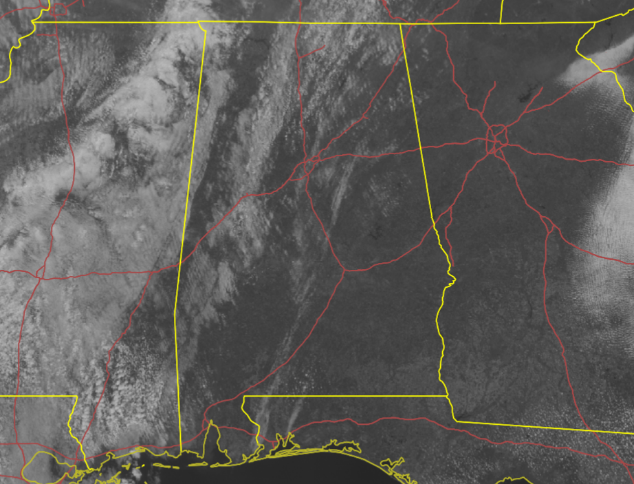
MIDDAY WEATHER CHECKUP: We have a few clouds out there over the western and northwestern parts of the area, but much of the rest of North/Central Alabama are enjoying plenty of sunshine. You will have to hang onto your hat and have to continuously fix your hair while you are outdoors at this point as winds are quite breezy with gusts reaching as high as 25 mph at times. Temperatures were mainly in the 70s across the area according to the 11 am roundup. Haleyville was the cool spot at 69 degrees. Troy was knocking of the door of the 80s, sitting at 79 degrees. Birmingham was at 74 degrees.
REST OF YOUR SATURDAY: We’ll continue to have mostly sunny skies and it will be breezy at times throughout the rest of the daylight hours. Afternoon highs will reach the lower to mid 80s across the area. For tonight, skies will be partly to mostly clear across the area and temperatures will stay rather mild for the night. Lows will be in the 50s.
SUNDAY’S WEATHER: Much of Central Alabama will stay dry on Sunday, but clouds will begin to move in from the west. A few scattered showers and maybe a rumble of thunder or two will be possible over the western parts of the area, while along and east of I-65 will be dry with a mix of sun and clouds. Highs will be in the lower to mid 80s. The clouds will hang around for the evening and overnight hours, but any shower activity will dissipate and all of Central Alabama will be dry. Lows will be in the upper 50s to the mid 60s.
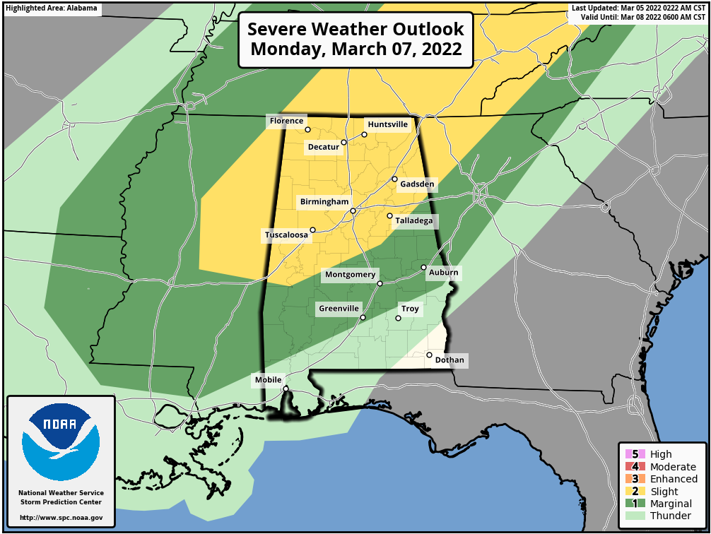
MONDAY’S SEVERE WEATHER THREAT: A frontal system will begin to move into the northwestern parts of the area just after the midday hour on Monday and will push eastward across Central Alabama throughout the remainder of the day. The latest model runs continue to show that the activity will be mainly along a squall line with no evidence at this point of any rogue cells developing out ahead of it. There will be just enough instability mixed in with a good bit of shear that we’ll have to watch for severe storms with the main threat coming from damaging wind gusts up to 60 mph. A brief spin-up tornado may be possible embedded in the line, but the overall tornado threat looks low at this point.
The Storm Prediction Center continues a Slight Risk for severe storms is up for all of North Alabama and stretches into Central Alabama down to a line from just south of Demopolis to Clanton to Fruithurst. A Marginal Risk is up for nearly the rest of Central Alabama, except for locations south of a line from Stills Crossroads (Pike Co.) to Phenix City (Russell Co). The rough window for the threat of severe storms will be from 12 pm to 9 pm, but as more high-resolution model data come in, we’ll be able to get a better feel on how this system will behave and what the more precise timing will be. We’ll keep you posted.
Category: Alabama's Weather, ALL POSTS, Severe Weather
About the Author (Author Profile)
Scott Martin is an operational meteorologist, professional graphic artist, musician, husband, and father. Not only is Scott a member of the National Weather Association, but he is also the Central Alabama Chapter of the NWA president. Scott is also the co-founder of Racecast Weather, which provides forecasts for many racing series across the USA. He also supplies forecasts for the BassMaster Elite Series events including the BassMaster Classic.Subscribe
If you enjoyed this article, subscribe to receive more just like it.


