Quiet for Now, but Severe Threat Continues for a Few Hours Longer
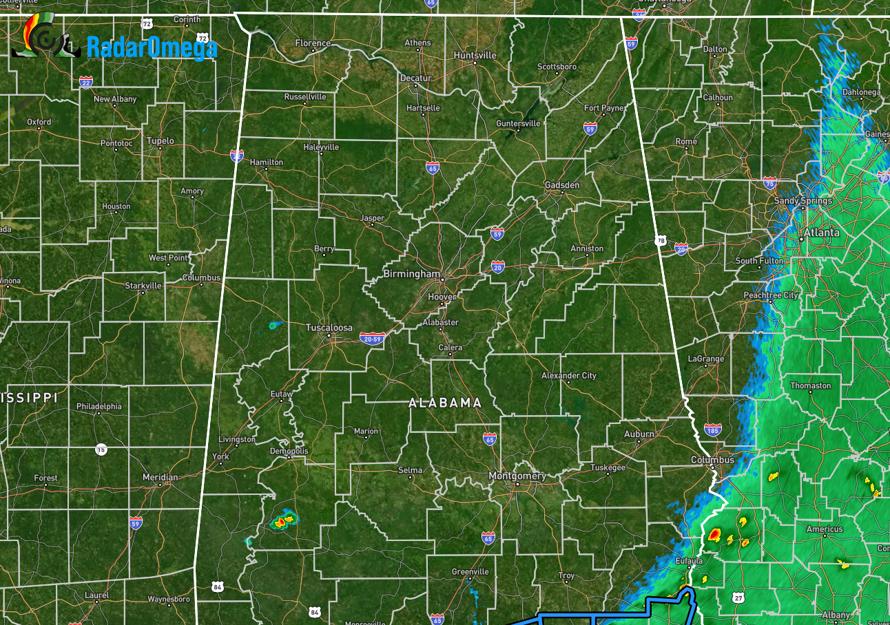
As of 2:56 pm, the first line of storms have pushed out of the area, with only a few stray showers left over the extreme eastern parts of Russell and Barbour counties. Other than that, radar is dry across North/Central Alabama, other than a stay shower over the southwestern parts of Marengo County and over the eastern part of Pickens County.
No severe weather watches or warnings are in effect, but the threat for stronger to severe storms has not ended for the day.
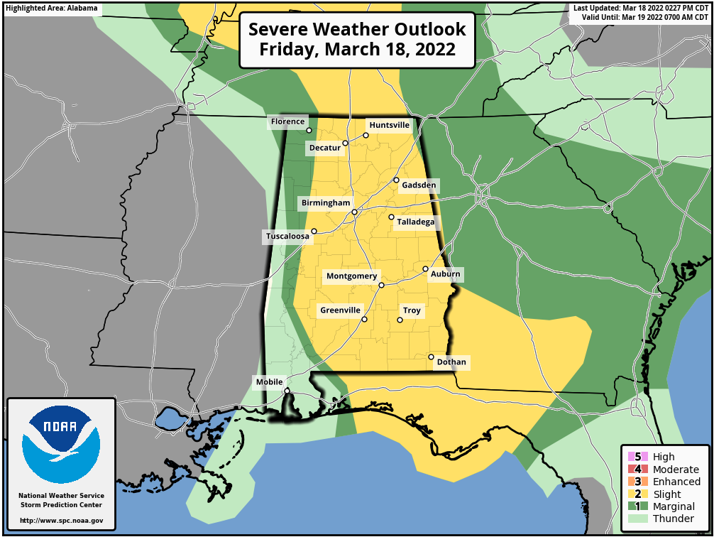
A SLIGHT RISK continues for much of North/Central Alabama west of a line from Green Hill (Lauderdale Co.) to Coker (Tuscaloosa Co.) to Sweet Water (Marengo Co.).
A MARGINAL RISK continues west of that to as far west as Bexar (Marion Co.) to Carrollton (Pickens Co.) to Bettamy (Sumter Co.) and for the extreme northeastern corner of the area east of a line from Rocky Springs (Jackson Co.) to Hall Valley (Cherokee Co.).
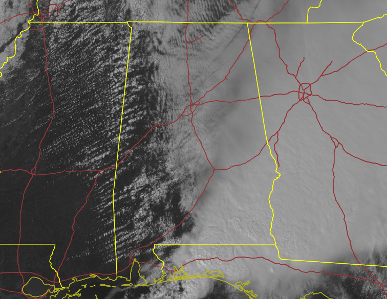
While the eastern half of the area is still completely covered in clouds, the western parts of the area is seeing some clearing, and this will allow the sun to heat the surface and rise those instability values. However, for the time being, instability remains too low at this point for shower and thunderstorm development.
We still have a few hours of sunshine left for today, so there is still time for that instability to rise, the atmosphere to become unstable, and scattered showers and thunderstorms to develop. Any thunderstorm that will be able to develop will be capable of producing large hail, damaging winds, and localized flooding. Wind shear profiles are becoming more unidirectional over time, so the tornado threat is decreasing as it gets later in the day.
The mid-levels of the atmosphere may dry out enough over the extreme western parts of the area by the start of the evening that will end the risk for severe storms. That drier air will work over the rest of the area throughout the evening.
Category: Alabama's Weather, ALL POSTS, Severe Weather
About the Author (Author Profile)
Scott Martin is an operational meteorologist, professional graphic artist, musician, husband, and father. Not only is Scott a member of the National Weather Association, but he is also the Central Alabama Chapter of the NWA president. Scott is also the co-founder of Racecast Weather, which provides forecasts for many racing series across the USA. He also supplies forecasts for the BassMaster Elite Series events including the BassMaster Classic.Subscribe
If you enjoyed this article, subscribe to receive more just like it.


