EXPIRED — SEVERE T-STORM WARNING: Parts of Colbert, Lauderdale, Lawrence, Limestone, Morgan Co. Until 6 pm
The National Weather Service in Huntsville Alabama has issued a
* Severe Thunderstorm Warning for…
Eastern Lauderdale County in northwestern Alabama…
Limestone County in north central Alabama…
East central Colbert County in northwestern Alabama…
Western Morgan County in north central Alabama…
Lawrence County in northwestern Alabama…
* Until 600 PM CDT.
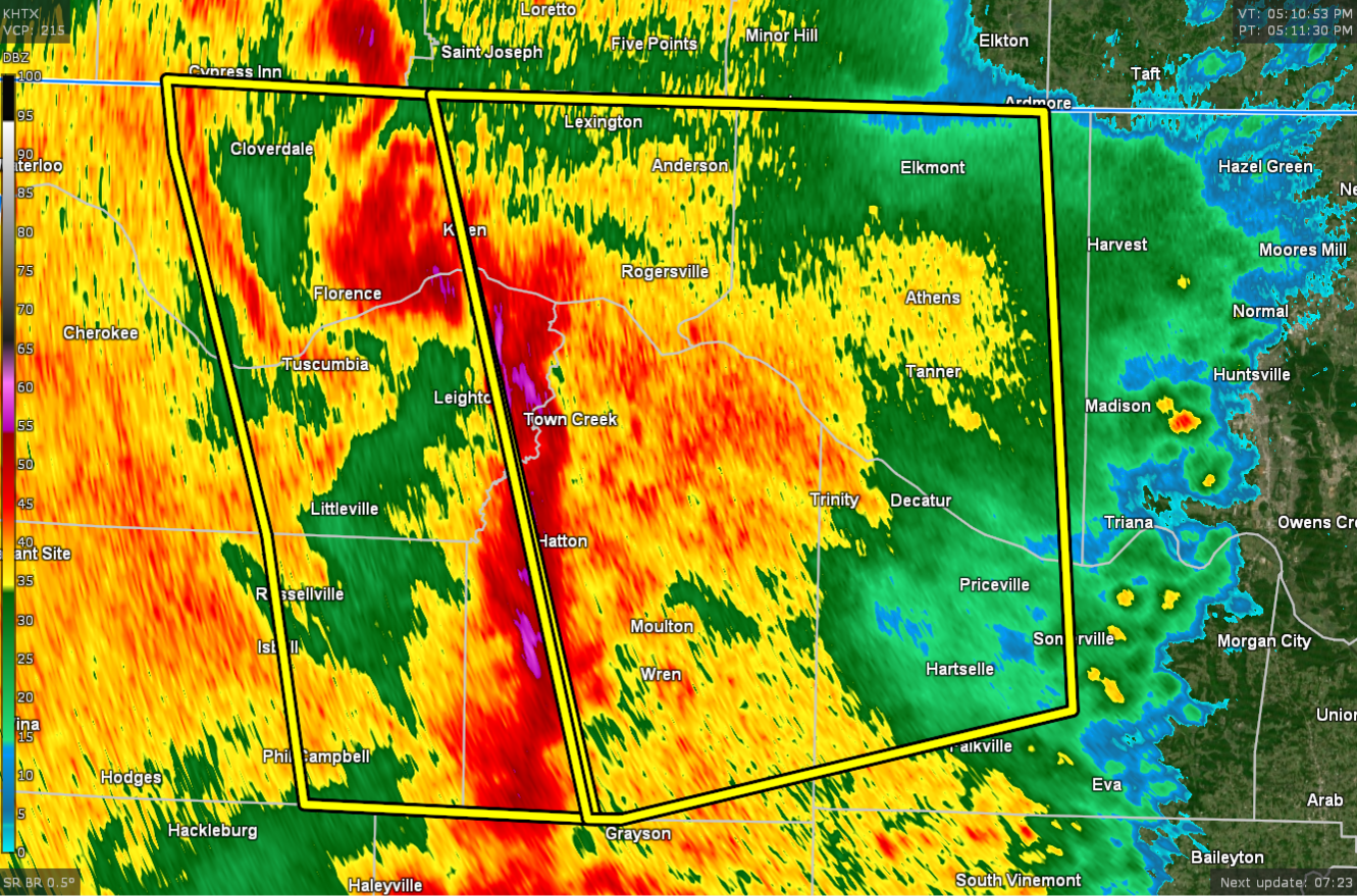
* At 508 PM CDT, severe thunderstorms were located along a line
extending from 10 miles north of Underwood-Petersville to near
Leighton to 9 miles southwest of Moulton, moving northeast at 55
mph. This storm has a history of producing small hail, having
several small, broad circulations, and numerous trees are down.
HAZARD…60 mph wind gusts and penny size hail.
SOURCE…Radar indicated.
IMPACT…Expect damage to roofs, siding, and trees.
* Locations impacted include…
Decatur, Athens, Hartselle, Moulton, Priceville, Trinity,
Falkville, Rogersville, Ardmore and Killen.
PRECAUTIONARY/PREPAREDNESS ACTIONS…
For your protection move to an interior room on the lowest floor of a
building.
A Tornado Watch remains in effect until 700 PM CDT for northwestern
Alabama. A Tornado Watch also remains in effect until 1100 PM CDT for
north central Alabama.
Category: Alabama's Weather, ALL POSTS, Severe Weather
About the Author (Author Profile)
Scott Martin is an operational meteorologist, professional graphic artist, musician, husband, and father. Not only is Scott a member of the National Weather Association, but he is also the Central Alabama Chapter of the NWA president. Scott is also the co-founder of Racecast Weather, which provides forecasts for many racing series across the USA. He also supplies forecasts for the BassMaster Elite Series events including the BassMaster Classic.Subscribe
If you enjoyed this article, subscribe to receive more just like it.


