AREAL FLOOD WARNING: Parts of Franklin, Lawrence, Morgan Co. Until 1 am
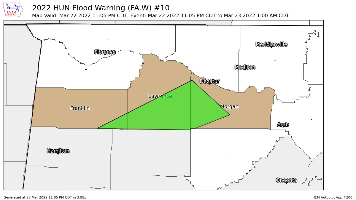
…FLOOD WARNING IN EFFECT UNTIL 1 AM CDT WEDNESDAY…
* WHAT…Flooding caused by excessive rainfall is expected.
* WHERE…Portions of north central Alabama and northwest Alabama,
including southeastern portions of Franklin, southern portions of
Lawrence, and western portions of Morgan county.
* WHEN…Until 100 AM CDT.
* IMPACTS…Flooding of rivers, creeks, streams, and other low-lying
and flood-prone locations is imminent or occurring.
* ADDITIONAL DETAILS…
– At 1059 PM CDT, Flooding is already occurring in the warned
area. Reports of the 400 to 700 block of Targum road west of
Hartselle is experiencing confirmed heavy flooding over the
roadway. Between 1 and 3 inches of rain have fallen.
– Additional rainfall amounts up to 0.50 inches are possible in
the warned area.
– Some locations that will experience flooding include…
Decatur, Hartselle, Moulton, Trinity, Falkville, Speake,
Wren, Bankhead National Forest, Chalybeate Springs, Caddo,
Neel, Landersville, Massey and Basham.
– http://www.weather.gov/safety/flood
PRECAUTIONARY/PREPAREDNESS ACTIONS…
Turn around, don’t drown when encountering flooded roads. Most flood
deaths occur in vehicles.
Category: Alabama's Weather, ALL POSTS
About the Author (Author Profile)
Scott Martin is an operational meteorologist, professional graphic artist, musician, husband, and father. Not only is Scott a member of the National Weather Association, but he is also the Central Alabama Chapter of the NWA president. Scott is also the co-founder of Racecast Weather, which provides forecasts for many racing series across the USA. He also supplies forecasts for the BassMaster Elite Series events including the BassMaster Classic.Subscribe
If you enjoyed this article, subscribe to receive more just like it.


