Mid-Afternoon Update on Today’s Severe Weather Threat
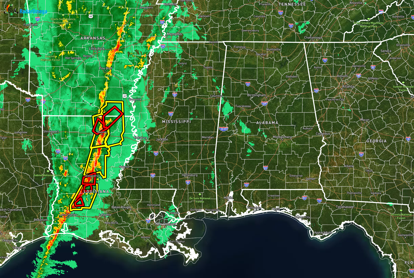
As of 1:30 pm, the line of thunderstorms that is expected to move into North/Central Alabama later this evening is currently west of the Mississippi River over east-central parts of Arkansas and down through central and west-central parts of Louisiana. There were six active tornado warnings and four severe thunderstorm warnings along the southern parts of the line. Unfortunately, the atmosphere will be more conducive for severe storms in Mississippi and the western half of Alabama.
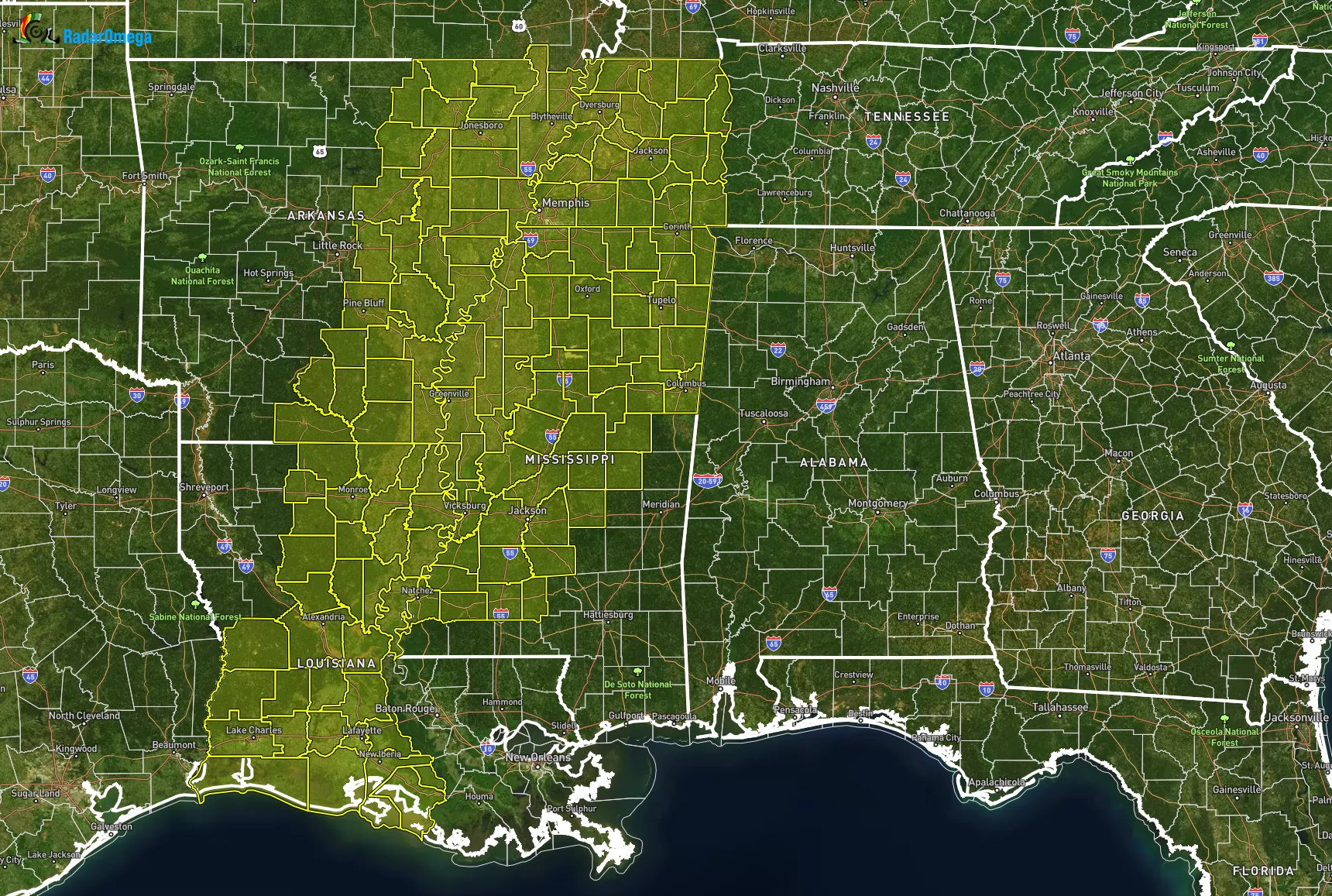
Tornado watches are already in effect for the western parts of Tennessee, much of Mississippi, the central and west-central parts of Louisiana, and the eastern parts of Arkansas. A Tornado Watch most likely be issued for portions of North/Central Alabama over the next few hours. Here is a breakdown of what to expect…
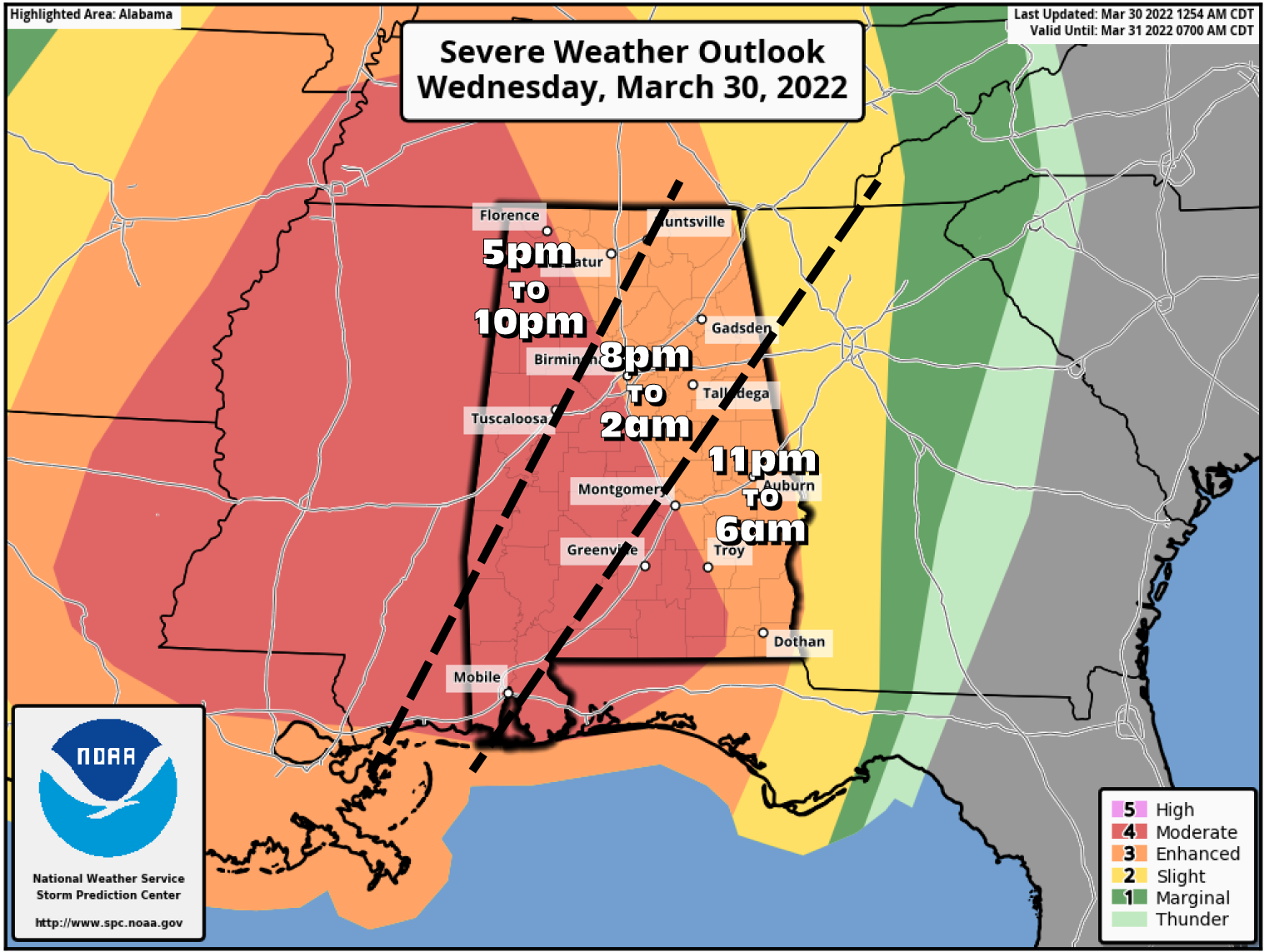
MODERATE RISK (level 4/5)
West of a line from roughly Florence (Lauderdale Co.) to Alabaster (Shelby Co.) to Troy (Pike Co.).
ENHANCED RISK (level 3/5)
Nearly the rest of the area east of the Moderate Risk to the AL/GA state line.
MAIN THREATS
Damaging winds will be a major threat as thunderstorm wind gusts could reach 70-80 mph, especially in the moderate risk areas with the strongest winds possible over the northwestern parts of the area.
There is a small tornado threat with this system, especially with brief spin-up tornadoes along the line of storms. With the wind energy, a strong tornado could form along the line. Discrete cell formation does not look likely at this time for much of the area. However, conditions may become conducive enough that one or two may develop over the west and southwestern parts of the area. If that is the case. A strong tornado would be possible with any discrete supercell that forms.
Hail up to one inch in diameter may be possible within the Moderate Risk locations, but not likely for the rest of the area.
IMPORTANT: Today is a day that you will need to treat all warnings very seriously. With the potential of damaging winds up to and exceeding 80 mph, damage equal to an EF1 tornado may occur. So, if a severe thunderstorm warning is issued for your location, go through your tornado safety plan and get to your safe place.
TIMING
5 pm – 10 pm: West of a line from Huntsville (Madison Co.) to Whitfield (Sumter Co.).
8 pm – 2 am: East of that to a line from Hopewell (Cleburne Co.) to Macedonia (Lowndes Co.).
11 pm – 6 am: East of a line from Hopewell (Cleburne Co.) to Macedonia (Lowndes Co.) to the AL/GA state line.
HIGH WIND WARNING & WIND ADVISORIES
Gusty winds will start during the late morning hours on Wednesday as sustained winds will be averaging 15-25 mph with gusts up to 50 mph in the advisory areas, and up to 60 mph or greater in the High Wind Warning area.
High Wind Warning (now until Thu. 1 am):
Colbert, Franklin, Lauderdale, and Lawrence counties in North Alabama.
High Wind Warning (Wed. 5 pm to 10 pm):
Fayette, Lamar, Marion, Pickens, and Winston counties in Central Alabama.
Wind Advisory (now until Thu. 1 am):
Colbert, Cullman, DeKalb, Franklin, Jackson, Lauderdale, Lawrence, Limestone, Madison, Marshall, and Morgan counties in North Alabama.
Wind Advisory (now until 5 pm):
Fayette, Lamar, Marion, Pickens, and Winston counties in Central Alabama.
Wind Advisory (now until Thu. 1 am):
Autauga, Bibb, Blount, Chilton, Dallas, Greene, Hale, Jefferson, Lowndes, Marengo, Perry, Shelby, St. Clair, Sumter, Tuscaloosa, and Walker counties in Central Alabama.
Wind Advisory (now until 4 am):
Barbour, Bullock, Calhoun, Chambers, Cherokee, Clay, Cleburne, Coosa, Elmore, Etowah, Lee, Macon, Montgomery, Pike, Randolph, Russell, Talladega, and Tallapoosa counties in Central Alabama.
HEAVY RAINFALL
From 1 am Wednesday through 12 pm Thursday, rainfall amounts will range from as low as 1.00-1.50 inches for much of the area, to as high as 2.00-3.00 inches in some locations over the southern half of the area. A few minor flash flooding issues may arise with the already-saturated ground.
Category: Alabama's Weather, ALL POSTS, Severe Weather
About the Author (Author Profile)
Scott Martin is an operational meteorologist, professional graphic artist, musician, husband, and father. Not only is Scott a member of the National Weather Association, but he is also the Central Alabama Chapter of the NWA president. Scott is also the co-founder of Racecast Weather, which provides forecasts for many racing series across the USA. He also supplies forecasts for the BassMaster Elite Series events including the BassMaster Classic.Subscribe
If you enjoyed this article, subscribe to receive more just like it.


