A Brief Weather Check as of 1:15 am
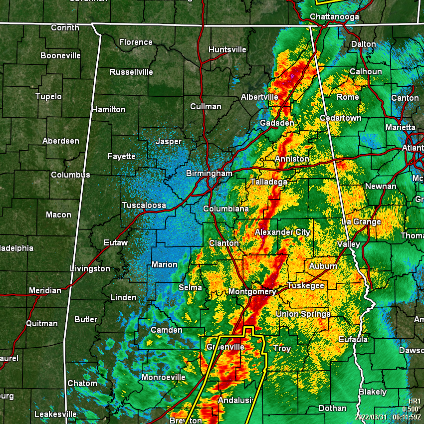
As of 1:15 am, the line of storms stretches from Valley Head and Fort Payne down to the south-southwest through Talladega and Waldo, and exits Central Alabama just to the south of Fort Deposit. At this time, there are no active severe weather warnings for North/Central Alabama, and the first tornado watch was allowed to expire.
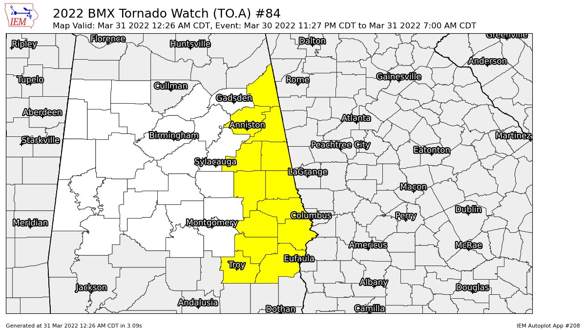
The second tornado watch continues until 7 am for Barbour, Bullock, Calhoun, Chambers, Cherokee, Clay, Cleburne, Lee, Macon, Pike, Randolph, Russell, and Tallapoosa counties in Central Alabama. These counties will most likely be removed from the watch well before that 7 am expiration time.
There is still plenty of wind shear and helicity over the eastern parts of the state along and ahead of the line, but the good news is that the Significant Tornado Parameter values are 1.0 and less for those locations.
We can continue to expect heavy rainfall and loud thunder throughout the overnight hours until the line exits out of the area. We’ll continue to have a very small risk of damaging wind gusts up to 60 mph and a non-zero risk of a brief spin-up tornado, but those may be unlikely as there is virtually no instability left ahead of the line.
Category: Alabama's Weather, ALL POSTS, Severe Weather
About the Author (Author Profile)
Scott Martin is an operational meteorologist, professional graphic artist, musician, husband, and father. Not only is Scott a member of the National Weather Association, but he is also the Central Alabama Chapter of the NWA president. Scott is also the co-founder of Racecast Weather, which provides forecasts for many racing series across the USA. He also supplies forecasts for the BassMaster Elite Series events including the BassMaster Classic.Subscribe
If you enjoyed this article, subscribe to receive more just like it.


