Marginal Risk Remains for Southern Portions of Central Alabama; More Counties Removed from Watch
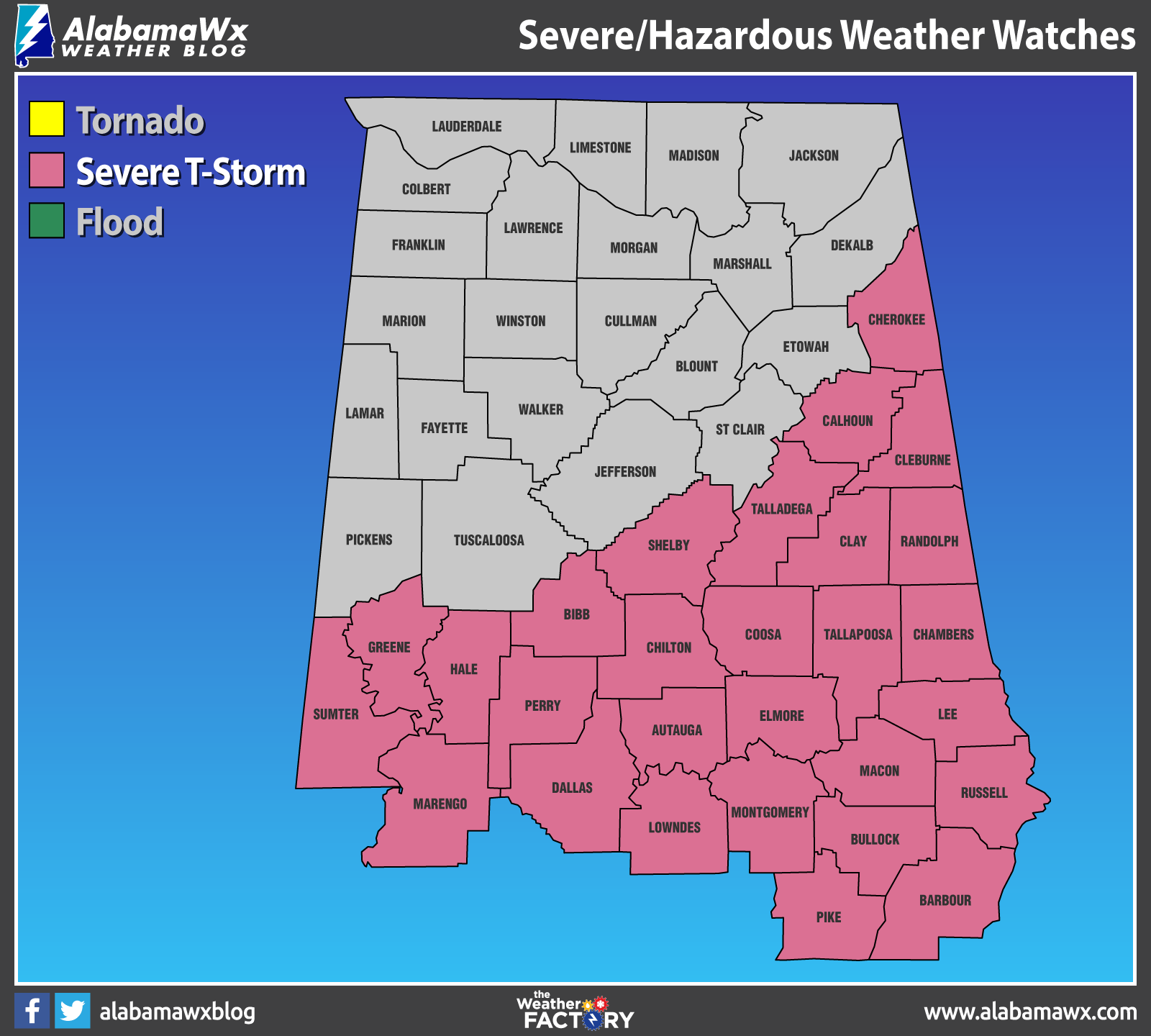
NWS Birmingham continues the SEVERE THUNDERSTORM WATCH until 9 pm tonight for Autauga, Barbour, Bullock, Calhoun, Chambers, Chilton, Clay, Cleburne, Coosa, Dallas, Elmore, Lee, Lowndes, Macon, Marengo, Montgomery, Perry, Pike, Randolph, Russell, Talladega, and Tallapoosa counties in Central Alabama.
Bibb, Cherokee, Greene, Hale, Shelby, Sumter, Etowah, St. Clair, Jefferson, Blount, and Tuscaloosa counties were the last set of counties removed from the watch as the threat for severe storms are over for those locations.
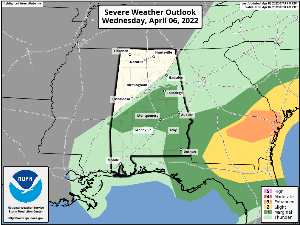
Only a Marginal Risk for severe storms remains through the rest of the evening and into the late-night hours for the southern parts of Central Alabama. This includes the cities of Anniston, Talladega, Alexander City, Clanton, Auburn, Demopolis, Selma, Montgomery, Eufaula, and Troy. The rest of North/Central Alabama is free from any risk of severe storms.
Isolated damaging wind gusts up to 60 mph and quarter size hail remain as the main threats in the Marginal Risk locations, while the tornado threat has nearly dropped to zero. That still means that a brief tornado may be possible with any storm that can get going.
Category: Alabama's Weather, ALL POSTS, Severe Weather
About the Author (Author Profile)
Scott Martin is an operational meteorologist, professional graphic artist, musician, husband, and father. Not only is Scott a member of the National Weather Association, but he is also the Central Alabama Chapter of the NWA president. Scott is also the co-founder of Racecast Weather, which provides forecasts for many racing series across the USA. He also supplies forecasts for the BassMaster Elite Series events including the BassMaster Classic.Subscribe
If you enjoyed this article, subscribe to receive more just like it.


