Severe Thunderstorm Watch Issued for the Western Portion of North Alabama Until 3 am
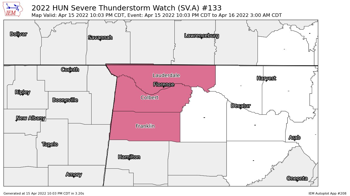
NWS Huntsville issues a SEVERE THUNDERSTORM WATCH until 3 am for Colbert, Franklin, and Lauderdale counties in North Alabama.
• A couple tornadoes possible
• Scattered hail up to two inches in diameter possible
• Isolated damaging wind gusts up to 65 mph possible
Here is the text from the Storm Prediction Center:
The NWS Storm Prediction Center has issued a
* Severe Thunderstorm Watch for portions of
Northwest Alabama
Far eastern Arkansas
Northern Mississippi
Southern Tennessee
* Effective this Friday night and Saturday morning from 1000 PM
until 300 AM CDT.
* Primary threats include…
Scattered large hail and isolated very large hail events to 2
inches in diameter possible
Isolated damaging wind gusts to 65 mph possible
A tornado or two possible
SUMMARY… Long-tracked supercell with history of significant large
hail is expected to weaken as it spreads east-southeast in western
Tennessee. Additional storms should evolve into a broader convective
cluster overnight. Severe hail will be the primary threat with the
strongest updrafts.
REMEMBER… A Severe Thunderstorm Watch means conditions are
favorable for severe thunderstorms in and close to the watch area.
Persons in these areas should be on the lookout for threatening
weather conditions and listen for later statements and possible
warnings. Severe thunderstorms can and occasionally do produce
tornadoes.
Category: Alabama's Weather, ALL POSTS, Severe Weather
About the Author (Author Profile)
Scott Martin is an operational meteorologist, professional graphic artist, musician, husband, and father. Not only is Scott a member of the National Weather Association, but he is also the Central Alabama Chapter of the NWA president. Scott is also the co-founder of Racecast Weather, which provides forecasts for many racing series across the USA. He also supplies forecasts for the BassMaster Elite Series events including the BassMaster Classic.Subscribe
If you enjoyed this article, subscribe to receive more just like it.


