An Early Afternoon Look at Our Weather Situation
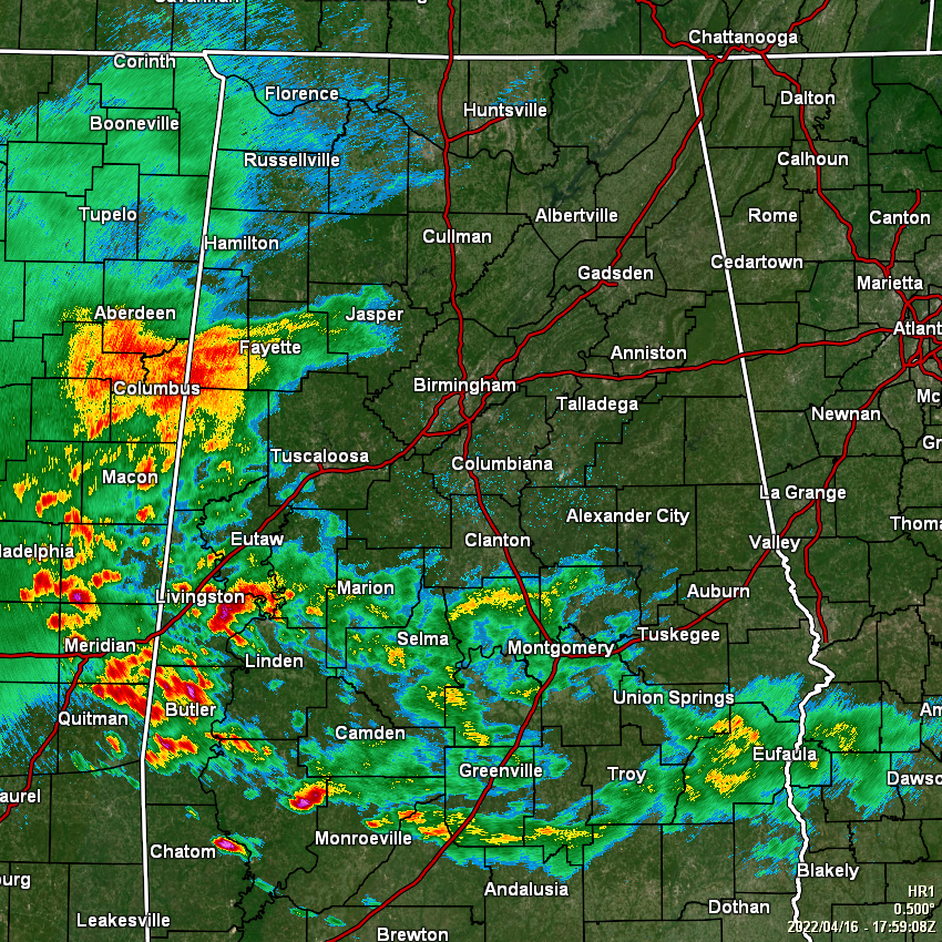
As of 1:00 pm, We have rain and thunderstorms mainly south of a line from Eutaw to Verbena to Hurtsboro, with some heavy rain and plenty of lightning over those southwestern parts of Central Alabama. We also have more rain and some thunder pushing in to the western parts of the area from Mississippi, with the farthest extent of the rain reaching Jasper and the central parts of Walker County.
Temperatures were in the mid 60s to the lower 70s across the area at this point. Anniston was the warm spot at 72º. Haleyville and Prattville were tied for the cool spots at 65º. Birmingham was sitting at 70º.
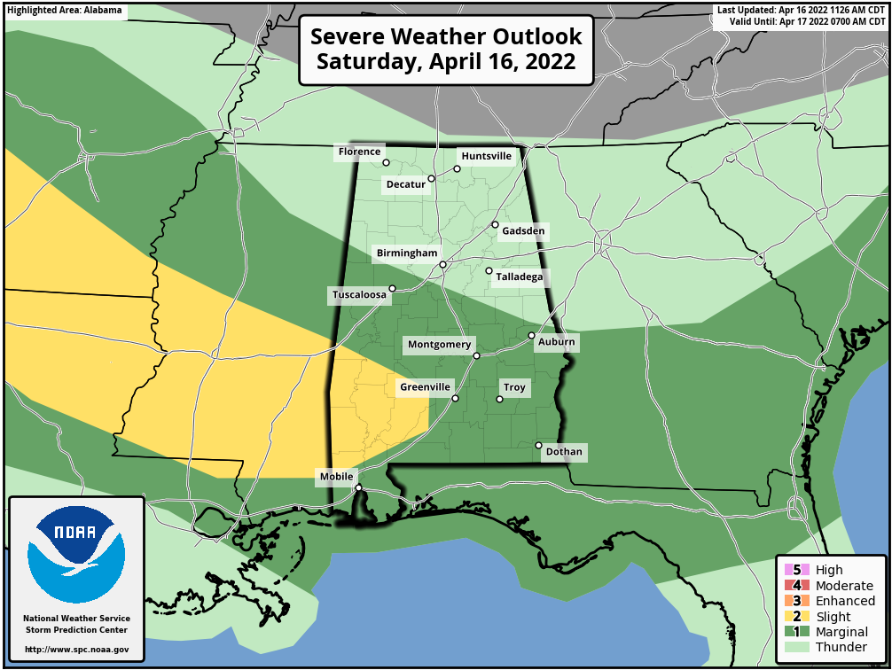
For the rest of today, we’ll continue to have showers and thunderstorms move into and across the area throughout the rest of the afternoon and into the early evening hours. One or two of those storms may become strong to severe over the southern half of the area. A Marginal Risk is up for locations along and south of a line from Tuscaloosa to Jemison to Auburn, while a Slight Risk is up for locations along and south of a line from Emelle to Thomaston. Main threats will be from damaging winds and hail up to quarter size. Highs will be in the lower 70s to the lower 80s across the area from northwest to southeast.
For tonight, we will have a lull in the action for much of the area for the first few hours after dark, but more showers and storms are expected to form and move into the area. The greatest risk of those will be over the southwestern quarter of the area, while only a small chance can be expected for the northeastern quarter. Lows will be in the lower 50s to the lower 60s.
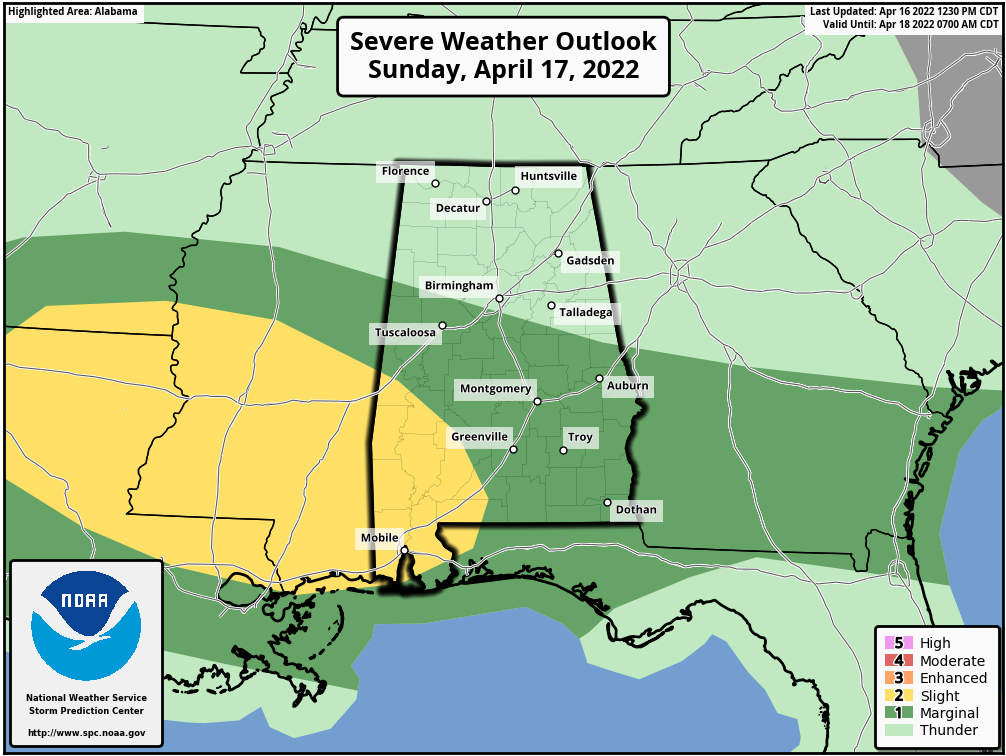
Unfortunately, it looks like showers and thunderstorms will develop and move across Central Alabama throughout the day on Easter Sunday, with the potential of a few of those storms becoming strong to severe. Almost the same story on the Slight and Marginal Risk locations, mainly for Sunday afternoon and evening. It won’t be an all-day washout, but have a backup plan if you have outdoor activities scheduled, just in case a storm moves through your area. Highs will be in the upper 60s to the upper 70s.
Category: Alabama's Weather, ALL POSTS, Severe Weather
About the Author (Author Profile)
Scott Martin is an operational meteorologist, professional graphic artist, musician, husband, and father. Not only is Scott a member of the National Weather Association, but he is also the Central Alabama Chapter of the NWA president. Scott is also the co-founder of Racecast Weather, which provides forecasts for many racing series across the USA. He also supplies forecasts for the BassMaster Elite Series events including the BassMaster Classic.Subscribe
If you enjoyed this article, subscribe to receive more just like it.


