Late Afternoon Weather Check for Central Alabama
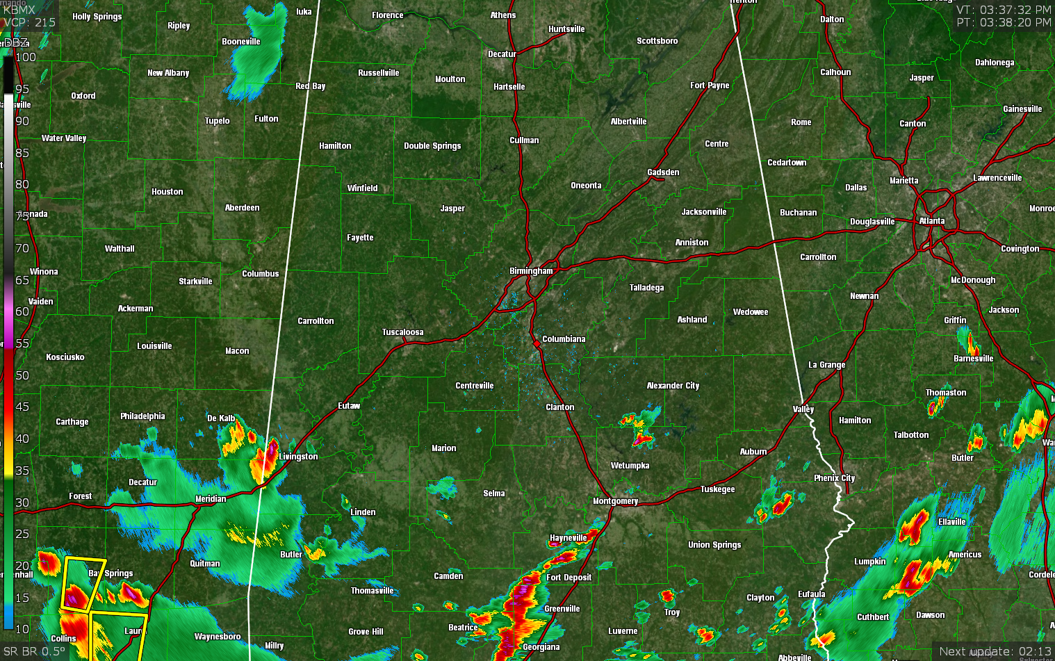
At this point, much of the activity has stayed along and south of the I-85 and US-80 corridors this afternoon over South Alabama, while nearly all of Central Alabama has remained dry. Temperatures as of the 3 pm roundup were in the mid 80s to the lower 90s across the area. Birmingham was at 92 degrees. The hot spot was Tuscaloosa at 93 degrees. Alexander City was the cool spot at 85 degrees. Afternoon highs will top out in the upper 80s to the lower 90s.
We’ll continue to have a risk of scattered showers and storms throughout the remainder of the afternoon and into the evening hours. Higher rain chances will be over the southern and southwestern parts of the area. Some of these storms could become strong to marginally severe with gusty winds and some hail. Once we start to lose the heating of the day, the activity will start to decrease and dissipate from northeast to southwest. Skies will be partly to mostly cloudy with lows reaching the upper 60s to the lower 70s.
Sunday will be a day that will feature periods of showers and thunderstorms across all of the area. Once again, some of these storms may become strong to severe with gusty winds and hail. The good news is that afternoon highs will be held back into the upper 70s to the mid 80s thanks to the cloud cover and rainfall.
Category: Alabama's Weather, ALL POSTS, Severe Weather
About the Author (Author Profile)
Scott Martin is an operational meteorologist, professional graphic artist, musician, husband, and father. Not only is Scott a member of the National Weather Association, but he is also the Central Alabama Chapter of the NWA president. Scott is also the co-founder of Racecast Weather, which provides forecasts for many racing series across the USA. He also supplies forecasts for the BassMaster Elite Series events including the BassMaster Classic.Subscribe
If you enjoyed this article, subscribe to receive more just like it.


