EXPIRED – Areal Flood Advisory: Parts of Shelby Co. Until 4:30 pm
…FLOOD ADVISORY IN EFFECT UNTIL 430 PM CDT THIS AFTERNOON FOR
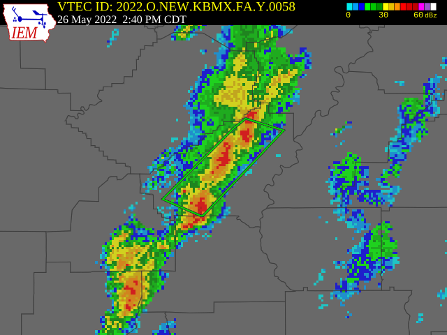
CENTRAL SHELBY COUNTY…
* WHAT…Urban and small stream flooding caused by excessive
rainfall is expected.
* WHERE…A portion of central Alabama, including the following
county, Shelby.
* WHEN…Until 430 PM CDT.
* IMPACTS…Minor flooding in low-lying and poor drainage areas.
Water over roadways. Ponding of water in urban or other areas is
occurring or is imminent.
* ADDITIONAL DETAILS…
– At 238 PM CDT, Doppler radar and automated rain gauges
indicated heavy rain. This will cause urban and small stream
flooding. Between 1 and 1.5 inches of rain have fallen.
– Additional rainfall amounts of 0.5 to 1 inch are expected
over the area. This additional rain will result in minor
flooding.
– Some locations that will experience flooding include…
Alabaster, Pelham, Calera, Chelsea, Montevallo, Vincent,
Westover, Oak Mountain State Park, Highland Lakes, Fowler
Lake, Mount Laurel, Shelby County Airport, Maylene, American
Village, Bounds Lake, Ballantrae, Saddle Lake Farms, Camp
Branch, Saginaw and Siluria.
PRECAUTIONARY/PREPAREDNESS ACTIONS…
Turn around, don’t drown when encountering flooded roads. Most flood
deaths occur in vehicles.
Be aware of your surroundings and do not drive on flooded roads.
Category: Alabama's Weather, ALL POSTS
About the Author (Author Profile)
Scott Martin is an operational meteorologist, professional graphic artist, musician, husband, and father. Not only is Scott a member of the National Weather Association, but he is also the Central Alabama Chapter of the NWA president. Scott is also the co-founder of Racecast Weather, which provides forecasts for many racing series across the USA. He also supplies forecasts for the BassMaster Elite Series events including the BassMaster Classic.Subscribe
If you enjoyed this article, subscribe to receive more just like it.


