Sun Angle Changes
With the days getting very short now (we’re down to 10 hours and 40 minutes of daylight now, from 14 hours 22 minutes at the peak in the summer), the sun angle is also much lower in the sky, and twilight does not last as long early in the morning or late in the afternoon or evening.
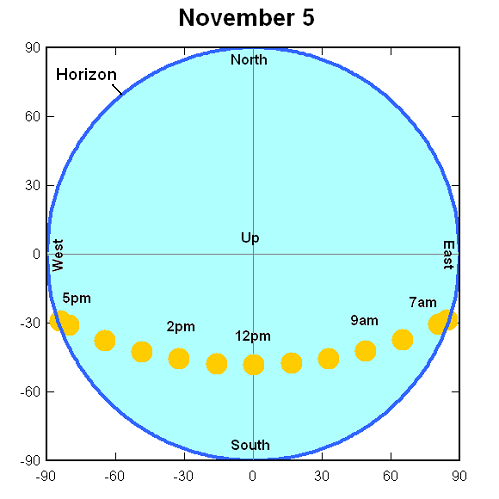
Due to the tilt of the earth and its position in its orbit around the sun, the sun is directly overhead at latitudes much farther south now than in Summer. This means that the sun is lower on the horizon in Alabama, even at noon. It also means the sun rises and sets farther in the southeast and southwest. Here is a computer simulation of the sun’s position in the sky at Birmingham by hour for today. The center of the graph would be looking straight up, and the circle is the visible sky.
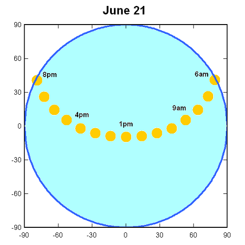
Now compare this with the sun position on June 21:
On June 21, the sun comes up in the NE, stays low on the horizon for a while, and then goes across the sky at a very high angle…almost directly overhead. It then sets in the NW, staying low on the horizon between 6 pm and 8 pm, providing the long evenings of twilight in the summer.
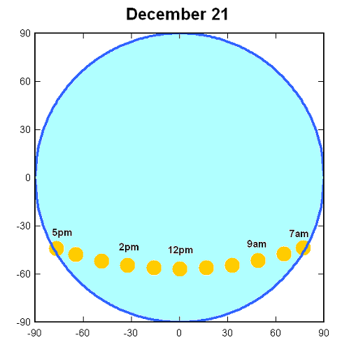
Now take a look at December 21, the shortest day of the year:
The sun stays fairly low on the horizon all day, rising in the SE and setting in the SW.
Weather radars actually pick up the sunrise and sunset most days, since a band of the sun’s energy matches the radar wavelength. When the sun is just above the horizon, a few minutes after sunrise and then a few minutes before sunset, it shines into the radar, making the radar detect echoes along the direction of the sun. Below are radar pictures from December 21, 2008 and June 21, 2009.
Notice how the direction of the sunrise and sunset change with the seasons, and match the charts shown above.
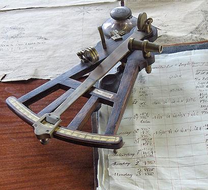
Before the days of GPS and LORAN, the position of the sun in the sky was often used to navigate at sea. A sextant or octant (shown below) was used to determine the elevation of the sun in the sky, and a compass was used to determine the azimuth. If one knows the date and time, this information can be used to determine the latitude and longitude.
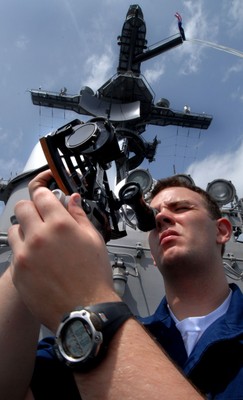
(Quartermaster Kurtis Rodgers uses a sextant to shoot a line of position toward the sun to verify the position of Nimitz-class aircraft carrier USS John C. Stennis (CVN 74). U.S. Navy photo by Kyle Steckler)
Category: Met 101/Weather History



Comments (1)
Trackback URL | Comments RSS Feed
Sites That Link to this Post