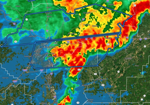
Flash Flood Warning: Parts of Jefferson, Shelby, St. Clair Co. Until 11 pm
The National Weather Service in Birmingham has issued a
* Flash Flood Warning for…
Southeastern Jefferson County in central Alabama…
Southwestern St. Clair County in central Alabama…
Northeastern Shelby County in central Alabama…
* Until 1100 PM CDT.
* At 808 PM CDT, Doppler radar indicated thunderstorms producing
heavy rain across the warned area. Between 0.5 and 1 inch of rain
has fallen. The expected rainfall rate is 1 to 3 inches in 1 hour.
Additional rainfall amounts of 1 to 2 inches are possible in the
warned area. Flash flooding is ongoing or expected to begin
shortly.
HAZARD…Flash flooding caused by thunderstorms.
SOURCE…Radar.
IMPACT…Flash flooding of small creeks and streams, urban
areas, highways, streets and underpasses as well as
other poor drainage and low-lying areas.
* Some locations that will experience flash flooding include…
Birmingham, Hoover, Vestavia Hills, Bessemer, Homewood, Mountain
Brook, Hueytown, Pell City, Irondale, Leeds, Moody, Fairfield,
Pleasant Grove, Tarrant, Lincoln, Midfield, Adamsville, Brighton,
Indian Springs Village and Lipscomb.
PRECAUTIONARY/PREPAREDNESS ACTIONS…
Turn around, don’t drown when encountering flooded roads. Most flood
deaths occur in vehicles.
Category: Alabama's Weather, ALL POSTS


