Gusty Winds & Heavy Rain with Thunderstorms Possible for Locations in Mesoscale Discussion
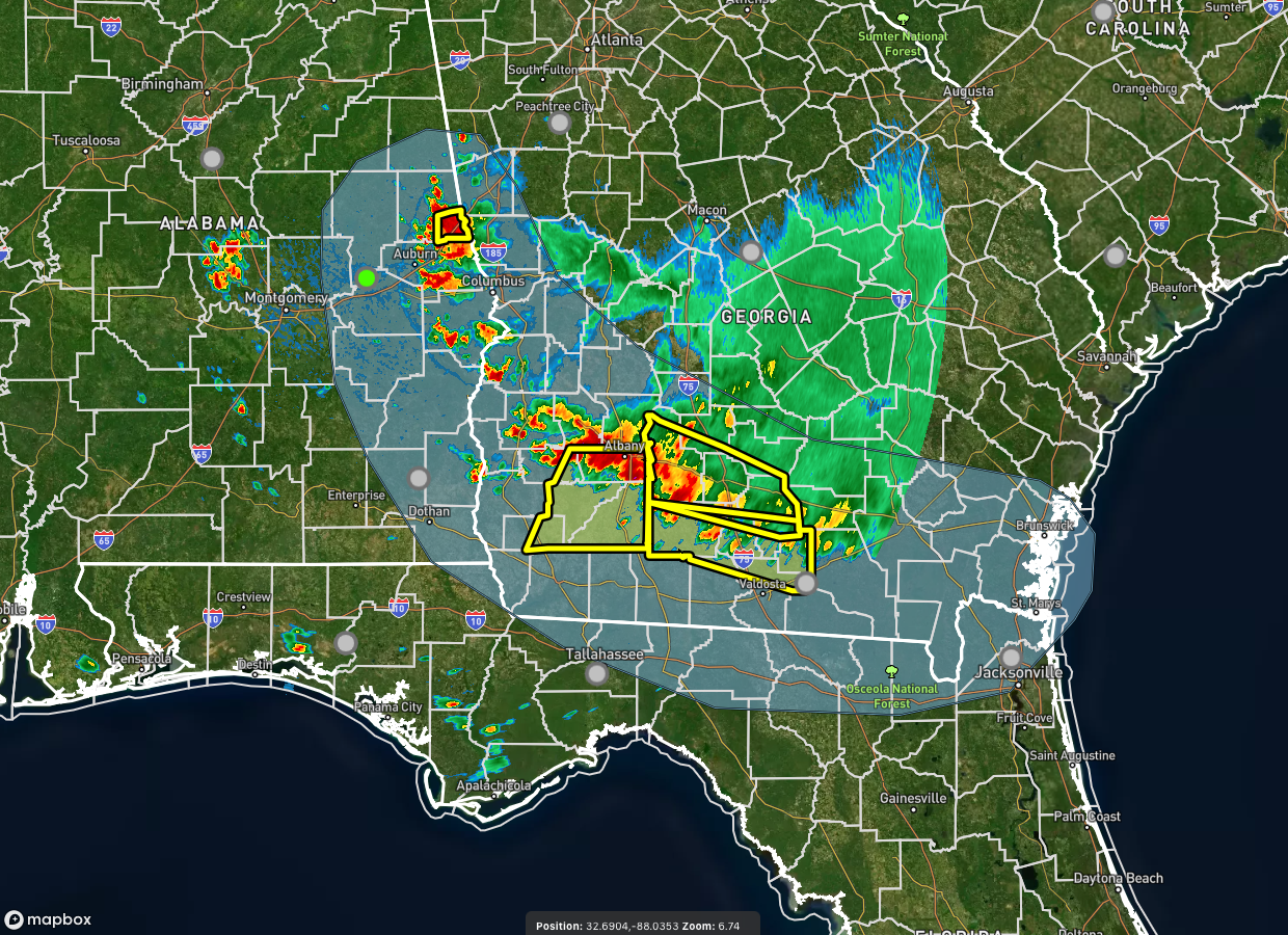
From the Storm Prediction Center.
SUMMARY… Sporadic strong/locally damaging gusts remain possible
within Severe Thunderstorm Watch 367. An isolated strong gust or two
may also occur over portions of eastern AL and northern FL as
convection spreads into these areas.
DISCUSSION… A cluster of loosely organized cells will continue to
propagate southward across southern GA the next couple of hours, and
may persist into northern FL amid a very unstable and moist airmass.
A modest cold pool has developed in the wake of these storms, aiding
in some organization of this activity. However, weak vertical shear
and warm midlevel temperatures beneath the upper ridge are likely
limiting more intense convection.
Additional thunderstorm clusters are ongoing near the western
GA/eastern AL state line vicinity. This activity recently produce a
48 kt gust at KCSG in east-central GA. This activity will encounter
similar strong instability but weak vertical shear as it shifts into
eastern AL. This will ultimately limit organization, though high PW
values and very steep low-level lapse rates could support sporadic
strong/locally damaging gusts through the remainder of the
afternoon. At this time, new watch issuance is not expected across
AL or northern FL.
Category: Alabama's Weather, ALL POSTS, Severe Weather
About the Author (Author Profile)
Scott Martin is an operational meteorologist, professional graphic artist, musician, husband, and father. Not only is Scott a member of the National Weather Association, but he is also the Central Alabama Chapter of the NWA president. Scott is also the co-founder of Racecast Weather, which provides forecasts for many racing series across the USA. He also supplies forecasts for the BassMaster Elite Series events including the BassMaster Classic.Subscribe
If you enjoyed this article, subscribe to receive more just like it.


