It’s Hot Out There at Midday; A Few Strong to Severe Storms Possible Later Today
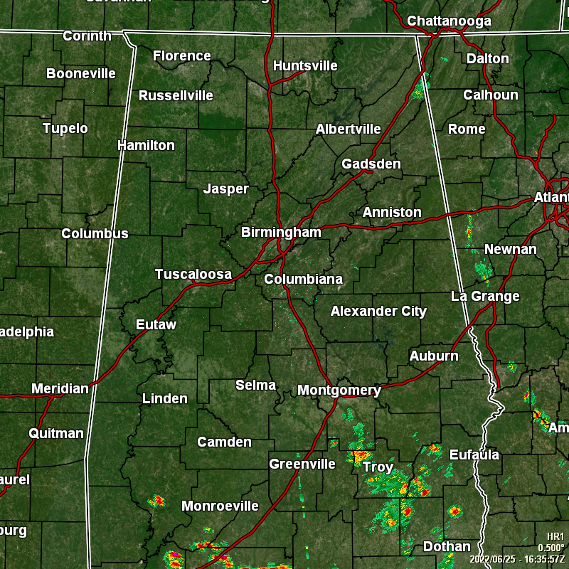
Much of Central Alabama is dry at this point, except for several locations south of the I-85 corridor, as scattered showers and storms have already developed with the heating of the day. We also see that a shower has formed along I-59 in eastern DeKalb County. Temperatures as of the 11 am roundup were in the mid 80s to the lower 90s. Multiple reporting stations were tied as the “cool” spots at 85º, while Birmingham was the hot spot at 92ª.
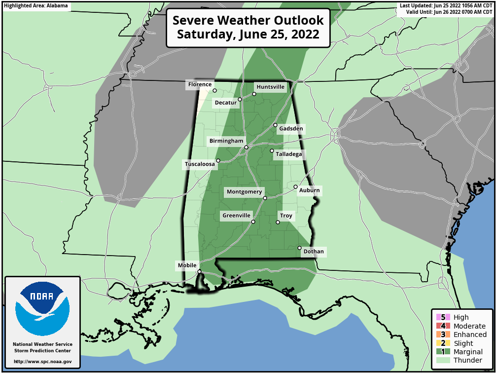
The good news is that most of us will have a good chance of getting some rain as scattered to numerous thunderstorms look to develop across the area this afternoon and continue into the evening hours. The bad news is that a few of these storms may become strong to severe, with damaging thunderstorm winds and large hail being the threats. The Storm Prediction Center has placed all of the central-third of the area in a level 1/5 marginal risk for severe storms through the remainder of your Saturday. Afternoon highs look to top out in the upper 80s to the upper 90s.
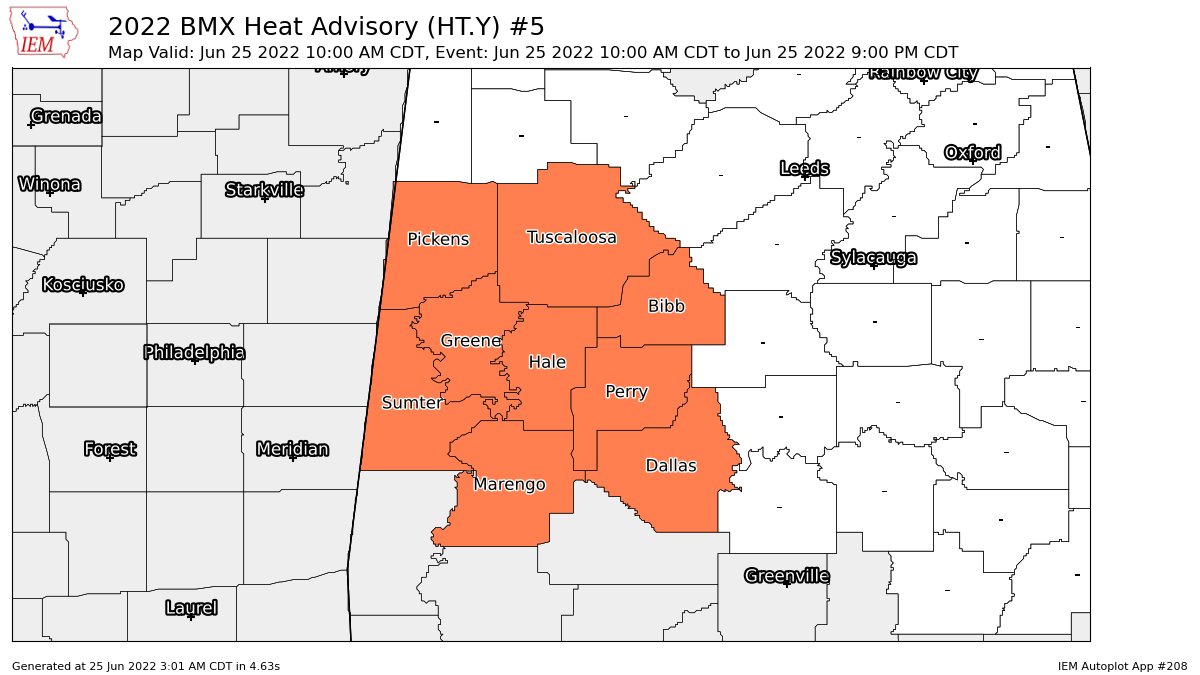
A heat advisory also continues until 9 pm tonight for the following counties in the southwestern part of Central Alabama: Bibb, Dallas, Greene, Hale, Marengo, Perry, Pickens, Sumter, and Tuscaloosa.
Some of the storm activity will continue into the evening and late-night hours tonight, but those should fade away as we get close to and cross over midnight. Lows will be in the upper 60s to the mid 70s.
No change from this morning’s video, as we’ll keep scattered afternoon showers and storms in the forecast on Sunday, but chances will be a little lower. Afternoon highs will be lower as well, reaching the upper 80s to the lower 90s.
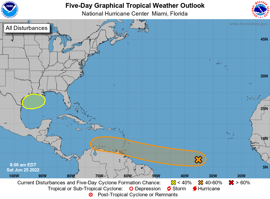
No change in the tropical update as well… We have a tropical wave moving westward across the far eastern Atlantic that could become a depression by early next week. It has a 60% chance of formation within the next five days. Most likely, this will become Tropical Storm Bonnie, but will it become a hurricane? We’ll have to watch and see.
We also will have to watch an area just off of the Texas and Louisiana coasts as a low may develop and try to develop. This disturbance is expected to drift westward, but is only given a 20% chance for development over the next five days.
Category: Alabama's Weather, ALL POSTS, Severe Weather, Tropical
About the Author (Author Profile)
Scott Martin is an operational meteorologist, professional graphic artist, musician, husband, and father. Not only is Scott a member of the National Weather Association, but he is also the Central Alabama Chapter of the NWA president. Scott is also the co-founder of Racecast Weather, which provides forecasts for many racing series across the USA. He also supplies forecasts for the BassMaster Elite Series events including the BassMaster Classic.Subscribe
If you enjoyed this article, subscribe to receive more just like it.


