Rather Quiet & Getting Hot at Midday; Strong to Severe Storms Possible Later Today
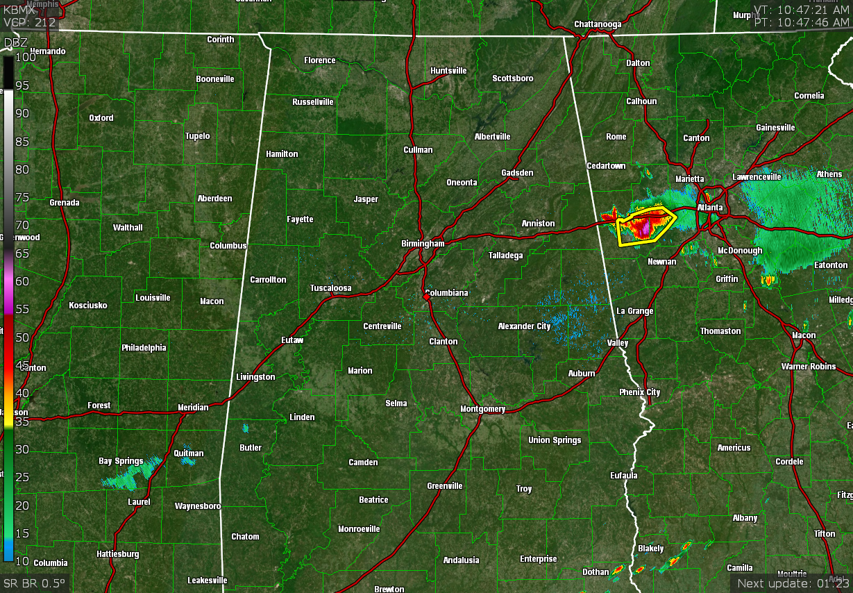
RADAR CHECK: As of 10:48 am, all of the isolated shower activity that was occurring earlier this morning has dissipated and all of North/Central Alabama is dry at this point. 10 am temperatures were in the 80s across the area. Montgomery was the warm spot at 89 degrees, while Auburn was the cool spot at 82 degrees. Birmingham was sitting at 86 degrees. Unfortunately, with higher humidity levels, head index values will make it up to and exceeding 105 degrees today, with afternoon highs reaching the mid to upper 90s.
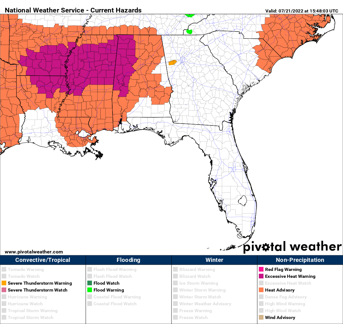
HEAT WARNINGS & ADVISORIES: An Excessive Heat Warning is up for Fayette, Greene, Hale, Lamar, Marengo, Marion, Pickens, Sumter, Tuscaloosa, Walker, Winston counties in Central Alabama, and for Colbert, Franklin, Lauderdale, Lawrence counties in North Alabama until 7 pm tonight. Dangerously hot conditions with heat index values of 110 to 114 degrees can be expected in these areas.
A Heat Advisory is up for Autauga, Bibb, Blount, Chilton, Dallas, Elmore, Jefferson, Lowndes, Montgomery, Perry, Shelby counties in Central Alabama, and for Cullman, DeKalb, Jackson, Limestone, Madison, Marshall, Morgan counties in North Alabama until 7 pm tonight. Heat index values up to 109 degrees can be expected in these areas.
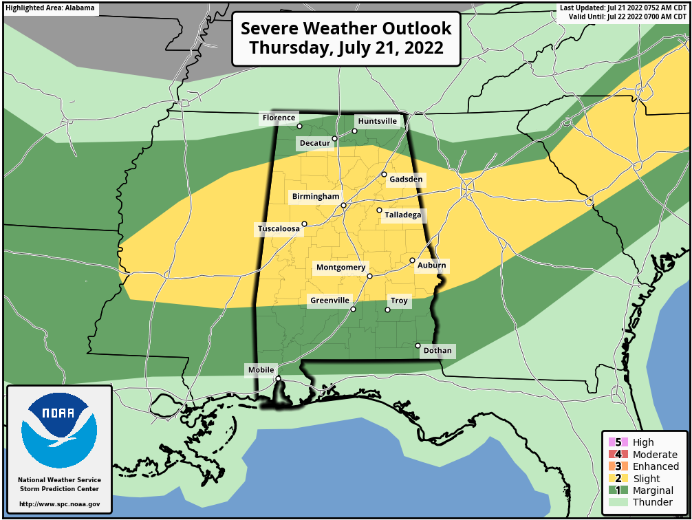
STRONG TO SEVERE STORMS POSSIBLE: Nearly the entire state is under a risk of severe storms today. A Slight Risk is up for much of the area, mainly south of a line from Phil Campbell (Winston Co.) to Somerville (Morgan Co.) to just north of Cedar Bluff (DeKalb Co.), down through all of Central Alabama except for locations south of a line from Briar Hill (Pike Co.) to Howe (Barbour Co.). Showers and stronger storms are expected to develop with the main heating of the day and move southward throughout the afternoon and evening hours, and potentially continuing through the overnight hours in the southern parts of the area. The main window for the threat of severe storms will be from 2 pm to midnight tonight.
Coverage will be scattered in nature to start with and may become linear in form by the evening as a boundary will be moving southward through the area. Damaging winds up to 60 mph and quarter-size hail will be possible with any storm that becomes severe. You can guarantee that every storm will be high cloud-to-ground lightning producers, so move indoors immediately if you hear thunder. Not everyone will get rain today, but there should be a good coverage of the area that will have received rain by sunrise tomorrow morning.
FRIDAY’S WEATHER: Rain chances will remain high over the southern half of the area as showers and thunderstorms will move southward, while most areas along and north of the I-20 corridor will remain dry with partly cloudy skies. Afternoon highs will be in the upper 80s to the mid 90s.
Category: Alabama's Weather, ALL POSTS, Severe Weather
About the Author (Author Profile)
Scott Martin is an operational meteorologist, professional graphic artist, musician, husband, and father. Not only is Scott a member of the National Weather Association, but he is also the Central Alabama Chapter of the NWA president. Scott is also the co-founder of Racecast Weather, which provides forecasts for many racing series across the USA. He also supplies forecasts for the BassMaster Elite Series events including the BassMaster Classic.Subscribe
If you enjoyed this article, subscribe to receive more just like it.


