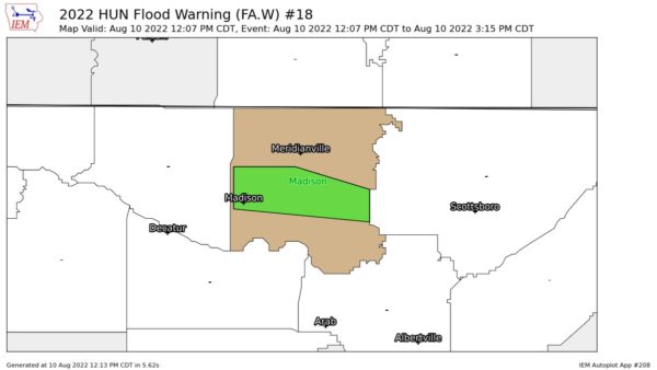
Flood Warning — Parts of Madison Co. Until 3:15 pm
…FLOOD WARNING IN EFFECT UNTIL 315 PM CDT THIS AFTERNOON…
…REPLACES FLASH FLOOD WARNING…
* WHAT…Flooding caused by excessive rainfall is expected.
* WHERE…A portion of north central Alabama, including the
following county, Madison.
* WHEN…Until 315 PM CDT.
* IMPACTS…Flooding of rivers, creeks, streams, and other low-lying
and flood-prone locations is imminent or occurring.
* ADDITIONAL DETAILS…
– At 1203 PM CDT, Doppler radar and automated rain gauges
indicated heavy rain due to thunderstorms. Flooding is
ongoing or expected to begin shortly in the warned area.
Between 1 and 3 inches of rain have fallen.
– Additional rainfall amounts of 1 to 2 inches are possible in
the warned area.
– Some locations that will experience flooding include…
Huntsville, Madison, Redstone Arsenal, Gurley, Alabama A And
M University, University Of Alabama In Huntsville, Harvest,
Ryland, Hampton Cove and Brownsboro.
– http://www.weather.gov/safety/flood
PRECAUTIONARY/PREPAREDNESS ACTIONS…
Turn around, don’t drown when encountering flooded roads. Most flood
deaths occur in vehicles.
Category: Alabama's Weather, ALL POSTS


