

Showers and Storms Moving into West Central Alabama
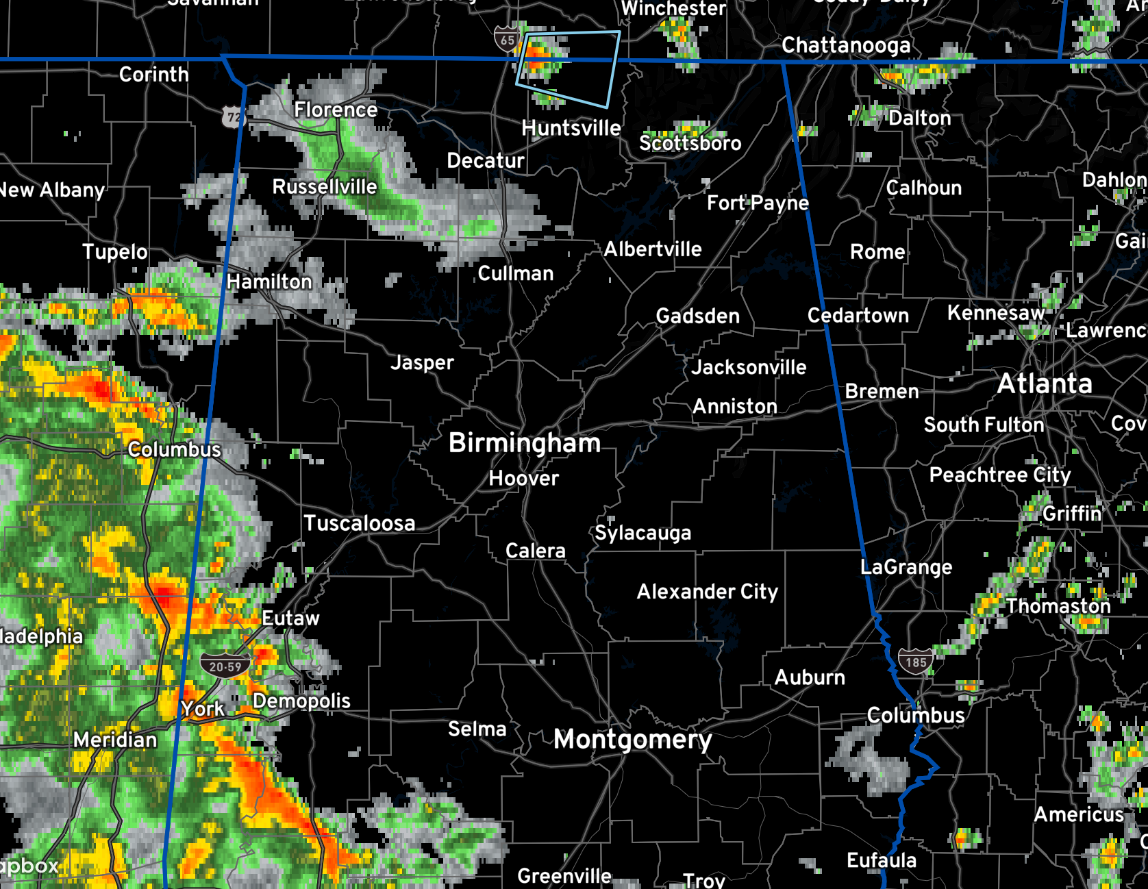
A large area of rain and embedded thunderstorms is pushing into and through West Central Alabama at this hour.
The rain area over Northwest Alabama is weakening at this time.
The rain and storms are moving into areas from Lamar and Marion Counties southward. The activity is pushing southeastward.
The Tuscaloosa area may avoid the heavier rain, which is good since they got record rainfall yesterday. The heaviest rain that is now over parts of Sumter, Hale, Greene, and Marengo counties will be pushing east southeastward over areas that experienced rainfall this morning, so some local flooding is possible. And as it travles southeastward it will encounter increasing instability, so it will likely intensify. Some borderline severe stprms are possible.
The activity will reach the Birmingham area in about 2 1/2 hours. Jasper in about 90 minutes. Get ready for some heavy rain and gusty winds.
Continuing to monitor North Alabama for a low-end severe threat through early this evening as storms fire up over Northern Mississippi and Northern Alabama ahead of a cold front that is trying to drop into the area.
Category: Alabama's Weather, ALL POSTS, Severe Weather
About the Author (Author Profile)
Bill Murray is the President of The Weather Factory. He is the site's official weather historian and a weekend forecaster. He also anchors the site's severe weather coverage. Bill Murray is the proud holder of National Weather Association Digital Seal #0001 @wxhistorianSubscribe
If you enjoyed this article, subscribe to receive more just like it.


