Sunday Afternoon Update: Sunshine Peeking Through, Showers/Storms Developing
Visible satellite imagery on this September Sunday afternoon indicates that skies are partly sunny across North and Central Alabama.
An area of storms continues southeast of Montgomery, where flash flood warnings were issued earlier for the heavy rains across parts of Macon, Montgomery, and Bullock Counties. Those warnings were just canceled.
Showers and storms are developing to the northwest of I-59. They are being sparked by a cold front that lies along a line from Nashville to Oxford at this hour.
Temperatures are in the 80s where there is sunshine and 70s where it is raining or has been raining.
The showers and storms should continue into the evening hours, gradually pushing southeastward. The showers and the front should be southeast of Birmingham before midnight and approaching Montgomery by sunrise.
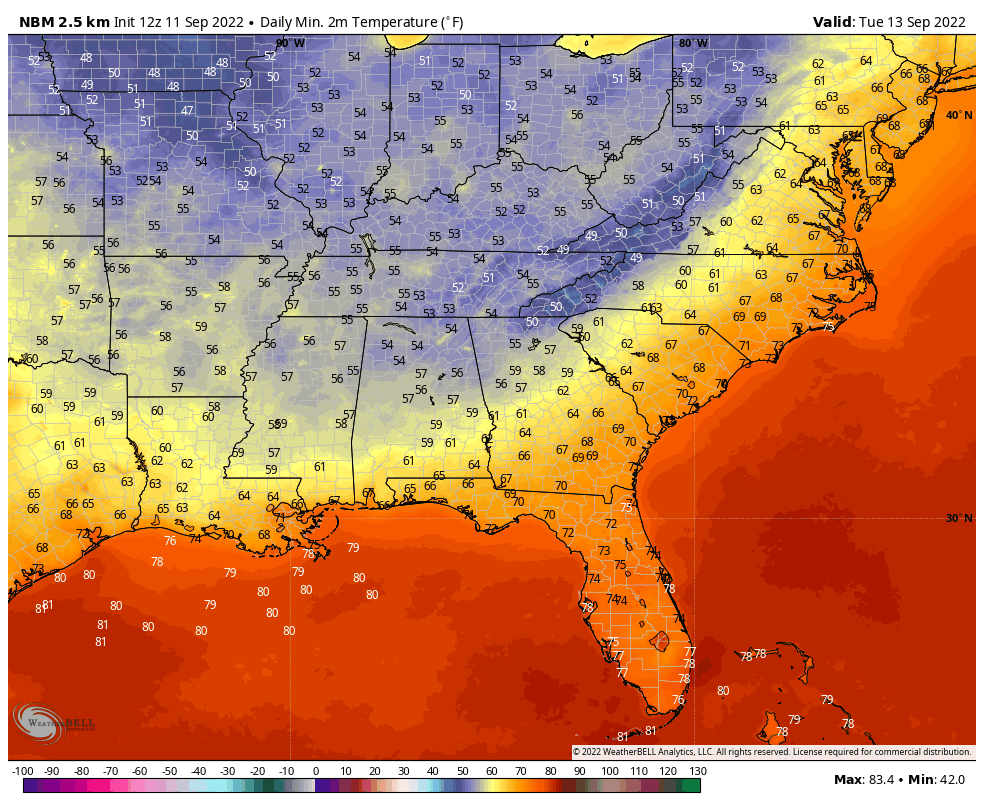
Dewpoints will be dropping into the 50s over Northweat Alabama by early morning, and reaching the I-59 corridor by late afternoon. By tomorrow night, those 50 degree dewpoints will be over the entire area, with even some 40s over Northwest Alabama. Tuesday morning lows should look like this:
The remainder of the week will be dry. Shower chances will not return until at least Sunday.
Category: Alabama's Weather, ALL POSTS
About the Author (Author Profile)
Bill Murray is the President of The Weather Factory. He is the site's official weather historian and a weekend forecaster. He also anchors the site's severe weather coverage. Bill Murray is the proud holder of National Weather Association Digital Seal #0001 @wxhistorianSubscribe
If you enjoyed this article, subscribe to receive more just like it.


