Midday Nowcast: Sunny September Day
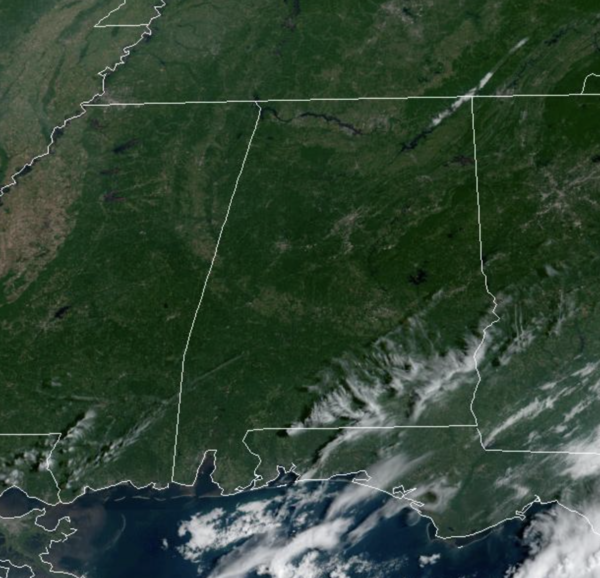
It felt great this morning, and it will continue to be that way the next few mornings. The days are sunny and warm with highs in the low 80s today, followed by mid and upper 80s the rest of this week. Again, humidity levels are very low, making it feel comfortable, even during the afternoon hours. With no moisture to work with, there is no threat for rain in the forecast.
WEEKEND & NEXT WEEK: Dry weather continues with a good supply of sunshine Saturday and Sunday with highs in the mid to upper 80s and lows in the 60s. No rain worries for college games across the state Saturday. For next week, more of the same as the quiet weather pattern continues. Highs in the mid to upper 80s will be common and we may have to mention the chance for a few isolated showers late in the week, but no signs of any major rain event the next ten days or so…a long, dry spell in upon us.
IN THE TROPICS: No active storms in the Atlantic currently, but the NHC is monitoring two tropical waves for potential development.
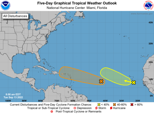
Conventional and Low-earth orbit satellite data indicate that showers and thunderstorms associated with a tropical wave located about midway between the west coast of Africa and the Windward Islands have increased and become better organized since yesterday afternoon. Further development of this system is possible and a tropical depression could form over the next several days while it generally moves westward to west-northwestward over the central tropical Atlantic and approaches the Leeward Islands on Friday. Formation chance through 5 days…medium…40 percent.
Showers and thunderstorms have changed little overnight in association with a tropical wave approaching the Cabo Verde Islands. Environmental conditions appear only marginally favorable, and any development of this system should be slow to occur while it moves westward or west-northwestward across the eastern tropical Atlantic through the end of the week. Formation chance through 5 days…low…20 percent.
BEACH FORECAST CENTER: Get the latest weather and rip current forecasts for the beaches from Fort Morgan to Panama City on our Beach Forecast Center page. There, you can select the forecast of the region that you are interested in visiting.
WORLD TEMPERATURE EXTREMES: Over the last 24 hours, the highest observation outside the U.S. was 118.2F at Nuwasib, Kuwait. The lowest observation was -95.1F at Concordia, Antarctica.
CONTIGUOUS TEMPERATURE EXTREMES: Over the last 24 hours, the highest observation was 103F at Death Valley, CA. The lowest observation was 11F at Peter Sinks, UT.
Category: Alabama's Weather, ALL POSTS
About the Author (Author Profile)
Macon, Georgia Television Chief Meteorologist, Birmingham native, and long time Contributor on AlabamaWX. Stormchaser. I did not choose Weather, it chose Me. College Football Fanatic. @Ryan_StinnetSubscribe
If you enjoyed this article, subscribe to receive more just like it.


