A Few Morning Clouds Across the Area
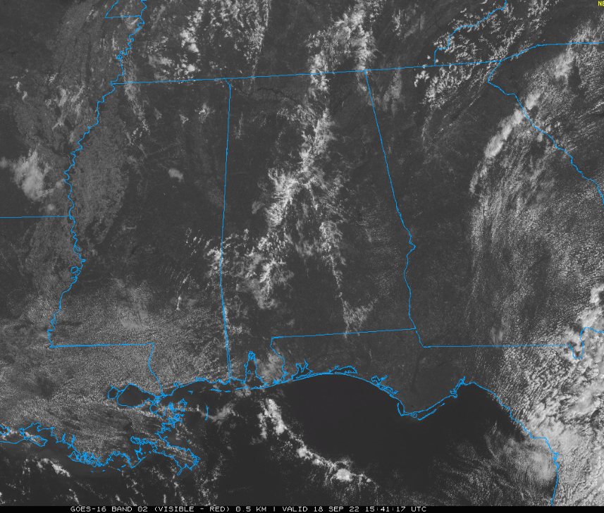
The I-65 Corridor has some clouds over it late on this Sunday morning, giving the Alabama landscape kind of a springy, stormy sort of look. But outside the convergence area casuing these clouds, sunshine is plentiful and temperatures will be heating up into the 80s.
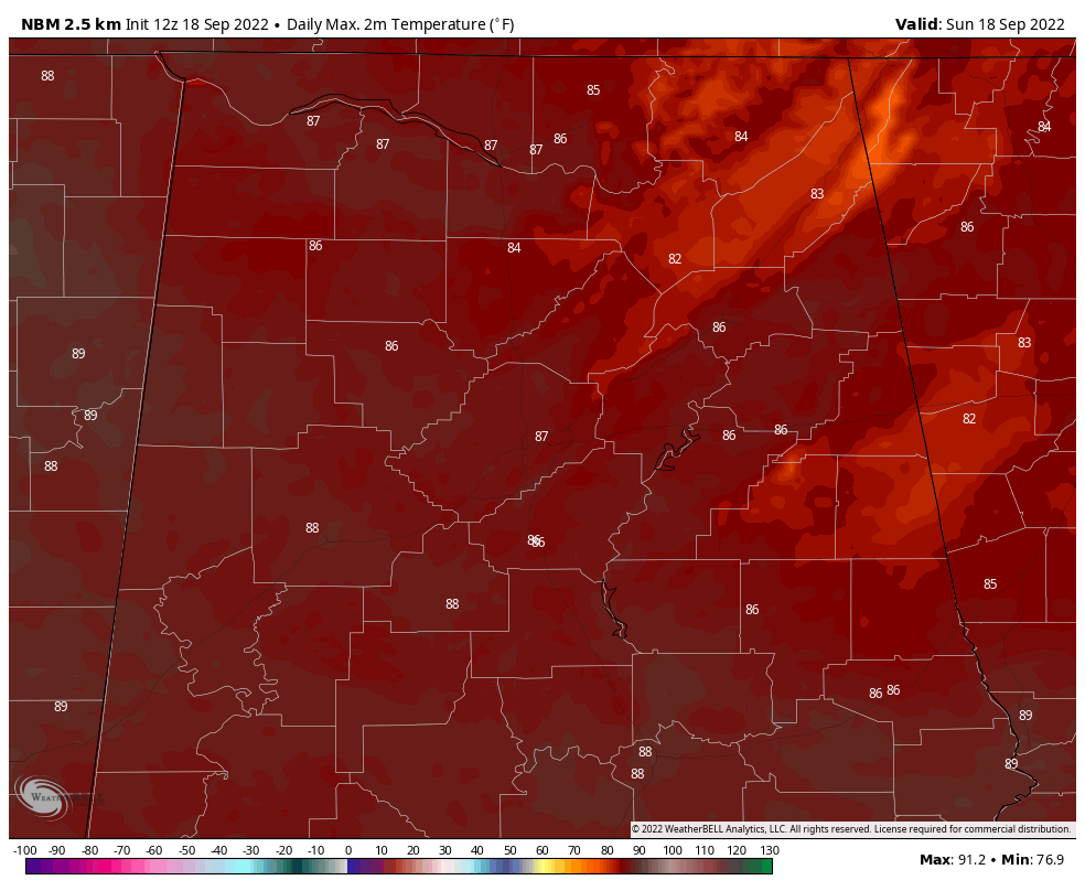
A few spots in the South will approach 90F today. 90s will be fairly commonplace across Central Alabama as we go through the week. In fact, the middle and upper 90s will be on the map Tuesday, Wednesday, and Thursday afternoons. That is quite warm for mid-September in Alabama and only 4-6 degrees outside of record territory.
High pressure will remain in control of our weather through much of the week ahead. A sort of backdoor cold front will bring drier air in just in time for the weekend. No rain is expected across central Alabama over the next 7 days.
Here is the radar from San Juan this morning as Fiona is tracking toward the southwestern part of the Territory. The curent observation at Luis Munoz Marin International Airport (TJSJ) is 77F with a dewpoint of 75F. There is heavy rain and fog, and winds are east at 42 mph, gusting to 56 mph. The altimeter is 1009 mb or 29.80 inches. The central pressure in the storm now is 29.26 inches or 991 mb.
Category: ALL POSTS
About the Author (Author Profile)
Bill Murray is the President of The Weather Factory. He is the site's official weather historian and a weekend forecaster. He also anchors the site's severe weather coverage. Bill Murray is the proud holder of National Weather Association Digital Seal #0001 @wxhistorianSubscribe
If you enjoyed this article, subscribe to receive more just like it.


