A Very Nice Late Saturday Morning Across Central Alabama
THE LATE MORNING NOWCAST
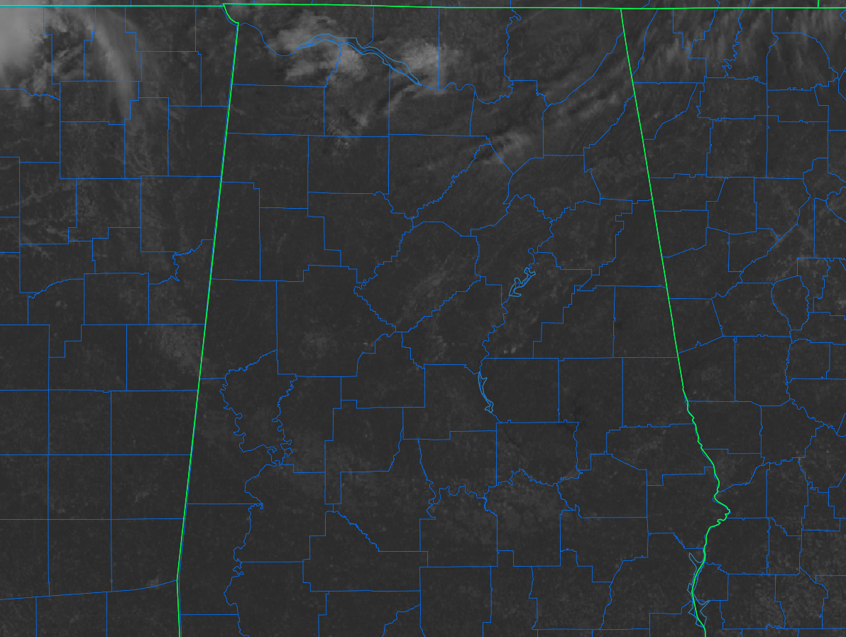
As we start the run-up to the midday hour, skies are clear across much of Central Alabama with only a few clouds crossing over the northern parts of the area from North Alabama, mainly in northern Winston and northern Blount counties. And, at this time, there are no raindrops under any of those clouds, and we are not expected to see any in the area. However, a few showers may slip into the northern and northwestern parts of North Alabama later today.
Temperatures as of the 10 am roundup were ranging from as low as 63º in Alexander City to as high as 73º in Troy. Birmingham was sitting at 72 degrees.
FOR THE REST OF YOUR SATURDAY
Skies will be mostly sunny across the area, and it will be a warm day. Afternoon highs will make it up into the lower to mid 80s. What a great day to be outdoors, soaking in the sunshine and warmth before the much cooler air moves in for the work week. Skies will be mostly clear through the evening and overnight hours, and lows will dip into the lower to mid 50s.
SHOWERS POSSIBLE LATE ON SUNDAY
A cold front will start to work into the northern parts of Central Alabama late on Sunday (late afternoon) that will bring a chance of a few scattered showers and maybe a clap or two of thunder. Those shower chances will eventually make it a few miles south of the I-59 corridor before hitting the midnight hour. At this point, showers and a few thunderstorms are more likely along and north of the Tennessee River. Afternoon highs will be throughout the 80s across the area.
FIRST FREEZE OF THE SEASON ON WEDNESDAY?
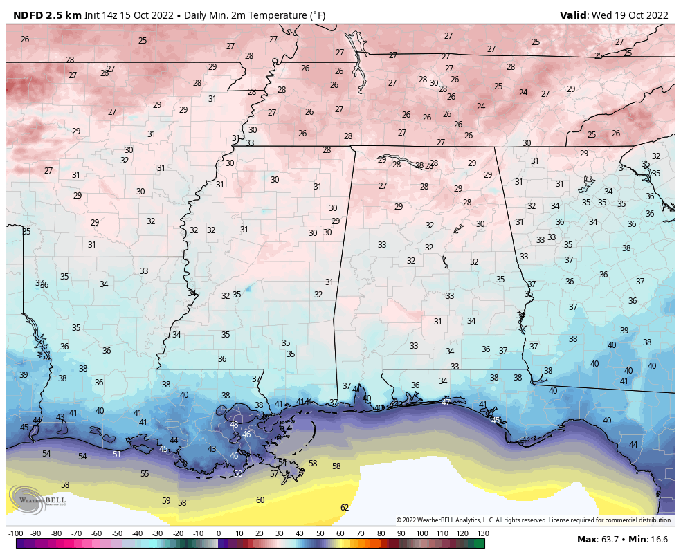
After the cold front moves through and out of the area on Monday, a trough will deepen over the eastern US. This will send a big blast of colder air into the Deep South. We are now expecting lows on Wednesday morning to be in the 27º to 34º range across Central Alabama, with the usual colder spots hitting the mid 20s.
THE TROPICS
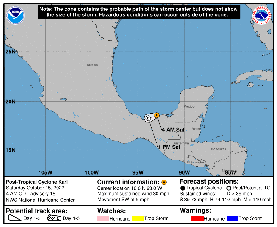
As of 4 am this morning, Karl has now become a post-tropical cyclone as it continues to drift to the southwest at 5 mph. Karl will continue to weaken today and is expected to dissipate later this evening. Unfortunately, heavy rainfall could lead to flash flooding and mudslides over portions of Southern Mexico through the weekend.
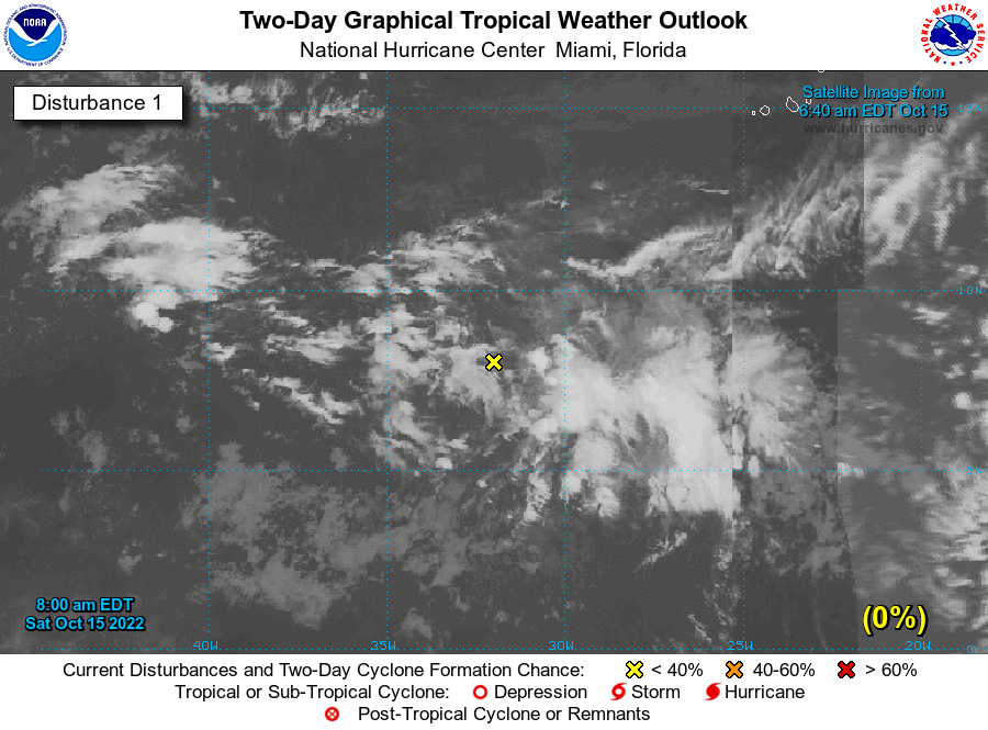
As of 7 am this morning, a tropical wave located several hundred miles southwest of the Cabo Verde Islands is producing a broad area of disorganized showers and thunderstorms. Development of this system is not anticipated while the wave moves westward or west-northwestward at about 10 mph. The rest of the tropics are quiet for now.
Category: Alabama's Weather, ALL POSTS, Tropical
About the Author (Author Profile)
Scott Martin is an operational meteorologist, professional graphic artist, musician, husband, and father. Not only is Scott a member of the National Weather Association, but he is also the Central Alabama Chapter of the NWA president. Scott is also the co-founder of Racecast Weather, which provides forecasts for many racing series across the USA. He also supplies forecasts for the BassMaster Elite Series events including the BassMaster Classic.Subscribe
If you enjoyed this article, subscribe to receive more just like it.


