A Very Nice Sunday Afternoon; Strong to Severe Storms Possible on Tuesday
A GLORIOUS WAY TO END THE WEEKEND
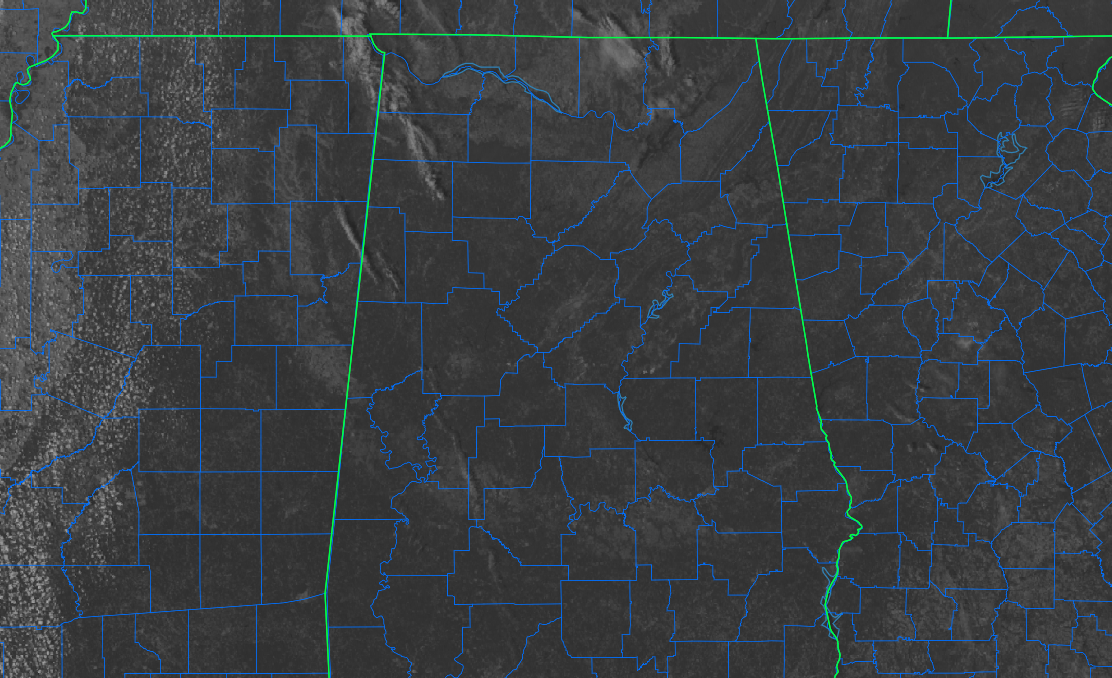
Only a few clouds over the north and northwestern parts of the area are keeping our skies from being completely clear as of 1:02 pm in Central Alabama. Temperatures as of the roundup at noon were mostly in the lower to mid 70s, with the only one warmer than that was Troy at 77º. The cool spot was Alexander City at 70º. Birmingham was at 72º.
Skies will stay mainly clear through the rest of the daylight hours and through the evening and overnight hours. Afternoon highs will top out in the mid 70s to the lower 80s across the area, with overnight lows in the mid 40s to the lower 50s.
NOT A BAD START TO THE WORK WEEK
Much of Monday will feature plenty of sunshine and only a few clouds. However, clouds ahead of our next system will start to move in during the late afternoon through the rest of the evening. No rain at this point, but storms will be on the way. Afternoon highs will be in the mid 70s to the lower 80.
STRONG TO SEVERE STORMS POSSIBLE ON TUESDAY
Severe thunderstorms are now looking to be possible on Tuesday as a surface low and a cold front will be moving its way into Central Alabama. At this point, the main threat will be from damaging winds up to 60 mph, but a couple tornadoes cannot be ruled out, especially for the western half of the area. Even outside the storms, we could see breezy conditions as winds may gust up to 30-40 mph thanks in part to a tightening pressure gradient.
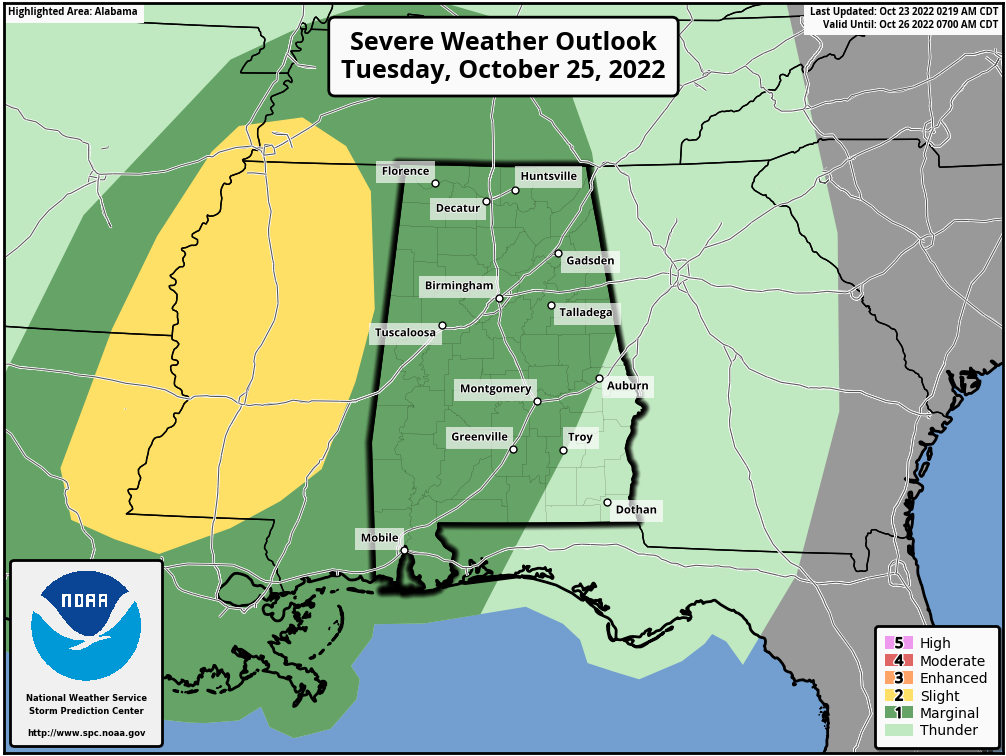
The Storm Prediction Center has placed nearly all of Central Alabama in a level 1 Marginal Risk for severe storms, except for locations east of a line from Auburn to Troy. As of now, the main window for the threat of severe storms will be Tuesday afternoon and evening. Timing may be a little earlier for the western parts of North Alabama, as that is where we could see the first activity move into the state.
This looks to be one of those tricky severe weather forecasts as there will be a narrow band of instability moving into the area just ahead of the cold front. If the convection can line up with the instability, there will be enough shear and forcing for severe weather to occur. If the convection outruns the instability, or if showers out ahead of the action form and stabilize the air, severe weather will be less likely. We’ll get a better look at the situation with the upcoming runs of the models. With the tornado threat in the west, I would not be surprised if parts of the western half of Central Alabama is upgraded to a level 2 Slight Risk for severe storms.
Storms will exit Central Alabama late on Tuesday night, with slightly cooler and drier air moving in behind it. Before that, afternoon highs look to reach the lower 70s to the lower 80s.
THE REST OF THE WORK WEEK
Skies will be in the process of clearing out behind the cold front on Wednesday and highs will be in the mid 60s to the lower 70s. Temperatures will begin to moderate on Thursday, as we’ll have plenty of sunshine and highs in the upper 60s to the upper 70s.
Clouds will start to increase in Central Alabama on Friday as another impulse will be heading in our direction. At this point, we should stay dry until the after midnight, when showers and storms will begin to move into the western and southwestern locations. Highs in the lower 70s to the lower 80s.
NEXT WEEKEND
That impulse will continue to slowly move into and through the western parts of the area on Saturday, keeping showers and storms possible at times. Highs in the mid 60s to the upper 70s. We’ll continue to keep some clouds and a chance of showers in the forecast for Sunday as well as the impulse tries to rotate back around and form a low just off to our east and northeast. Highs in the mid 60s to the lower 70s.
THE TROPICS
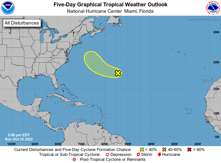
Central Subtropical Atlantic: A trough of low pressure located well to the east of Bermuda continues to produce disorganized shower and thunderstorm activity. Environmental conditions are not expected to be particularly conducive, and any subtropical or tropical development of the system should be slow to occur while it moves generally west-northwestward at 15 to 20 mph across the subtropical Atlantic. By the middle part of this week, further development appears unlikely as the system turns northward over the cooler waters of the northwestern Atlantic and encounters stronger upper-level winds.
* Formation chance through 48 hours… low… 10 percent.
* Formation chance through 5 days… low… 10 percent.
Category: Alabama's Weather, ALL POSTS, Severe Weather, Tropical
About the Author (Author Profile)
Scott Martin is an operational meteorologist, professional graphic artist, musician, husband, and father. Not only is Scott a member of the National Weather Association, but he is also the Central Alabama Chapter of the NWA president. Scott is also the co-founder of Racecast Weather, which provides forecasts for many racing series across the USA. He also supplies forecasts for the BassMaster Elite Series events including the BassMaster Classic.Subscribe
If you enjoyed this article, subscribe to receive more just like it.


