Counties Behind the Line of Storms Starting to be Cleared from Watch
The NWS is canceling counties where the line of storms has already passed.
These counties have been removed so far: Fayette, Pickens, Sumter, Choctaw, Colbert, Franklin, and Lauderdale.
The following counties are still under the Tornado Watch until 7 p.m.: Autauga, Bibb, Blount, Chilton, Cullman, Dallas, Greene, Hale, Jefferson, Lawrence, Limestone, Lowndes, Marengo, Morgan, Perry, Shelby, Tuscaloosa, Walker, and Winston.
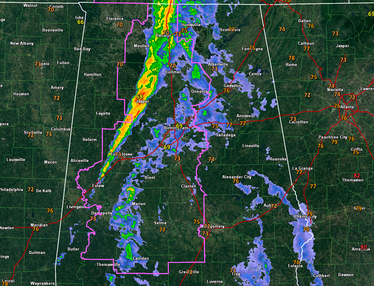
Our line of storms continues pressing eastward across North and Central Alabama. It now extends from Athens to Decatur to Jasper to the west of Coker and Eutaw to Boligee.
The most dangerous storms are approaching Jasper and Parrish in Walker County and is east of Arley in Winston County. Heavy rain, gusty winds, and not-so-frequent lightning are occurring. Probably no hail for now.
The line of storms will reach western parts of the Birmingham area by 5 p.m., downtown Birmingham by 5:30, Tuscaloosa by 5:40, Leeds shortly after 6 p.m. ad Gadsden by 7:30 pm and Anniston by 8 p.m.
So far the storms have been well-behaved, with no severe weather warnings issued for any part of our state. But we need to keep up our guard until the storms have cleared the area.
Category: Alabama's Weather, ALL POSTS, Severe Weather
About the Author (Author Profile)
Bill Murray is the President of The Weather Factory. He is the site's official weather historian and a weekend forecaster. He also anchors the site's severe weather coverage. Bill Murray is the proud holder of National Weather Association Digital Seal #0001 @wxhistorianSubscribe
If you enjoyed this article, subscribe to receive more just like it.


