Another Very Cool Fall Afternoon in Central Alabama
SKIES CONTINUING TO CLEAR OUT AT MIDDAY
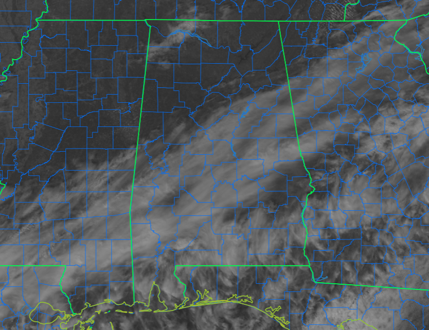
The good news is that skies are continuing to clear across the area from northwest to southeast as we have reached the afternoon hours, but much of the area south of the I-59 corridor remains mostly cloudy. North of that, skies are mostly sunny.
Temperatures as of the 12 pm roundup were in the mid 40s to the mid 50s, which is pretty close to what our daytime highs will be for the day. Bessemer and Haleyville were tied at 46º as the cold spots, while Eufaula was the warm spot at 55º. Birmingham was at 47º.
A FREEZE WATCH and a FROST ADVISORY have both been issued for the overnight hours tonight for Barbour, Bullock, Lee, Macon, Montgomery, Pike, and Russell counties in Central Alabama until 8 am Thursday morning.
Tonight will be cold across the area with fair skies and lows in the mid 20s to the mid 30s from northwest to southeast.
THE REST OF THE WORK WEEK
We’ll continue to see below-average temperatures for this time of the year as skies will be mostly clear through Thursday night, but some clouds will move in on Friday and Friday evening. We’ll see lower 40s to the lower 50s on Thursday, and upper 40s to the mid 50s on Friday.
THE CENTRAL ALABAMA WEEKEND
The clouds mainly move out for the weekend ahead, and we can expect mostly sunny to sunny skies across Central Alabama on both days. Highs will be in the mid 40s to the mid 50s.
THE START OF NEXT WEEK
Temperatures will start inching their way upward for the start of Thanksgiving week as skies will be sunny and highs in the lower 50s to the lower 60s on Monday. And at the end of the forecast period on Tuesday, skies will be partly to mostly sunny with highs in the upper 50s to the mid 60s, but a few spotty showers are possible.
THE TROPICS
The Atlantic Basin is free from any disturbances that look to have the potential of becoming tropical or subtropical in nature, and nothing is expected to form within the next five days. Not that many days are left in the Atlantic Hurricane Season for this year, as it ends on November 30th.
ON THIS DAY IN WEATHER HISTORY – 1959
The most severe November cold wave in U.S. history was in progress. A weather observing station located 14 miles northeast of Lincoln MT reported a reading of 53 degrees below zero, which established an all-time record low temperature for the nation for the month of November. Their high that day was one degree above zero.
Category: Alabama's Weather, ALL POSTS, Tropical
About the Author (Author Profile)
Scott Martin is an operational meteorologist, professional graphic artist, musician, husband, and father. Not only is Scott a member of the National Weather Association, but he is also the Central Alabama Chapter of the NWA president. Scott is also the co-founder of Racecast Weather, which provides forecasts for many racing series across the USA. He also supplies forecasts for the BassMaster Elite Series events including the BassMaster Classic.Subscribe
If you enjoyed this article, subscribe to receive more just like it.


