A Few Showers This Morning Over the Western Portions of Central Alabama; Marginal Risk Added for Tonight
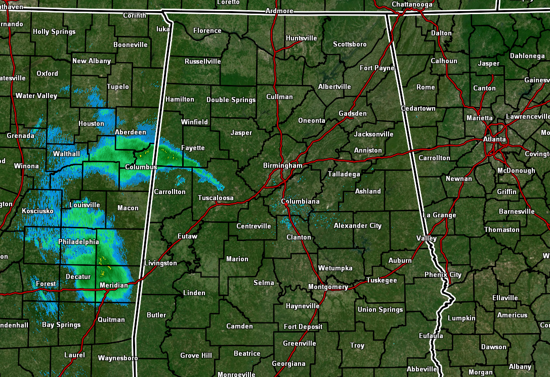
As we’ve hit the 9 am hour in Central Alabama, most locations are reporting partly sunny to mostly sunny skies. A few locations in the western parts of the area are seeing cloud cover and some light showers at the moment. The southern portions of Lamar, south and southwestern parts of Fayette, the extreme northern parts of Pickens, and into the northwest and north-central parts of Tuscaloosa counties are where those light raindrops are falling. At this point, the rest of Central Alabama is free from precipitation.

The latest run of the HRRR continues to show that the main activity with this approaching system will continue to stay to our west with only a few showers moving across the west and northwestern parts of the area. This image is valid at 2 pm today, and it is showing that there is some potential for some light showers falling in Tuscaloosa, just before the start of a game that has something to do with a bowl of iron. Unfortunately, it looks like showers may start again during the fourth quarter and will make the end of the game interesting.
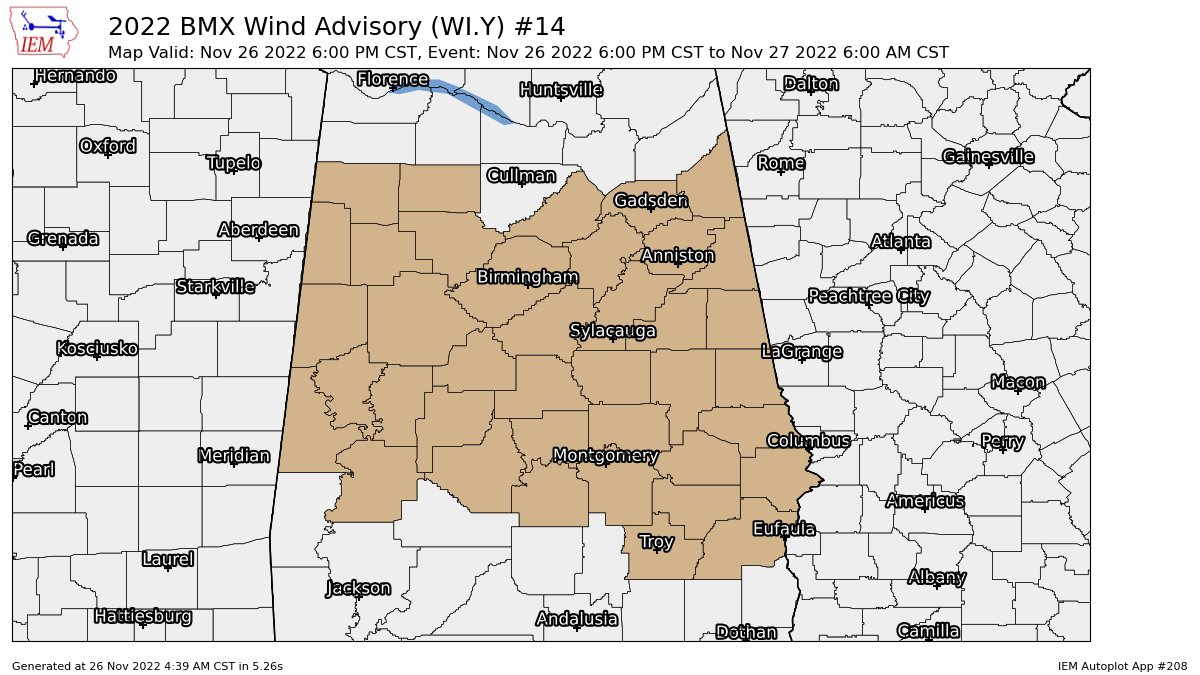
The breeze may also become an issue during the second half of the game as winds will start increasing with time as the system approaches. By 6 pm, a WIND ADVISORY goes into effect for all of Central Alabama for the potential of gusty winds as strong as 40 mph. That Wind Advisory goes through the night and overnight hours and is set to expire at 6 am Sunday morning. All of the North Alabama counties are also under a Wind Advisory for that same time window.

For the extreme southern locations of Central Alabama, a level one Marginal Risk of severe storms has been introduced for the very small potential of damaging winds and a brief tornado. That is mainly for locations along and south of a line from Sweet Water (Marengo Co.) to Prattville (Autauga Co.) to Auburn (Lee Co.) to Fort Mitchell (Russell Co.). Timing looks to be from roughly 6 pm tonight through 2 am Sunday.
We’ll keep you updated throughout the day, especially if there are any big changes to the expectations for today. I’ll have the next update out by midday.
Category: Alabama's Weather, ALL POSTS, Severe Weather
About the Author (Author Profile)
Scott Martin is an operational meteorologist, professional graphic artist, musician, husband, and father. Not only is Scott a member of the National Weather Association, but he is also the Central Alabama Chapter of the NWA president. Scott is also the co-founder of Racecast Weather, which provides forecasts for many racing series across the USA. He also supplies forecasts for the BassMaster Elite Series events including the BassMaster Classic.Subscribe
If you enjoyed this article, subscribe to receive more just like it.


