Snow dynamics – 2 pm
It’s about time to move away from models and look out the window. See James’ post below from the Storm Prediction Center. It is snowing heavily in parts of SE Texas now, with Houston reporting 1″ on the ground at noon. This is mainly due to an approaching upper level disturbance and Gulf moisture coming in at mid-levels.
The upper-level disturbance will move across Alabama tonight…the question is how much moisture will be available, and how strong will the upward motion be? The air should be plenty cold enough for a changeover to snow, at least as far south as Montgomery, Brewton, and Coffeeville by early tomorrow morning, especially once precipitation begins to fall and evaporation lowers the temperature more.
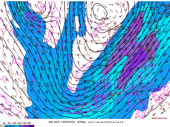
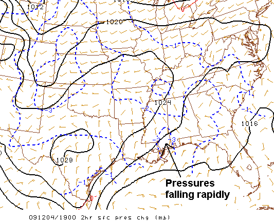
Interetingly, the area just to our west in the favorable right-rear quadrant of the upper-level jet, and upper-level divergence is occurring as the atmosphere is out of balance near the jet over Louisiana and parts of Mississippi. As a result of that, pressures are starting to fall rapidly along the Gulf Coast, at places like Gulfport, Mobile, and Panama City.

300 mb heights, winds, and divergence
Could this upper jet and falling pressures on the coast help the snow spread farther north as it moves eastward? Precipitation that is not reaching the ground yet due to dry air near the surface, but soon will, is moving into southern Mississippi. Pressures are falling at buoys 100 miles offshore too, but are the rapid falls along the coast an early sign of a Gulf low forming farther north than expected, or simply a fleeting issue? We don’t know yet. On the other hand, sunshine has warmed temperatures into the upper 40s in central Alabama, and clouds may hold them warmer after sunset, delaying a changeover to snow. But, if the low forms farther north, this could mean the NAM, the snowiest model for BHM, is the correct one. Here is its storm total:
I think the forecasts you have seen from all of us on this blog for the past two days are still the best guess, given current weather information. That would give BHM 1/2″ to 1″ of snow that melts quickly, with some locations farther SE (Montgomery) possibly seeing 2″. There could be a little more snow in the mountains of east Alabama, also. Still, this is not a major winter storm. It could cause some icy bridges. It is also possible that the whole thing will stay south, with areas NW of Clanton seeing no snow, but that scenario appears unlikely. It will mainly be something neat to look at early tommorrow morning (maybe before sunrise), then be a memory by lunchtime.
Category: Uncategorized


