Severe Thunderstorm Warnings over Northeast Mississippi and Northwest Alabama
Severe thunderstorm warning has been issued for parts of Colbert, Franklin, and Lauderdale counties in Northwest Alabama until 1 p.m.
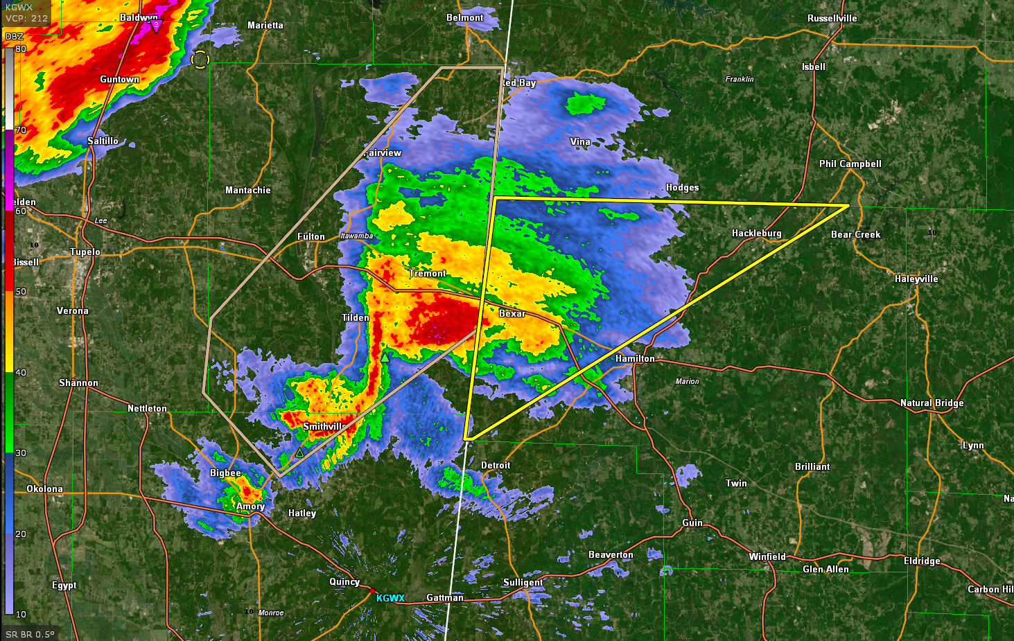
The severe thunderstorm warning continues for northwestern Marion County until 1 p.m. as well. The severe storm there is approaching Hackleburg.
Prentiss and Tishomingo counties in NE Mississippi are also under severe thunderstorm warning until 1 p.m.
Hail is the main threat with these storms since they are elevated in nature, which lessens the wind and tornado threat with them.
That will change later this evening as the stronger storms that form this afternoon over Louisiana and Mississippi move into Alabama. It is a dangerous situation to our west and we will be closely watching the storms as they head into Alabama later.
In Louisiana, a tornado warning remains in effect for Avoyelles and St. Landry parishes. That storm is near Palmetto, just east of I-59, moving toward Simmesport.
Category: ALL POSTS
About the Author (Author Profile)
Bill Murray is the President of The Weather Factory. He is the site's official weather historian and a weekend forecaster. He also anchors the site's severe weather coverage. Bill Murray is the proud holder of National Weather Association Digital Seal #0001 @wxhistorianSubscribe
If you enjoyed this article, subscribe to receive more just like it.


