Severe Weather Threat Continues Across the Tornado Watch Locations
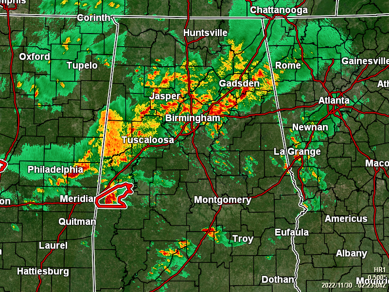
Heavy rain continues to fall over the northern parts of the state, especially along and north of the I-59 corridor. There are several flood advisories in effect for portions of the area until midnight tonight.
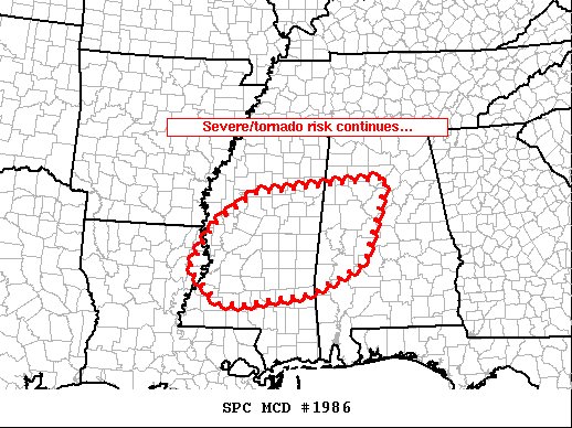
The severe threat continues across the Tornado Watch area mainly across the central third or so of Mississippi into west-central Alabama. Across this region, a moist air mass persists, ahead of the advancing cold front that is now crossing Arkansas/East Texas. Meanwhile, low-level shear has increased a bit over the past hour or so, as flow in the 1 to 2 km layer gradually strengthens.
While storms have decreased a bit with respect to organization in general over the past hour, likely due to modest after-dark stabilization, some increase is noted within streamers of showery convective cells south of the main convection (across southeastern Louisiana and southern Mississippi) including hints of weak rotation. This may be reflective of the aforementioned increase in low-level shear, which overall suggests that the potential for tornadoes continues across the area.
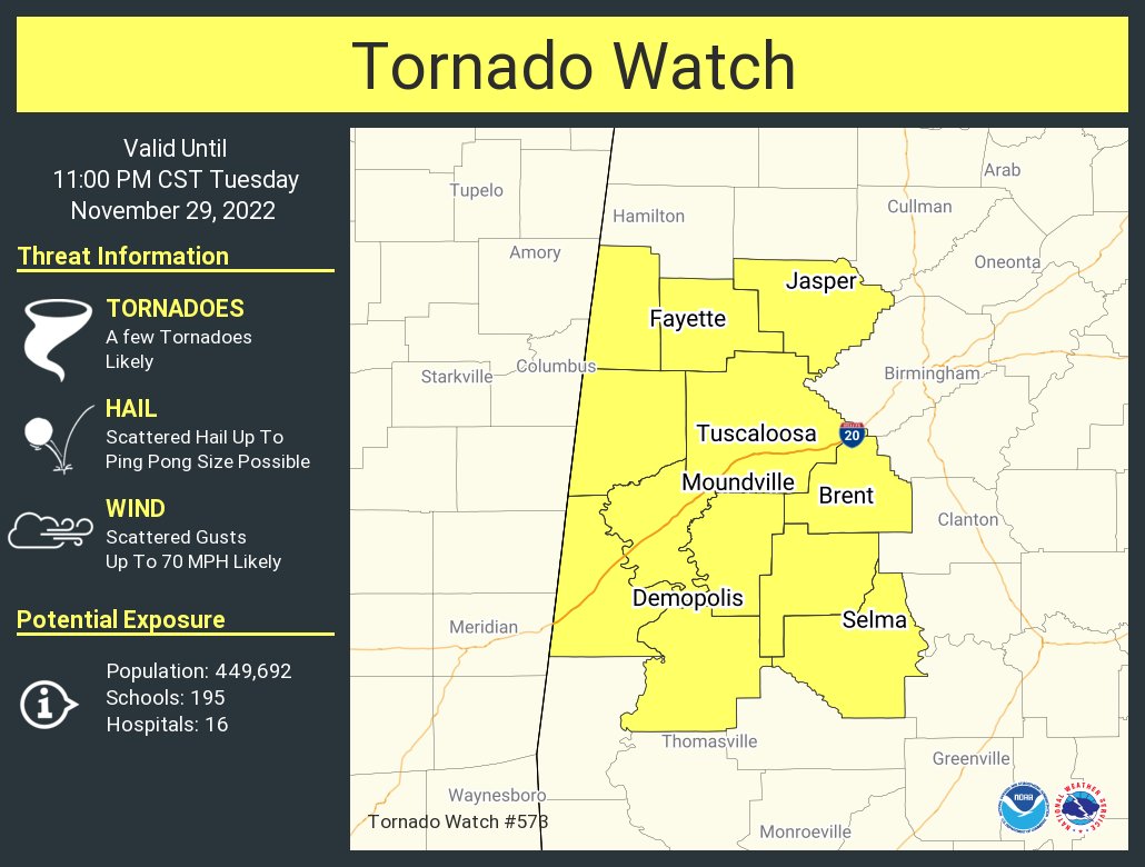
The Tornado Watch continues until 11 pm for Bibb, Dallas, Fayette, Greene, Hale, Lamar, Marengo, Perry, Pickens, Sumter, Tuscaloosa, and Walker counties in Central Alabama.
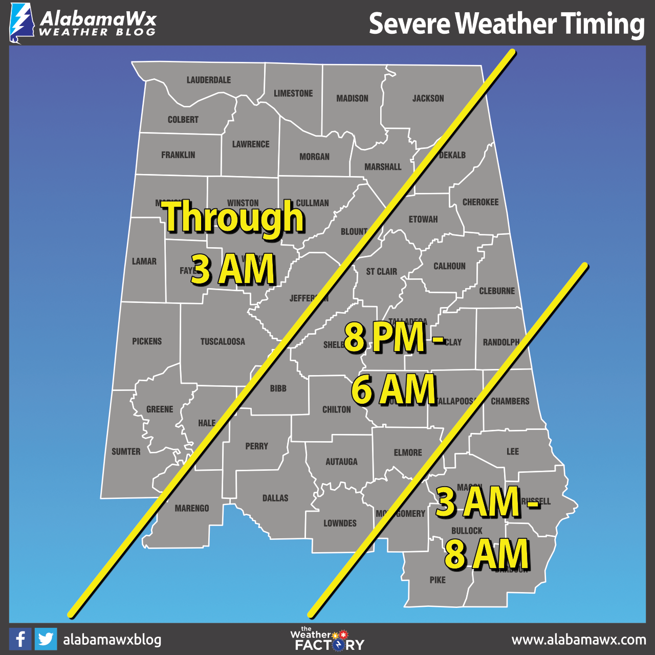
For the western section (from roughly Demopolis to Birmingham to Henagar), timing will be from now through 3 am Wednesday morning. For the middle section (east of the first section to a line from roughly Fort Deposit to roughly Roanoke), timing will be from 8 pm tonight through 6 am Wednesday. For the southeastern section, timing will be from 3 am through 8 am Wednesday morning.
Category: Alabama's Weather, ALL POSTS, Severe Weather
About the Author (Author Profile)
Scott Martin is an operational meteorologist, professional graphic artist, musician, husband, and father. Not only is Scott a member of the National Weather Association, but he is also the Central Alabama Chapter of the NWA president. Scott is also the co-founder of Racecast Weather, which provides forecasts for many racing series across the USA. He also supplies forecasts for the BassMaster Elite Series events including the BassMaster Classic.Subscribe
If you enjoyed this article, subscribe to receive more just like it.


