Snow Has Mostly Ended; Advisories Expired & Replaced with Special Weather Statements
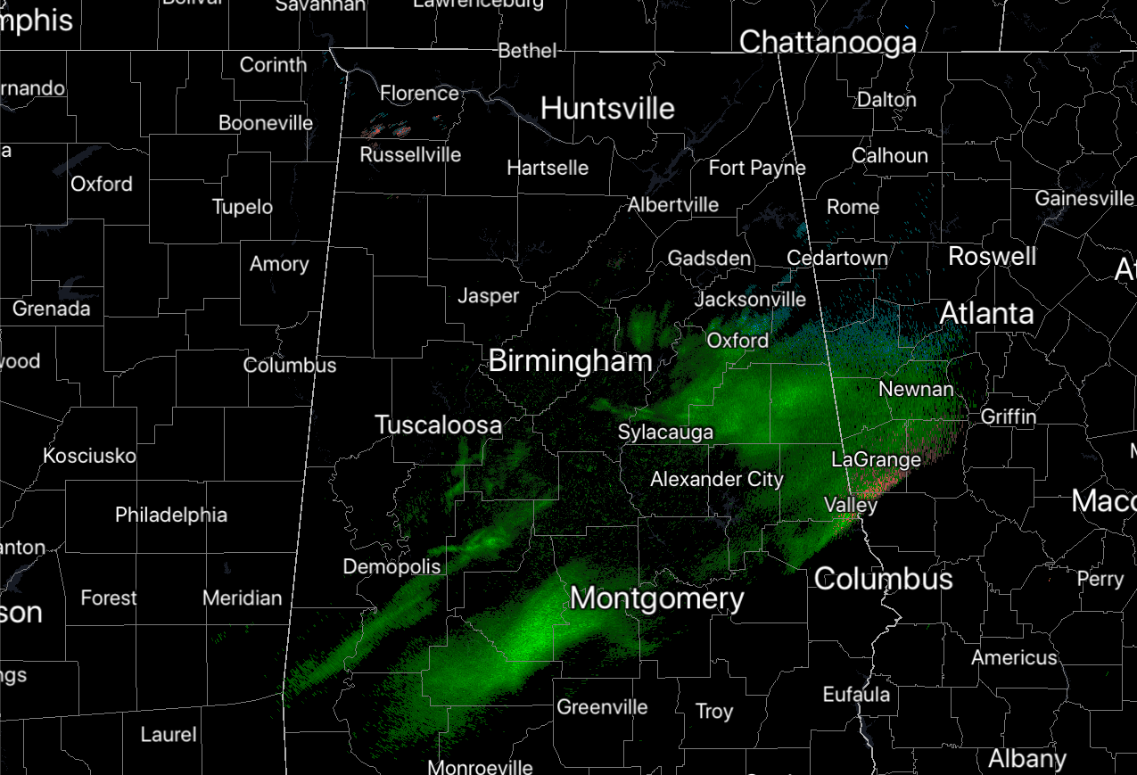
While a few flurries may still be falling over the northern portions of the area, much of the activity has shifted southward in the form of some very light showers or sprinkles mainly south of the I-59/I-20 and I-20 corridors. For now, the impactful snowfall that was occurring earlier has mainly come to an end. However, please stay off of the roadways if you don’t have to be out and about tonight. Here are some updates for tonight…
• As of 8:55 pm, The Winter Weather Advisories in effect for the eastern half of the Tennessee Valley Region and for Cherokee and Etowah counties in Central Alabama will be allowed to expire at 9 pm CST.
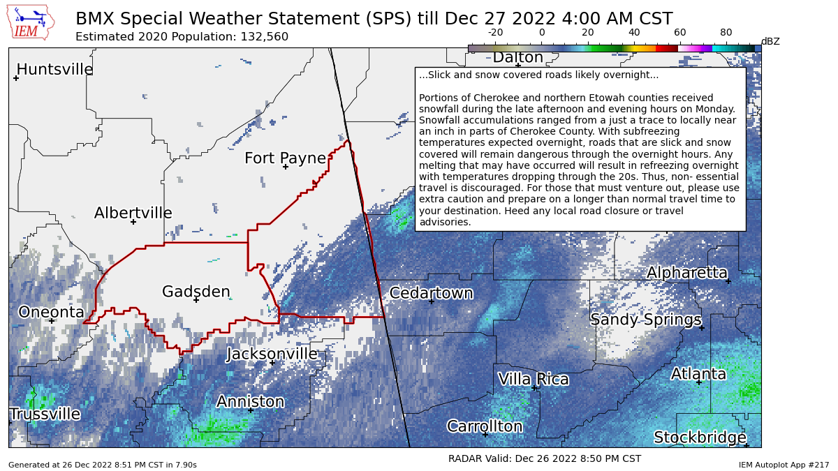
• NWS Birmingham has issued a Special Weather Statement for portions of Cherokee and Etowah counties effective from 9 pm until 4 am Tuesday morning. Here is the text from the statement:
Portions of Cherokee and northern Etowah counties received snowfall during the late afternoon and evening hours on Monday. Snowfall accumulations ranged from a just a trace to locally near an inch in parts of Cherokee County. With subfreezing temperatures expected overnight, roads that are slick and snow covered will remain dangerous through the overnight hours. Any melting that may have occurred will result in refreezing overnight with temperatures dropping through the 20s. Thus, non-essential travel is discouraged. For those that must venture out, please use extra caution and prepare for a longer than normal travel time to your destination. Heed any local road closure or travel advisories.
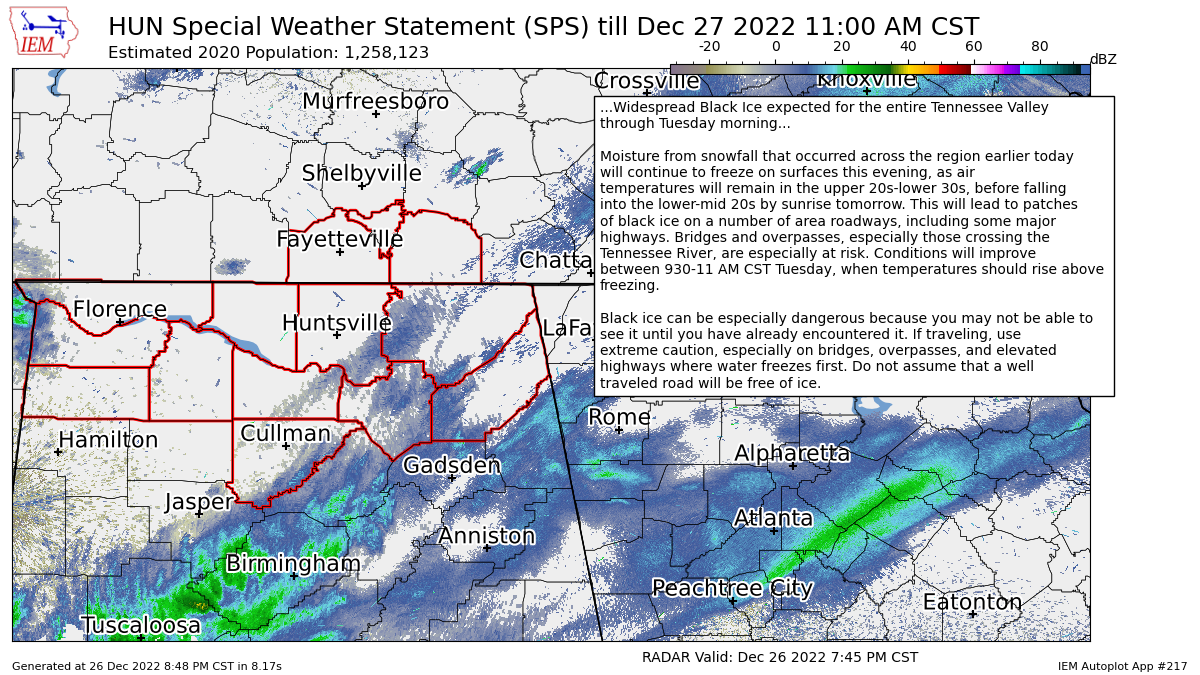
• NWS Huntsville has issued a Special Weather Statement for the Tennessee Valley Region effective immediately until 11 am Tuesday morning. Here is the text from the statement:
Moisture from snowfall that occurred across the region earlier today will continue to freeze on surfaces this evening, as air temperatures will remain in the upper 20s-lower 30s, before falling into the lower-mid 20s by sunrise tomorrow. This will lead to patches of black ice on a number of area roadways, including some major highways. Bridges and overpasses, especially those crossing the Tennessee River, are especially at risk. Conditions will improve between 930-11 AM CST Tuesday, when temperatures should rise above freezing.
Black ice can be especially dangerous because you may not be able to see it until you have already encountered it. If traveling, use extreme caution, especially on bridges, overpasses, and elevated highways where water freezes first. Do not assume that a well traveled road will be free of ice.
Category: Alabama's Weather, ALL POSTS, Winter Weather
About the Author (Author Profile)
Scott Martin is an operational meteorologist, professional graphic artist, musician, husband, and father. Not only is Scott a member of the National Weather Association, but he is also the Central Alabama Chapter of the NWA president. Scott is also the co-founder of Racecast Weather, which provides forecasts for many racing series across the USA. He also supplies forecasts for the BassMaster Elite Series events including the BassMaster Classic.Subscribe
If you enjoyed this article, subscribe to receive more just like it.


