The Early Afternoon Look at Tomorrow’s Severe Weather Threat
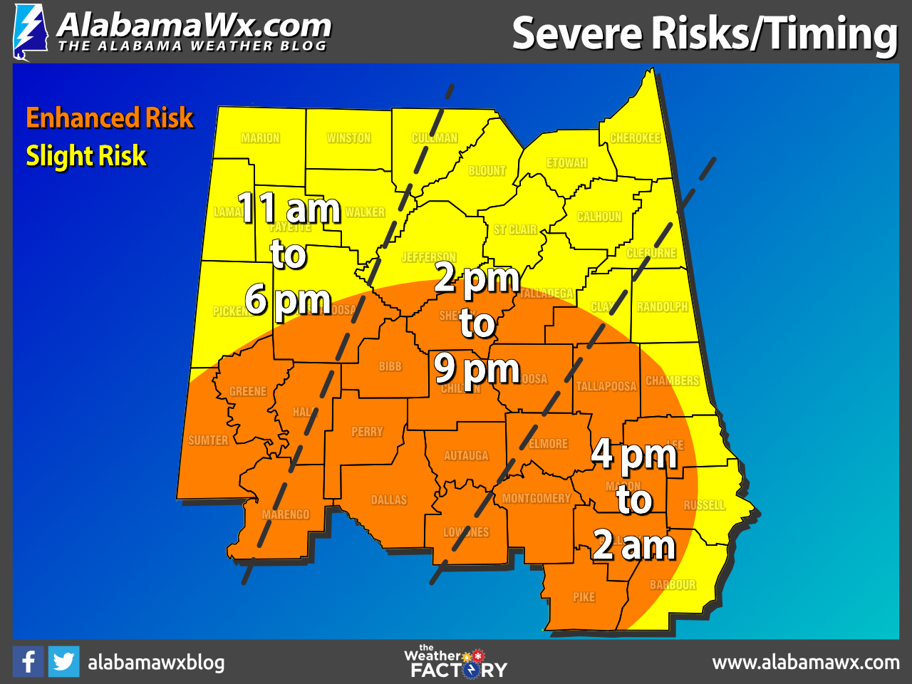
The Storm Prediction Center continues an Enhanced Risk (level 3/5) of severe storms for much of the southern half of Central Alabama which includes the cities of Tuscaloosa, Hoover, Alexander City, Clanton, Auburn, Demopolis, Selma, Montgomery, and Troy.
The rest of Central Alabama, including Cullman, Hamilton, Gadsden, Anniston, Birmingham, Talladega, and Eufaula, remain in a Slight Risk (level 2/5) on Tuesday.
All modes of severe weather will be possible with any severe storm, which includes damaging winds up to 60-70 mph, tornadoes, and hail up to quarter size in diameter. In the Enhanced Risk locations, there is the possibility of a strong tornado of EF-2 strength or greater.
Timing for the threat of severe storms will be from 11am-6pm for the western-third of the area, from 2pm-9pm for the central-third, and from 4pm-2am for the eastern-third of Central Alabama. There may be an increase in instability during the late-night and into the overnight hours that may cause a lengthening in timing for the southern and southeastern parts of the area.
Heavy rainfall will be another issue with this system as amounts could range as high as 1–3 inches across the area, with those heavier amounts occurring over the southern-third of the area and the extreme northern parts of the area.
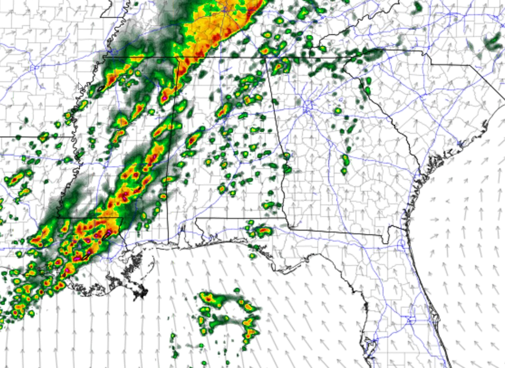
When the activity starts, it will be in the form of scattered storms to clusters of storms. The above is a depiction of what we could see at midday. We’ll have to watch the individual cells as there will be decent helicity, good wind shear, and good instability to help fuel the storms; and there is the potential for rotating storms.
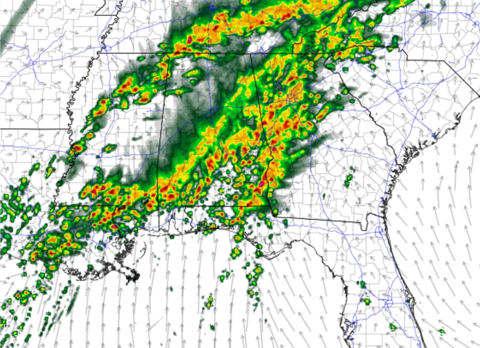
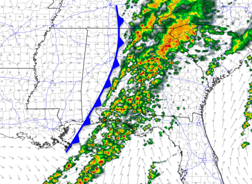
This system will move through in waves, as you can see with this depiction of what it may look like at 6pm. The first wave will be south and east of I-59, but another wave will b moving into the northwest corner of the state. That second wave will be moving in with the cold front trailing close behind.
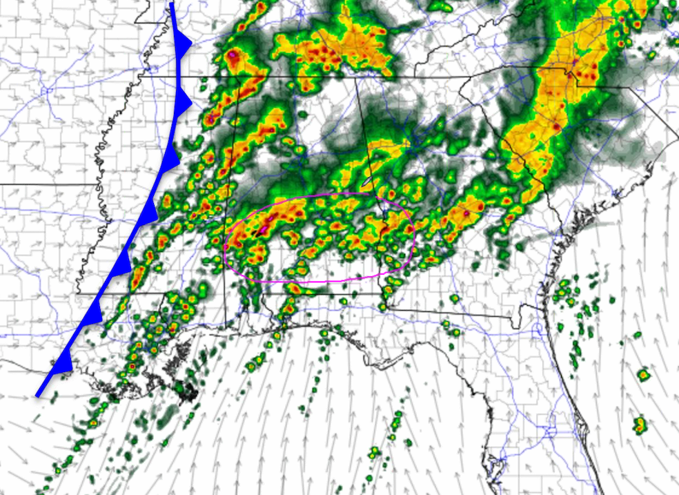
This is the projection for midnight, and you can see the front will be closer to the area and clusters of storms will continue to move into and across the area. Those storms over the southern half of Central Alabama may encounter a late night increase in instability, and this is where the threat of severe storms may be lengthened in time due to that possibility.
By sunrise, the western half of the area will be drying out, and the cold front will have passed. Much drier and cooler air will be moving in with the frontal passage. However, showers and storms will continue for a few hours longer for the eastern portions of Central Alabama. At this point, there is no threat of severe weather for Central Alabama at this time.
Model images from NWS Birmingham.
Category: Alabama's Weather, ALL POSTS, Severe Weather
About the Author (Author Profile)
Scott Martin is an operational meteorologist, professional graphic artist, musician, husband, and father. Not only is Scott a member of the National Weather Association, but he is also the Central Alabama Chapter of the NWA president. Scott is also the co-founder of Racecast Weather, which provides forecasts for many racing series across the USA. He also supplies forecasts for the BassMaster Elite Series events including the BassMaster Classic.Subscribe
If you enjoyed this article, subscribe to receive more just like it.


