Late Night Look at Our Severe Weather Threat on Tuesday Through Early Wednesday
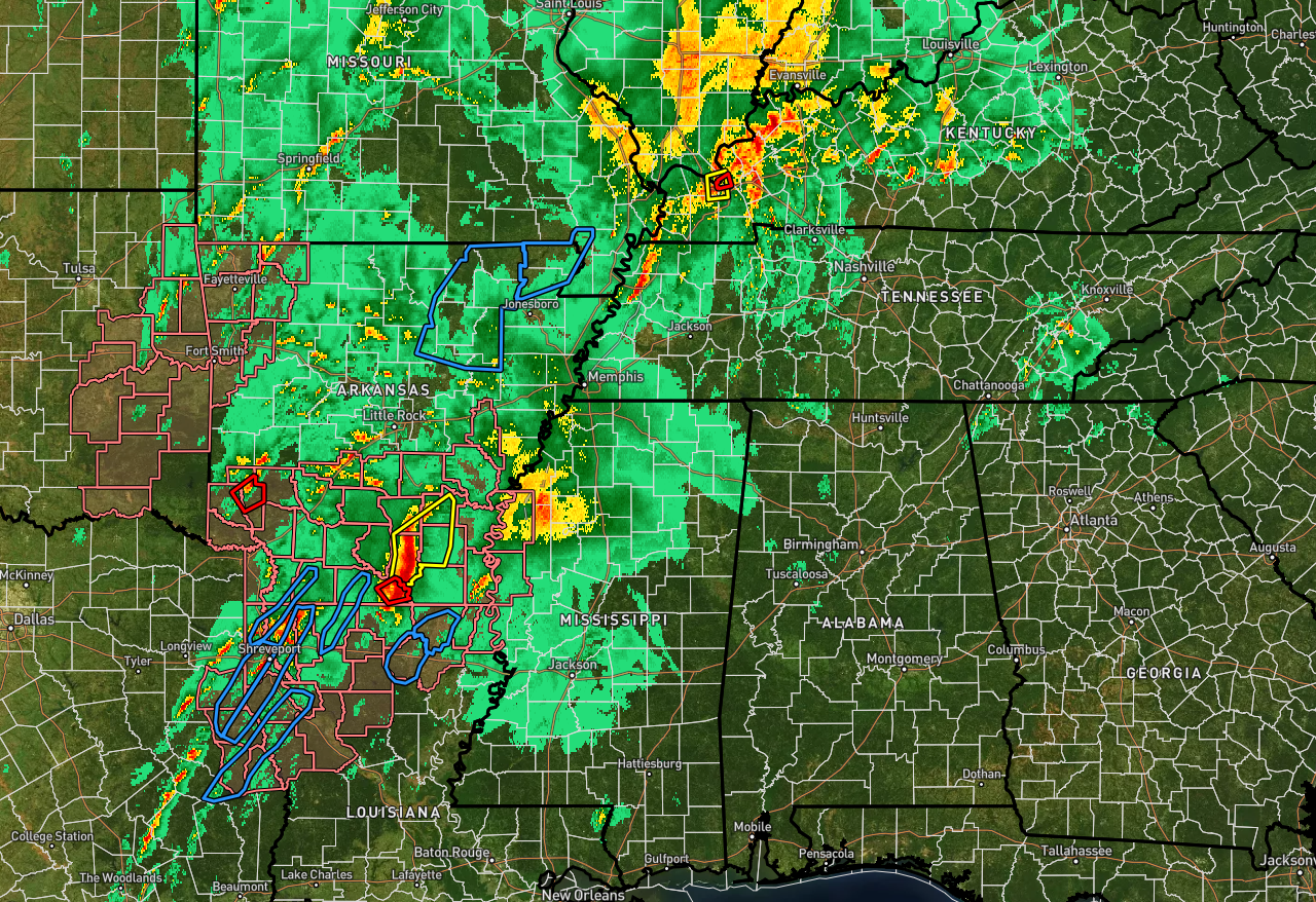
It’s a busy night out to our north and to our west as there are severe thunderstorm and tornado warnings, to go along with flash flood warnings and a couple of tornado watches. This activity stretches from Bloomington, Indiana, to as far south as Houston, Texas. A few showers are showing up over the northwestern quarter of Alabama, but there is no threat of severe weather for tonight. However, that is a different story for Tuesday.
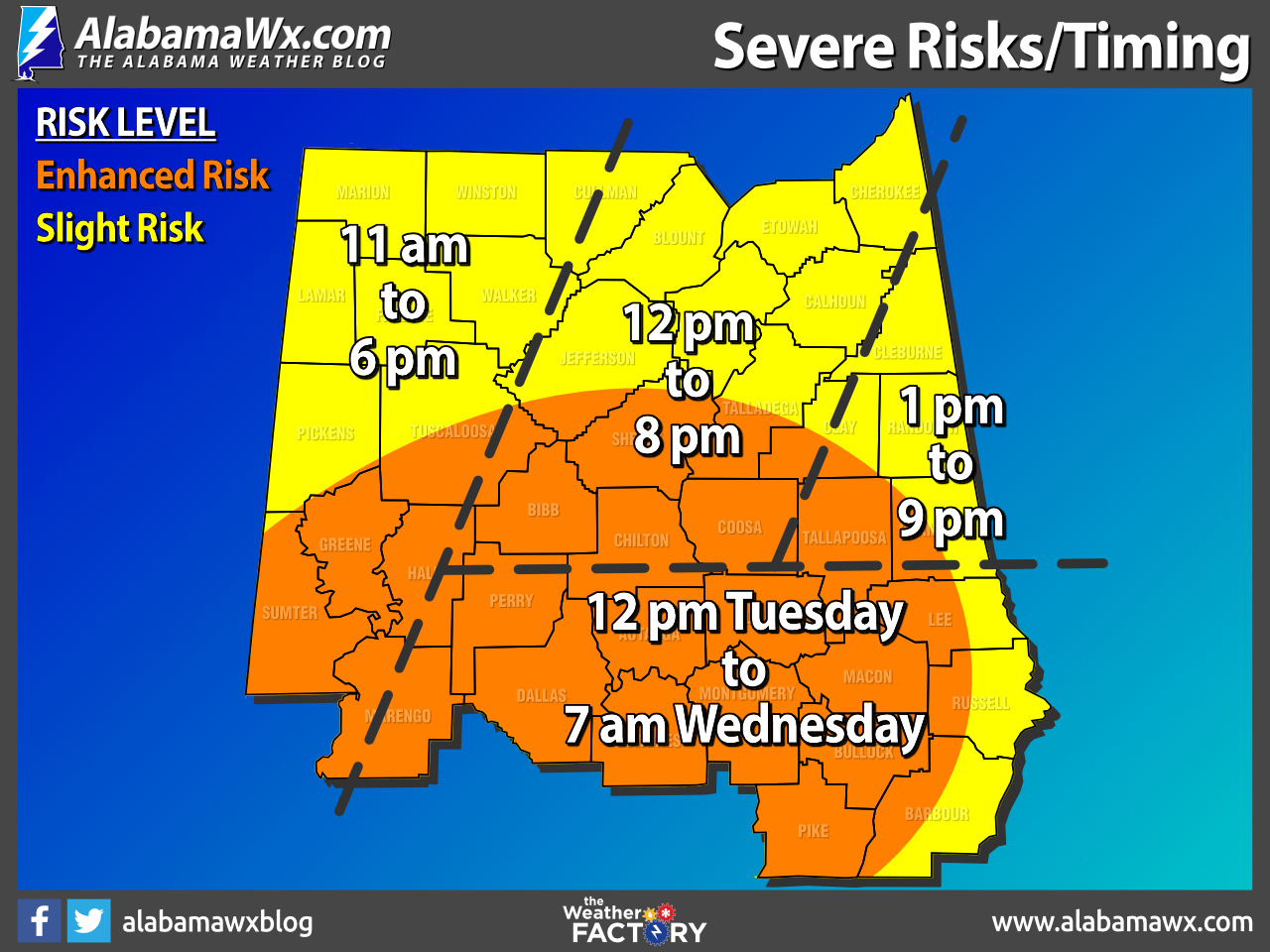
The Storm Prediction Center continues an Enhanced Risk (level 3/5) of severe storms on Tuesday for much of the southern half of Central Alabama which includes the cities of Tuscaloosa, Hoover, Alexander City, Clanton, Auburn, Demopolis, Selma, Montgomery, and Troy. The rest of Central Alabama, including Cullman, Hamilton, Gadsden, Anniston, Birmingham, Talladega, and Eufaula, remain in a Slight Risk (level 2/5) on Tuesday.
As I mentioned in my earlier post this afternoon, there was some concern that an increase in instability may occur during the late-night and into the overnight hours that could cause a lengthening in timing for the southern and southeastern parts of the area… and, that is now becoming more evident with the latest model runs.
For the northern 2/3rds of the area, the timing for the threat of severe weather will be from 11 am to 9 pm on Tuesday, while for the southern and southeastern parts of the area, the severe threat now looks to be from 12 pm Tuesday afternoon to 7 am Wednesday morning.
The threats continue to be the same… damaging winds up to 60-70 mph, tornadoes, and hail up to quarter size in diameter. In the Enhanced Risk locations, there is the possibility of a strong tornado of EF-2 strength or greater.
We’ll also have a minor threat of some flooding issues. Stronger storms will be high rain producers, and if any of those storms train over the same locations, flooding issues will be a concern.
There is no need to be anxious as these setups are not uncommon to see in Central Alabama from November to May, which is our main tornado season. Be sure you have a way to hear severe weather warnings (NOAA Weather Radio, WEA Alerts), and install the ABC 33/40 weather app on your smartphone.
Review your severe weather plan; know the safe place in your home, which is a small room on the lowest floor, near the center of the house, and away from windows. And, if you live in a mobile home be sure you know the location of the nearest shelter or site built structure that is available, and the quickest way of getting there.
Category: Alabama's Weather, ALL POSTS, Severe Weather
About the Author (Author Profile)
Scott Martin is an operational meteorologist, professional graphic artist, musician, husband, and father. Not only is Scott a member of the National Weather Association, but he is also the Central Alabama Chapter of the NWA president. Scott is also the co-founder of Racecast Weather, which provides forecasts for many racing series across the USA. He also supplies forecasts for the BassMaster Elite Series events including the BassMaster Classic.Subscribe
If you enjoyed this article, subscribe to receive more just like it.


